Environment Canada calls for baseball hail, 110km/h wind gusts & slight risk of a tornado in Alberta
InstantWeather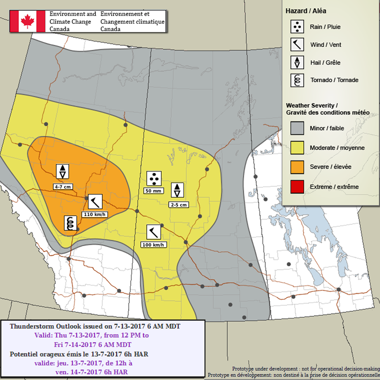
Environment Canada calls for baseball hail, 110km/h wind gusts & slight risk of a tornado in Alberta
They've included this risk for major cities like Edmonton & Red Deer, potentially.
Here's what they wrote:
"Alberta
Area(s): Central and portions of the north
Timing: Afternoon and Evening
Threats: Hail up to baseball size and 110 km/h winds
Weak low forms in Alberta with significant potential variation in its location. Latest guidance places it near Sundre this afternoon and will delimit the southern edge of storms. Just north of the low there is a slight potential for a tornadic storm. Higher likelihood for severe storms is through central regions where strong winds and large hail are the main threats. Storms will form over the western hazard area and track eastwards through the night."
For those wondering, these "prototype" maps are not yet available on EC's website. However, they will become operational soon and shared directly on their website. These forecasts and maps are issued by the same Environment Canada Meteorologists that issues all Watches and Warnings for the prairies. They're also temporarily hosted by the University of Manitoba here:
https://umanitoba.ca/faculties/environment/envirogeog/weather/conv_otlk/
More details ASAP!
- ATW (Adam S.)