Widespread Severe Thunderstorms Across Southern Ontario Ahead of a Cooldown
InstantWeather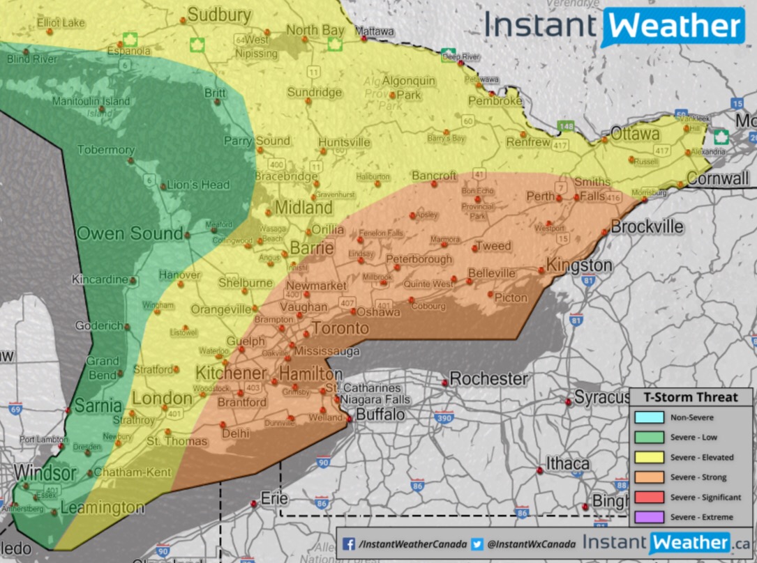
Forecast: (August 4th, 2017)
A strong frontal boundary will advance across Southern Ontario beginning in the early afternoon through Southwestern and Central Ontario, and through the Niagara Peninsula and Eastern Ontario in the evening as it makes its way east. The thunderstorms will likely impact the afternoon commute around the Golden Horseshoe and throughout the GTA - something to keep in mind.
DISCUSSION:
The thunderstorms will be widespread during Friday and will include risks such as: frequent to intense lightning, torrential downpours, loonie-size hail, damaging wind gusts, and the risk for a localized tornado or two.
The strongest potential for damaging thunderstorms lays within and area through the Niagara Region, Golden Horseshoe, GTA, east of Lake Simcoe and into southern sections of Eastern Ontario.
Two focal points in regards to the tornado threat include the Niagara Peninsula, and east of Lake Simcoe through Quinte West to Kingston, and north to Bon Echo Provincial Park.
Regardless of these focal points it’s important to note that severe thunderstorms can produce tornadoes and we’ll be watching Friday’s storms very closely throughout all of Southern Ontario.
We will continue to analyze the latest model guidance and update if anything changes.
After Friday, we are expecting a big cool down. With temperatures below seasonal for Saturday, Sunday and Monday. Westerly winds will aid in the below seasonal chill (relative to average), for Saturday. An isolated shower is also possible. Sunday looks like the beat day of the long weekend, with scattered showers returning Monday. Pack a sweater or two, if you are camping this long weekend. Overall, the weekend will be a pleasant one. Cool nights may help keep the bugs at bay.
-OTW (Kevin R., Kyle D., Troy B.)