Environment Canada Forecasting Hail, Damaging Winds & Isolated Flooding in Northwestern Ontario
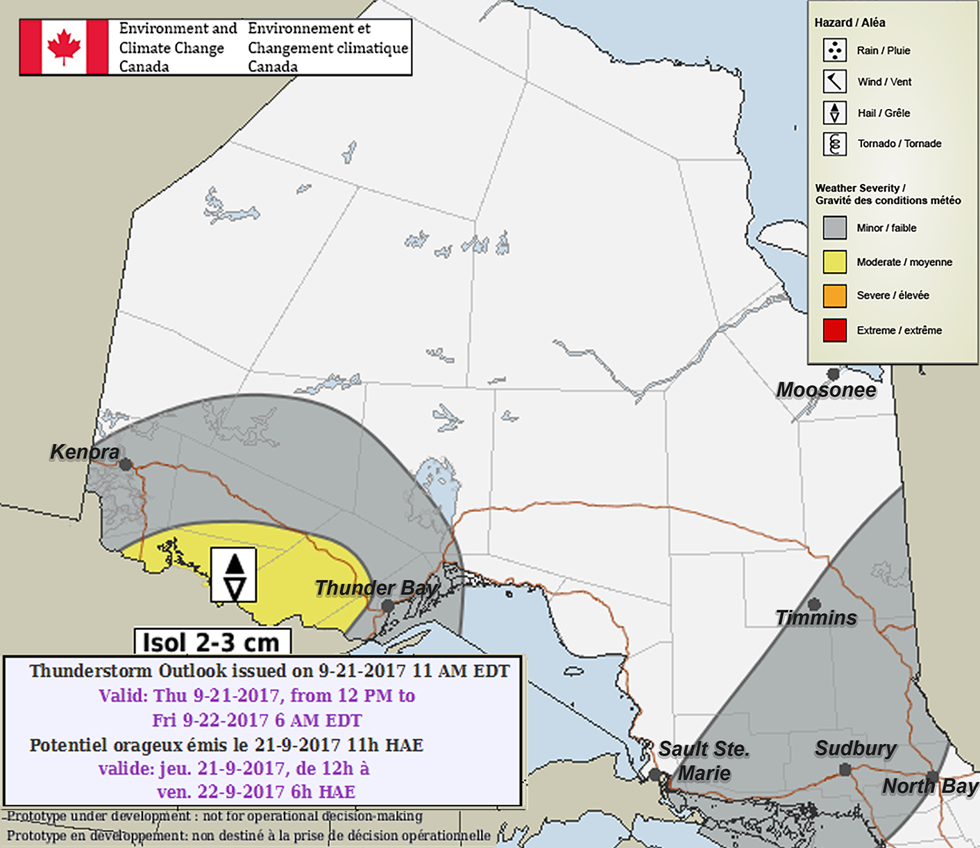
InstantWeatherToday's risk map, Thursday, September 21st, 2017:
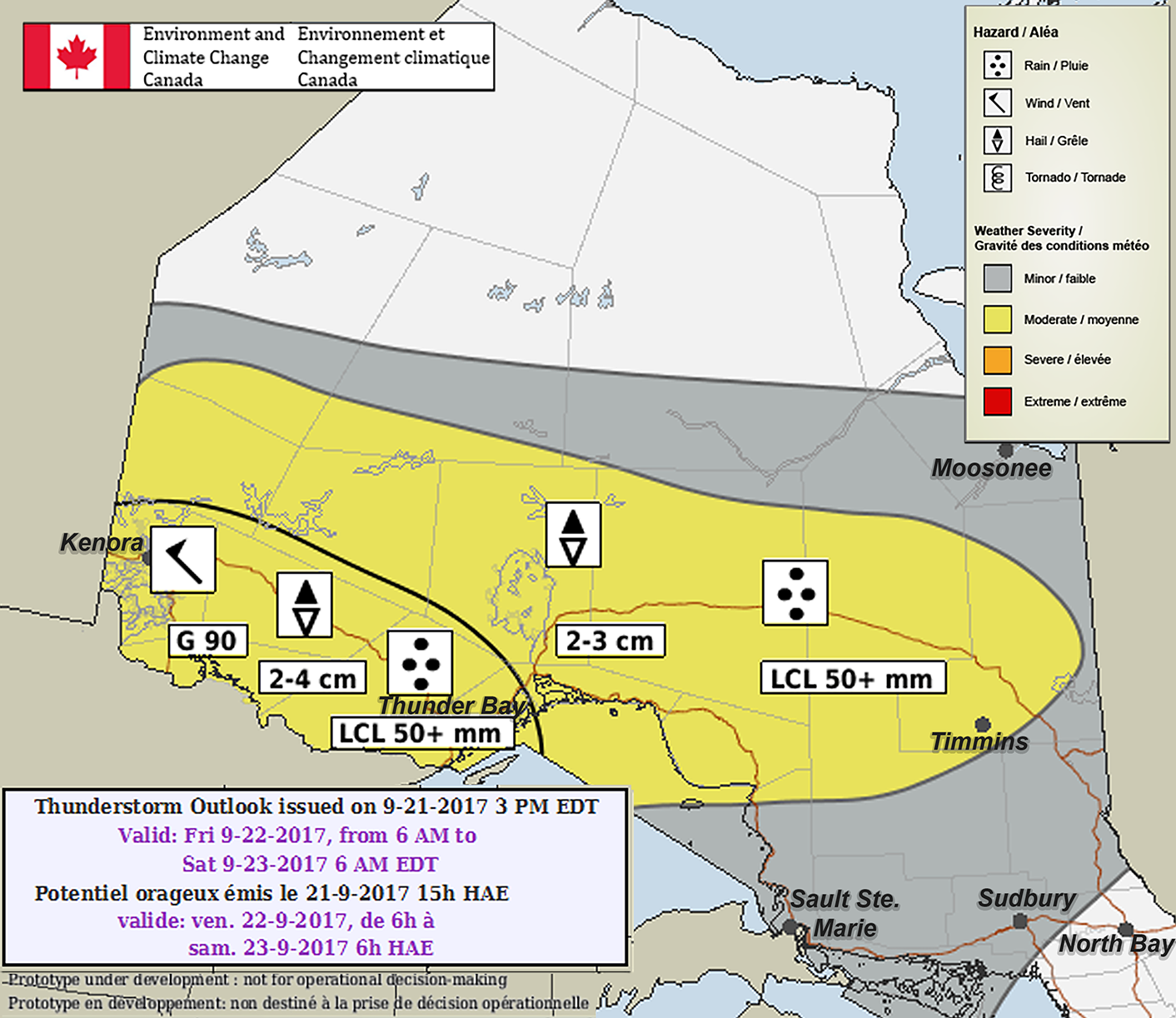
Tomorrow's risk map, Friday, September 22st, 2017 (LCL means Locally):
PLEASE READ DISCLAIMER BELOW
Here's what Environment Canada wrote:
"Thursday Night... There is a slight chance of severe thunderstorms over portions of Northwestern Ontario. Large hail is the main threat.
Friday... Dense fog patches are possible over Southern Ontario in the morning. There is a moderate chance of severe thunderstorms across Northwestern Ontario. Large hail and damaging winds are the main threats.
Outlook for Saturday... Dense fog patches are possible over Southern Ontario in the morning. There is a slight chance of a severe thunderstorm over areas near and north of Lake Superior towards Northeastern Ontario. Wind and rain are the main threats."
PLEASE READ: For those wondering, these "prototype" maps are not yet available on EC's website. However, they will become operational soon and shared directly on their site. These forecasts and maps are issued by the same Environment Canada Meteorologists that issues all Watches and Warnings for Ontario.
Environment Canada's disclaimer says:
"Disclaimer: These products are part of an experimental initiative at Environment and Climate Change Canada (ECCC). These are not official ECCC products and therefore may not be available on a daily basis. Please continue to monitor weather forecasts as well as watches and warnings via http://www.weather.gc.ca/."
More details ASAP!
- IWNO (Adam S.)