Quiet Start to the Week; Temperatures Below -10°c and Snow by Thursday & Friday
InstantWeather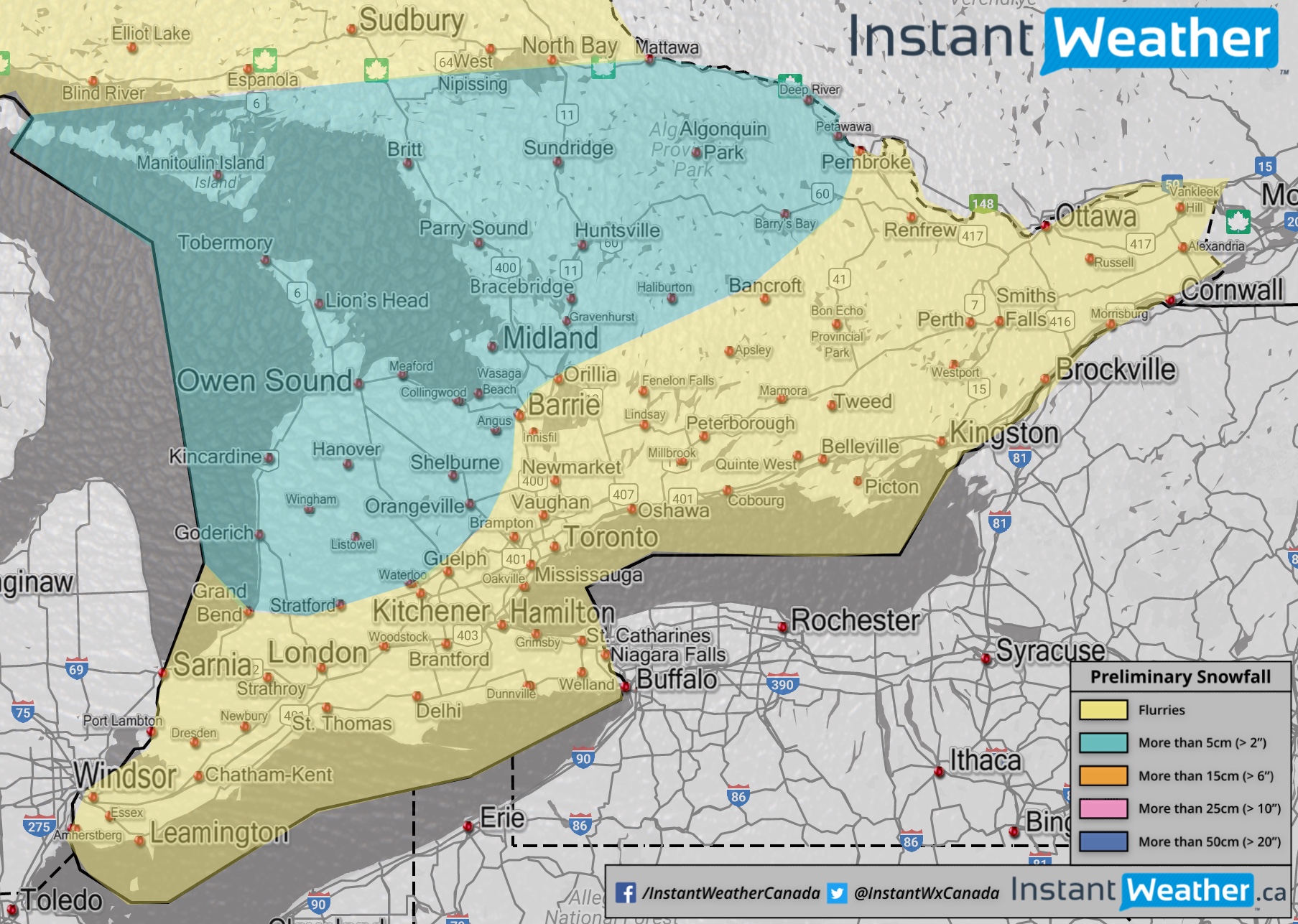
After a fairly warm October, it seems that winter is ready to make an appearance during the first full week of November. For starters, if you’ve been outside lately, you probably had to bundle up with temperatures in the single digits. The chilly temperatures are expected to continue for the rest of the week, though we’re not expecting precipitation during this short-range time period.
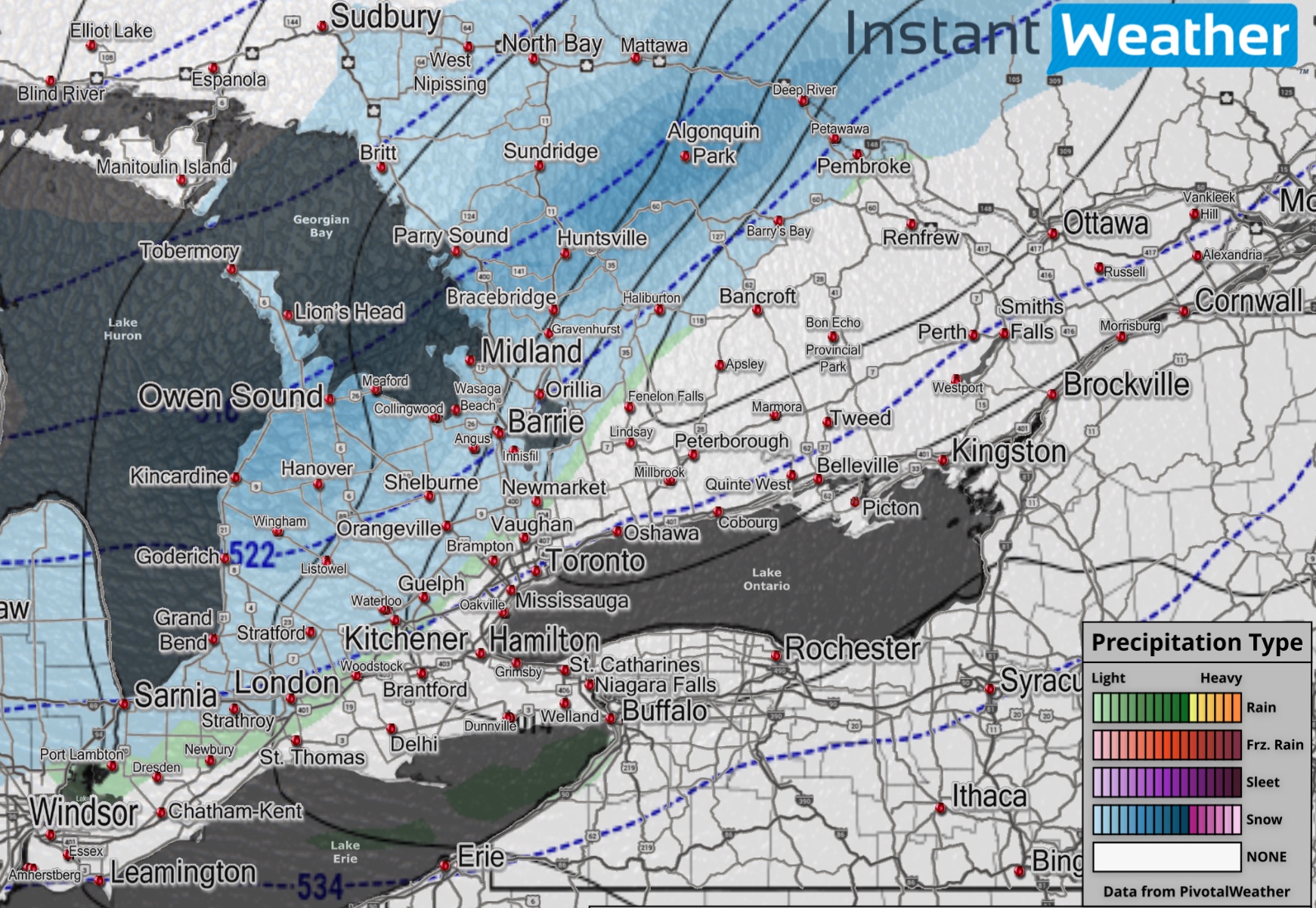
On Thursday, a weak system will move through Southern Ontario bringing rain showers and flurries/snow throughout the day. Any snow accumulation should be minimal with the exception of areas in the snow belts around Lake Huron and Georgian Bay. Lake enhancement could push totals above 5cm in this region.
This system will also usher in colder air and by Friday morning, temperatures could bottom out below -10°c. Once you factor in the windchill, it could feel like close to -20°c (unfortunately that’s not a typo) or even colder in higher elevations. 😮
The colder air is expected to start up the lake effect snow machine Thursday evening and it should last late into Friday. This could bring dangerous driving conditions due to blowing snow in the usual snow belts along with additional snowfall in addition to what already fell.
Right now it’s pretty early to pin down the exact areas that will be hardest hit by the lake effect snow. Though it appears that the likely scenario is a squall setting up southeast of Georgian Bay and another one east or southeast of Lake Huron.
We’ll have more details in the coming days, so be sure to stay tuned to our latest forecasts!
- IWO (Brennen P.)