48 Hour Snowfall Forecast
InstantWeather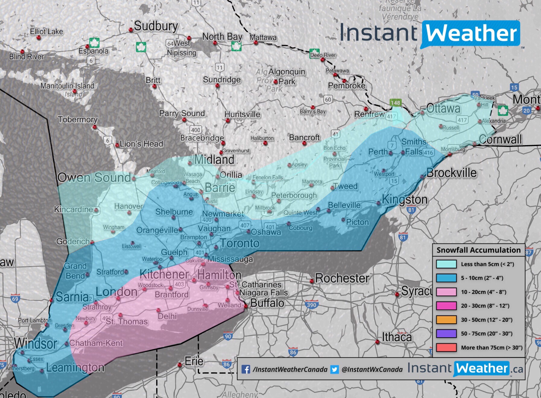
Here is our 48 hour snowfall forecast.
The snowfall has already begun falling this morning and will continue to slowly drift east into tomorrow.
Please pardon the lack of labels on the map.
Pink = 10-20cm or 4-8 inches
Dark blue = 5-10cm or 2-4 inches
Light blue = less than 5cm or 2 inches White = map :D
Road conditions will gradually deteriorate as the snow accumulates so please be cautious when traveling.
Environment Canada has even issued a Snowfall Warning for some areas:
Additionally, we’ve posted a video about the timing of the snow and we compared some model data:
Wind gusts shouldn’t be very strong so the main risk here is accumulation on the roads. Some gusts are possible but nothing too significant.
Please let us know what you’re experiencing and only when it’s safe to do so!
More details ASAP.
- IW (Adam S., Brennen P. & Steve R.)