What’s That Storm Cloud In The Sky? - (Part 3 of 3)
InstantWeatherThis three part series explores the various types of clouds you see everyday in the sky. Paying attention to the texture, shape, height and time of the day they form can help you determine if the weather is going to change. This series is designed to give you a general understanding of what these cloud formations mean and allow you to explore the signs yourself. Disclaimer *This is by no means should replace the forecasting provided by professionally, trained meteorologists.
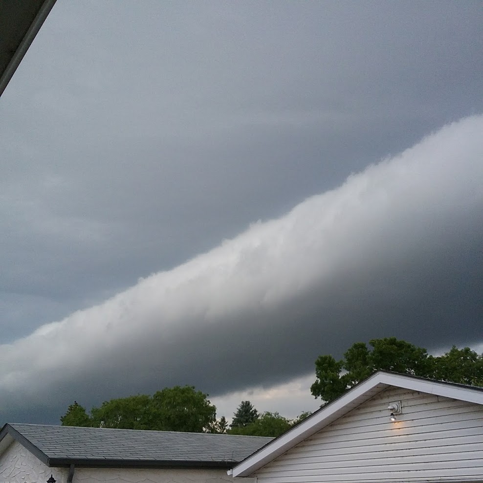
Arcus (Roll) Cloud
The roll cloud is a low, horizontal, tube shaped cloud and a rare form of the arcus cloud. Often mistaken for shelf clouds, this rare formation is completely detached from other cloud formations. It has a single crest and moves without changing speed or shape. Most form on the leading edge of the gust front and can often be associated with a thunderstorm, but not always.
(Photo Credit: Suzanne Pothe)
Shelf Cloud
What seems to be the most menacing of all the storm clouds, the shelf cloud is actually formed from the boundary between the downdraft and updraft of a thunderstorm. Shelf clouds are usually associated with a line of thunderstorms. Cooled water droplets plunge into the thunderstorm downdraft and then spread when reaching the ground surface. Often moist air is hoisted at the leading edge of the storm (the gust front) of the rain-cooled air. When this happens the result is the shelf cloud. This type of cloud is most often observed in the leading edge of a severe thunderstorm.
Scud Cloud
Sometimes you spot clouds that seem to be extending low to the ground during a thunderstorm and you think your eyes are playing tricks on you. Both severe and non severe thunderstorms can create what the observer thinks is a tornado, but in fact it is a scud cloud. Scud clouds can usually be spotted along the gust front of a thunderstorm. However, scud clouds do not rotate and therefore cannot be tornadoes. The key observation that needs to be present for a tornado is rotation. Often the angle, obscured lighting and the appearance of low hanging clouds can entice inexperienced observers to call in reports of tornadoes. If you are unsure what you are seeing, stay tuned to weather reports for tornado watches and warnings.
Tornadoes
A tornado is a rotating column of air, reaching all the way to the ground. Strong tornadoes are one of the most destructive forces of nature on a small scale, the strongest of which can level entire towns. A roaring noise, often compared to that of a train, can be heard in many cases when a tornado touches down to the ground. Tornado strength is measured by the EF Scale based on wind damage. The original Fujita scale (F scale) was developed by Dr. Theodore Fujita.
A funnel
A funnel cloud is a rotating column of air made up of condensed water droplets that extend from the base of the storm (usually a cumulonimbus) but does NOT reach the ground or body of water. Often funnels will have a needle-like appearance as they extend out of the cloud. Cold-air funnels are usually spotted during a cold front where there is enough moisture and instability to create cumulus clouds and rotation. Often these types of funnels are generally not considered dangerous. Consideration should be made though when a funnel is spotted as it is usually a precursor to a tornado.
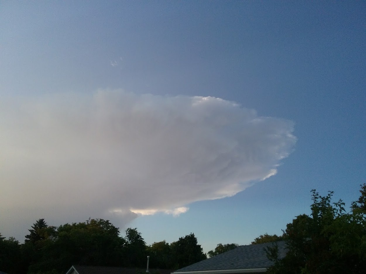
Anvil Cloud
This cloud is often characterized by a mushroom-like formation that is located in the upper part of the cumulonimbus cloud of a severe thunderstorm. This type of cloud is formed by the cool air bouncing off from the base of stratosphere and spreading out, sometimes for miles. Cumulonimbus clouds usually grow to heights from 20,000-70,000 feet in the air and are responsible for most severe weather including, lightning, hail, flooding, dangerous winds and tornadoes.
(Photo Credit: Suzanne Pothe)
Wall Cloud
A wall cloud is a large, persistent, lowered cloud at the base of a cumulonimbus storm. This part of the storm consists of significant rotation and is usually the precursor to the formation of tornadoes. Rotating wall clouds are usually an indication of a mesocyclone in the storm and usually produce strong tornadoes. If you see this type of cloud, take note of watches and warning and take cover as an impending tornado is possible.
RARE FIND
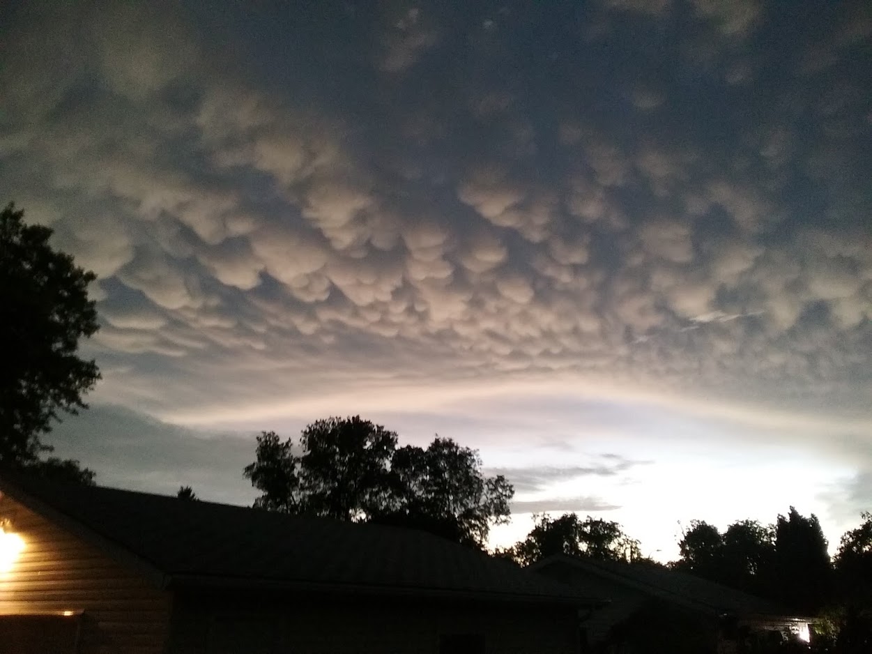
Mammatus Clouds
This type of cloud is most often observed from cumulonimbus clouds and can sometimes be associated with storms that can produce tornadoes. Mammatus clouds have a very distinct structure in the sky and usually can be observed before or after a severe thunderstorm. However, they have been known to also form in cirrus and altostratus clouds. What makes Mammatus clouds so unique is that its formation is due to sinking air rather than typical cloud formation from rising air. When a strong current of air that contains rain moves toward the top of the cloud, the air is dispersed in a horizontal direction (usually attached to the anvil cloud) with high concentrations of precipitation. Since the high precipitation air is denser than the surrounding air, the cloud sinks causing those unique pocket-like structures.
(Photo Credit: Suzanne Pothe)
IW (Suzanne. P.)
References:
https://en.wikipedia.org/wiki/Funnel_cloud
https://weather.com/news/news/thats-not-a-tornado-20130307 https://en.wikipedia.org/wiki/Arcus_cloud
https://weather.com/science/weather-explainers/news/shelf-cloud-roll-cloud-science-behind-photos http://namesofclouds.com/types-of-clouds/anvil-clouds.html
https://www.accuweather.com/en/weather-news/thunderstorm-clouds-mean-danger/25434310 http://apollo.lsc.vsc.edu/classes/met130/notes/chapter14/wall_cloud.html
https://en.wikipedia.org/wiki/Wall_cloud
https://www.accuweather.com/en/weather-glossary/what-are-mammatus-clouds/5506130
https://www.almanac.com/content/how-measure-tornadoes-ef-scale
https://www.accuweather.com/en/weather-glossary/what-are-mammatus-clouds/5506130