Environment Canada Forecasting 3-5cm Hail, 110km/h+ Damaging Winds & Potential for an Isolated Tornado Tomorrow (Sat, June 9th, 2018)
InstantWeather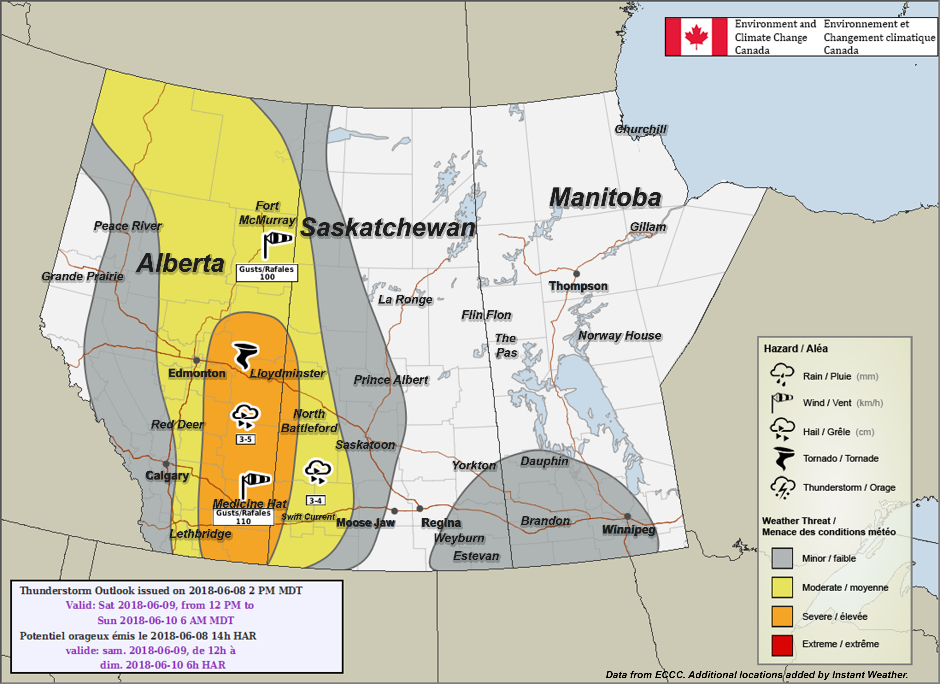
PLEASE READ DISCLAIMER BELOW
Here's what Environment Canada wrote:
"Area(s): Most of Alberta
Timing: Afternoon and evening
Threats: 3-5 cm hail, wind gusts of 110+ km/h, isolated tornado
A developing low pressure system and associated trough will develop in central Alberta tomorrow afternoon bringing thunderstorms to much of the province. Through most of the province thunderstorms have the potential to become severe with large hail and damaging wind gusts being the main threat. Over east-central Alberta there is also the potential to see an isolated tornado. Thunderstorms will initiate in the early afternoon over more western sections and then track eastwards into the late afternoon and evening."
PLEASE READ: For those wondering, these "prototype" maps are not yet available on EC's website. However, they will become operational soon and shared directly on their site. These forecasts and maps are issued by the same Environment Canada Meteorologists that issues all Watches and Warnings for the prairies. They're also temporarily hosted by the University of Manitoba here:
https://umanitoba.ca/faculties/environment/envirogeog/weather/conv_otlk/
Environment Canada's disclaimer says:
"Disclaimer: These products are part of an experimental initiative at Environment and Climate Change Canada (ECCC). These are not official ECCC products and therefore may not be available on a daily basis. Please continue to monitor weather forecasts as well as watches and warnings via http://www.weather.gc.ca/. Please address any questions, concerns and/or feedback regarding these products to the Decision Support Meteorologists at the Prairie and Arctic Storm Prediction Centre, available by email at ec.soutienmeteoouest-weathersupportwest.ec@canada.ca."
More details ASAP!
- Adam S.