Severe Thunderstorm Warning Issued
Environment Canada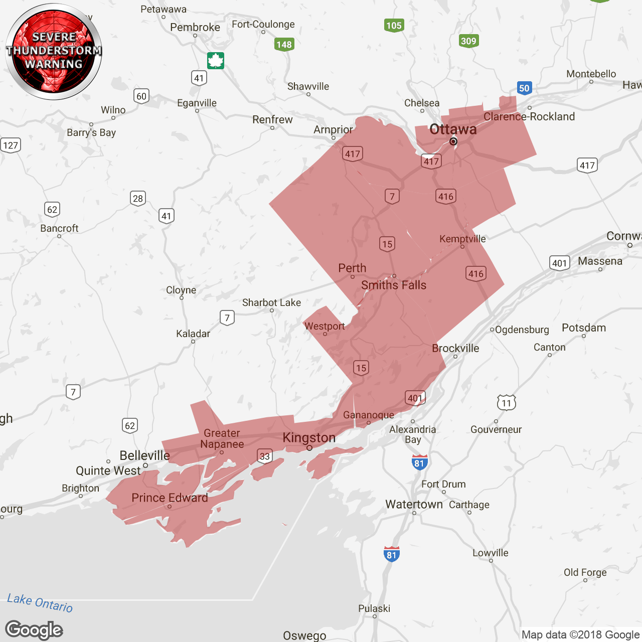
(Locations listed below description)
Updated or ended by 6:49 p.m. Edt.
At 4:55 p.m. Edt, environment canada meteorologists are tracking a line of severe thunderstorms capable of producing very strong wind gusts and up to nickel size hail.
This line of severe thunderstorms is located from 12 kilometres east of pembroke to calabogie to kaladar to 15 kilometres northwest of port hope, moving east at 75 km/h.
Communities in the path include: cobourg, belleville, kingston, trenton, stirling, napanee, renfrew, arnprior, perth and smiths falls.
Large hail can damage property and cause injury. Strong wind gusts can toss loose objects, damage weak buildings, break branches off trees and overturn large vehicles. Remember, severe thunderstorms can produce tornadoes. Lightning kills and injures canadians every year. Remember, when thunder roars, go indoors!
Severe thunderstorm warnings are issued when imminent or occurring thunderstorms are likely to produce or are producing one or more of the following: large hail, damaging winds, torrential rainfall.
The office of the fire marshal and emergency management recommends that you take cover immediately if threatening weather approaches.
Please continue to monitor alerts and forecasts issued by environment canada. To report severe weather, send an email to onstorm@canada.ca or tweet reports using #onstorm.
For more information:
http://www.emergencymanagementontario.ca/english/beprepared/beprepared.html.
ISSUED:
- Charleston Lake
- Consecon
- Eastern Lanark County
- Frontenac Islands
- Gananoque
- Gatineau
- Kanata
- Kemptville
- Kingston
- Mallorytown
- Merrickville-Wolford
- Metcalfe
- Napanee
- Odessa
- Orleans
- Ottawa North
- Ottawa South
- Perth
- Picton
- Richmond
- Sandbanks Park
- Smiths Falls
- Westport