Significant Structural Damage North of Lake Erie Earlier Today (Wed, June 13, 2018)
InstantWeatherMany folks have reported a potential tornado to us from this storm. All we could tell from radar was that it had very violent wind gusts and we issued several custom alerts to reflect what we were seeing on radar. Radar doesn't always tell the entire story though and it'll be up to Environment Canada's research team to officially determine if this was a downburst, microburst, straight-line wind event or a tornado. Based on the significance of the damage, we trust they'll be investigating this carefully.
Reports:
Joe D. shared this video from Waterford where the gentleman in the video explains that this garage was dropped on his sister while she was in her car. Hoping she's okay!
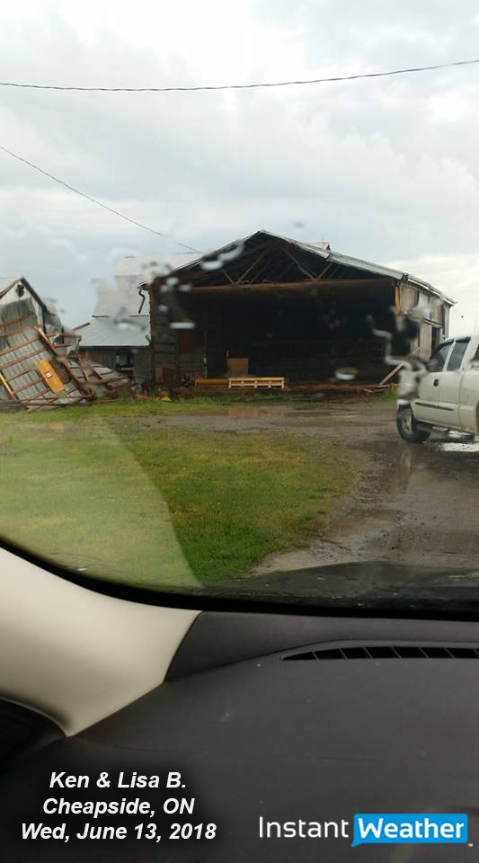
Ken & Lisa B. shared this photo below of significant structural damage from Cheapside, ON, also just north of Lake Erie. Thank you for sharing folks. Again, we hope everyone is okay!
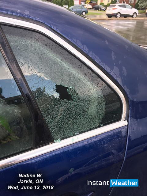
Nadine W. shared the photo below with us of debris that punctured a whole through her rear window. Glad you stayed safe Nadine!
Heather C.V. writes: "We drove through Simcoe towards Hagersville with parts of barns flying through the air. Everyone pulled over and cars were rocking back and forth. We thought for sure the car was going over into the ditch. Metal debris landing in front of the car and wrapped around behind it. Hail to the extreme and lashing rain. A short time before that we saw funnels and think it touched down just as we all pulled over."
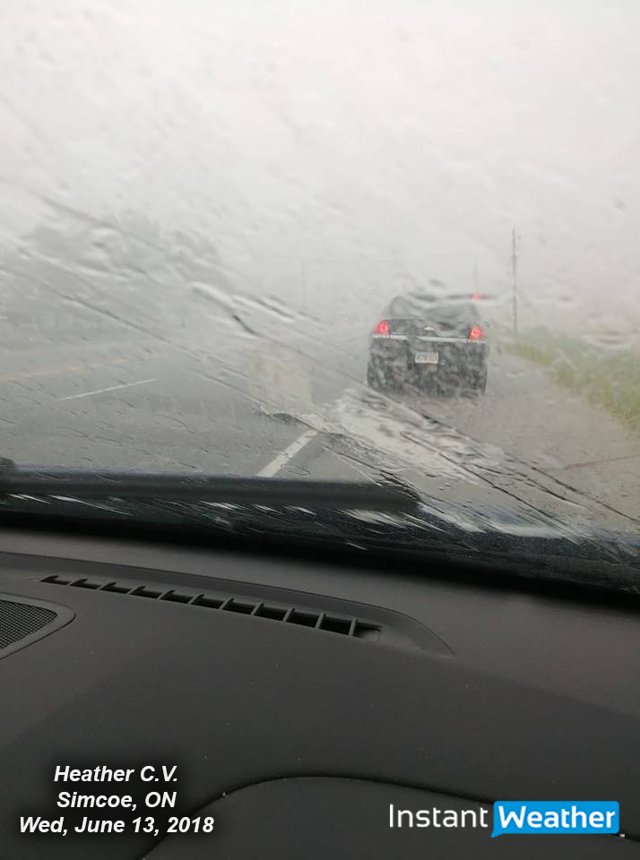
So glad you were able to stay safe Heather and thank you for sharing that intense story with us!
We've had many reports from this area now of damage, from Woodstock through Simcoe, and down to Lake Erie.
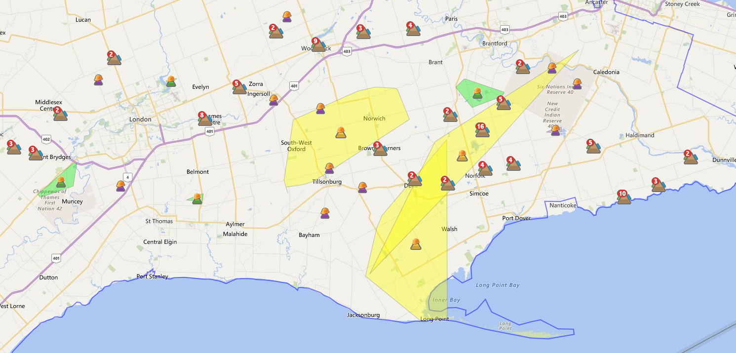
The HydroOne outage map below paints a fairly clear picture of where the storm did damage as it spawned near London and tracked to the southeast:
Below is a timeline of updates we posted for that intense storm. Radar looked VERY intense and we issued several custom alerts for damaging winds, including our first ever purple (extreme/violent) damaging wind alert. Radar was reaching 80mph+ (130km/h+). Easily the strongest radar signature we've seen this season.
Original forecast (Tuesday @ 1:55pm):
Updated forecast today (1:53pm):
Initial heads up radar update for London & surrounding area (2:16pm):
First heads up alert (2:19pm):
Second, significant alert (2:36pm):
Third, extreme alert (2:57pm):
Forth, severe alert (3:16pm):
We sincerely hope everyone stayed safe today! That certainly got intense!!!
Thank you to everyone for your reports and please let us know if we missed any in the comments.
<3
- All of us