Environment Canada Includes Tornado Risk & 100km/h Wind Gusts in their Forecast Map (Mon, June 18th, 2018)
InstantWeather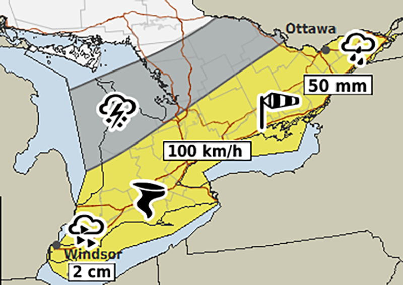
PLEASE READ DISCLAIMER BELOW
Here's what Environment Canada wrote:
"Monday…There is a risk of severe thunderstorms over parts of Eastern Ontario. Heavy rainfall and gusty winds are the main threats. Heat warnings over portions of Southern Ontario will come to an end as the cold front moves through late in the day."
Here's the full map:
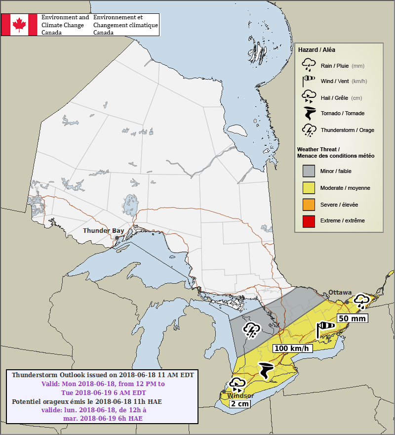
PLEASE READ: For those wondering, these "prototype" maps are not yet available on ECCC's website. However, they will become operational soon and shared directly on their site. These forecasts and maps are issued by the same Environment Canada Meteorologists that issues all Watches and Warnings for Ontario.
Environment Canada's disclaimer says:
"Disclaimer: These products are part of an experimental initiative at Environment and Climate Change Canada (ECCC). These are not official ECCC products and therefore may not be available on a daily basis. Please continue to monitor weather forecasts as well as watches and warnings via http://www.weather.gc.ca/."
We've posted a preliminary forecast as well:
And we're working on an updated forecast this morning.
More details ASAP!
- Adam S. & Alannah F.