Greater Sudbury, Sault Ste. Marie, North Bay, Timmins, etc. Included in Environment Canada's Forecast for 4cm Hail, 100km/h Winds, 50mm Rain & Possibly a Tornado (Sun, July 1st, 2018)
InstantWeather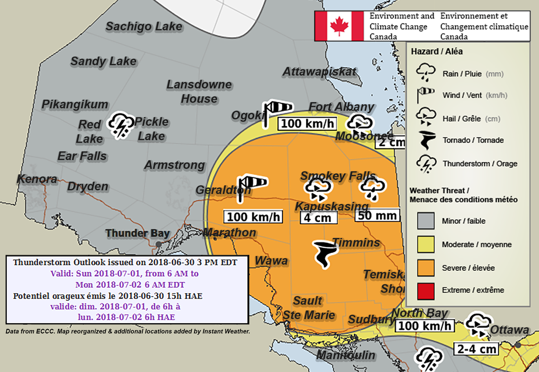
PLEASE READ DISCLAIMER BELOW
Here's what Environment Canada wrote:
"Sunday and Sunday Night…The heat event will continue over Southern Ontario and portions of Northeastern Ontario. Heat warnings will continue. There is a moderate chance of severe thunderstorms over Northeastern Ontario. There is a slight risk of severe thunderstorms over portions of Eastern, Central and Far-Northeastern Ontario as well as North of Superior. The main threats are wind gusts, large hail and torrential downpours. There is also a slight chance of a tornado in Northeastern Ontario."
PLEASE READ: For those wondering, these "prototype" maps are not yet available on ECCC's website. However, they will become operational soon and shared directly on their site. These forecasts and maps are issued by the same Environment Canada Meteorologists that issues all Watches and Warnings for Ontario.
Environment Canada's disclaimer says:
"Disclaimer: These products are part of an experimental initiative at Environment and Climate Change Canada (ECCC). These are not official ECCC products and therefore may not be available on a daily basis. Please continue to monitor weather forecasts as well as watches and warnings via http://www.weather.gc.ca/."
More details ASAP!
- IWNO (Adam S.)
P.S. The legends were reorganized & additional city names were added by Instant Weather. However, the forecast details, locations and severity levels are identical to the original map.