FRIDAY: Edmonton, Red Deer, Grande Prairie & Lloydminster are Included in Environment Canada's Forecast for up to Tennis Ball Hail and Risk for a Tornado (Fri, July 20th, 2018)
InstantWeather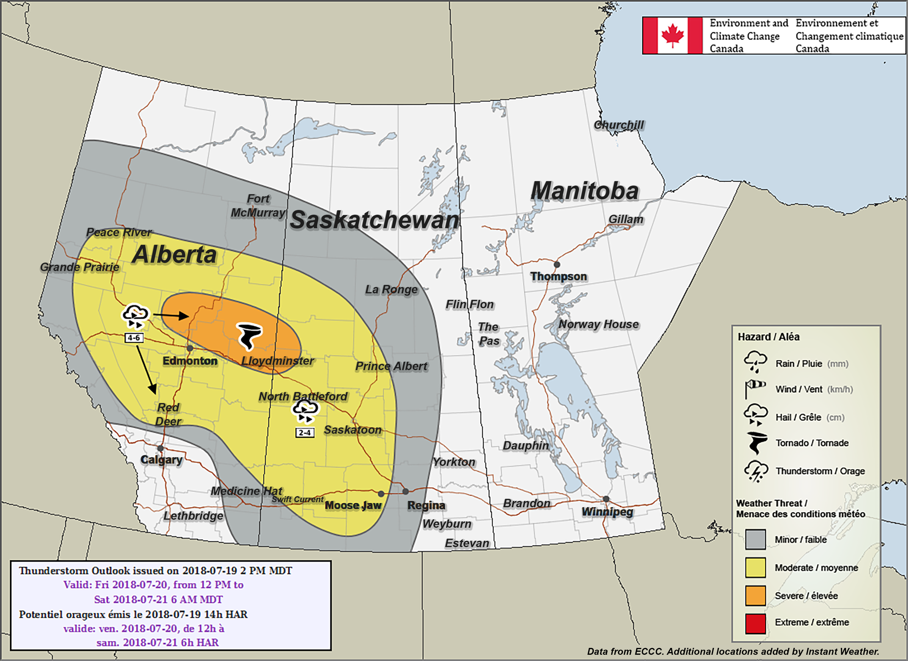
PLEASE READ DISCLAIMER BELOW
Here's what Environment Canada wrote:
"Alberta
Area(s): Central Alberta
Timing: Friday afternoon to overnight
Threats: 4-6 cm hail and risk of a tornado
A low pressure system will form south of Edmonton on Friday, which will be the focus of thunderstorms for Friday. Scattered severe thunderstorms are expected to develop early Friday afternoon along the northern foothills. These thunderstorms will move northeast throughout the afternoon and evening before weakening overnight. Large hail, up to tennis ball size, will be the main threat with these severe thunderstorms. Northeast of the low there is a risk of a tornado during the afternoon and evening hours."
PLEASE READ: For those wondering, these "prototype" maps are not yet available on EC's website. However, they will become operational soon and shared directly on their site. These forecasts and maps are issued by the same Environment Canada Meteorologists that issues all Watches and Warnings for the prairies. They're also temporarily hosted by the University of Manitoba here:
https://umanitoba.ca/faculties/environment/envirogeog/weather/conv_otlk/
Environment Canada's disclaimer says:
"Disclaimer: These products are part of an experimental initiative at Environment and Climate Change Canada (ECCC). These are not official ECCC products and therefore may not be available on a daily basis. Please continue to monitor weather forecasts as well as watches and warnings via http://www.weather.gc.ca/. Please address any questions, concerns and/or feedback regarding these products to the Decision Support Meteorologists at the Prairie and Arctic Storm Prediction Centre, available by email at ec.soutienmeteoouest-weathersupportwest.ec@canada.ca."
More details ASAP!