Ontario Forest Fire Update
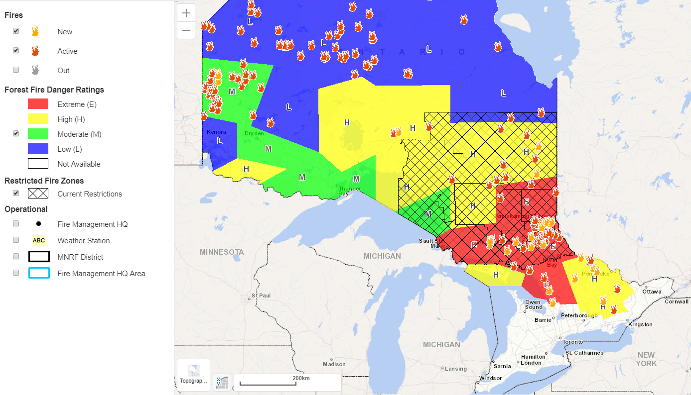
InstantWeatherBelow is the current fire risks and active fire locations:
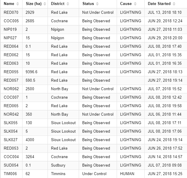
Below is a list with further details on many of the active wildfires:
@ONresources & @ONforestfires are great resources for current fire updates. Here are some of their most recent tweets:
"Due to smoky conditions from nearby #forestfires in the Pembroke district, the #OPP has advised the #MNRF that they will be temporarily closing Hwy 17 at Powell Lake Trail, east of #BissettCreek, until smoke conditions improve."
"Due to hot, dry & windy conditions, #MNRF Parry Sound district has recommended a mandatory evacuation of the #KeyHarbour area south of the French River Provincial Park for precautionary reasons. #OPP & #ConservationOfficers are onsite facilitating this evacuation.":
"#Smoke may be seen today along Hwy 11 North due to smoke drift from a number of #fires in the #Northwest Region. Drive safe! #Ontario":
"AFFES is responding to Parry Sound 33, a fire located southwest of Grundy Lake Provincial Park, west of Highway 69. Please be advised smoke may be visible from the Highway.":
Stay safe out there folks and a huge thanks to those risking their lives to keep these dangerous fires under control!
To view the interactive fire map (takes a while to load so please be patient), visit: http://www.gisapplication.lrc.gov.on.ca/ForestFireInformationMap/index.html?site=AFFES_ONLine&viewer=AFFES_ONLINE
<3
- Adam S.