Severe Thunderstorm Watch Issued
Environment Canada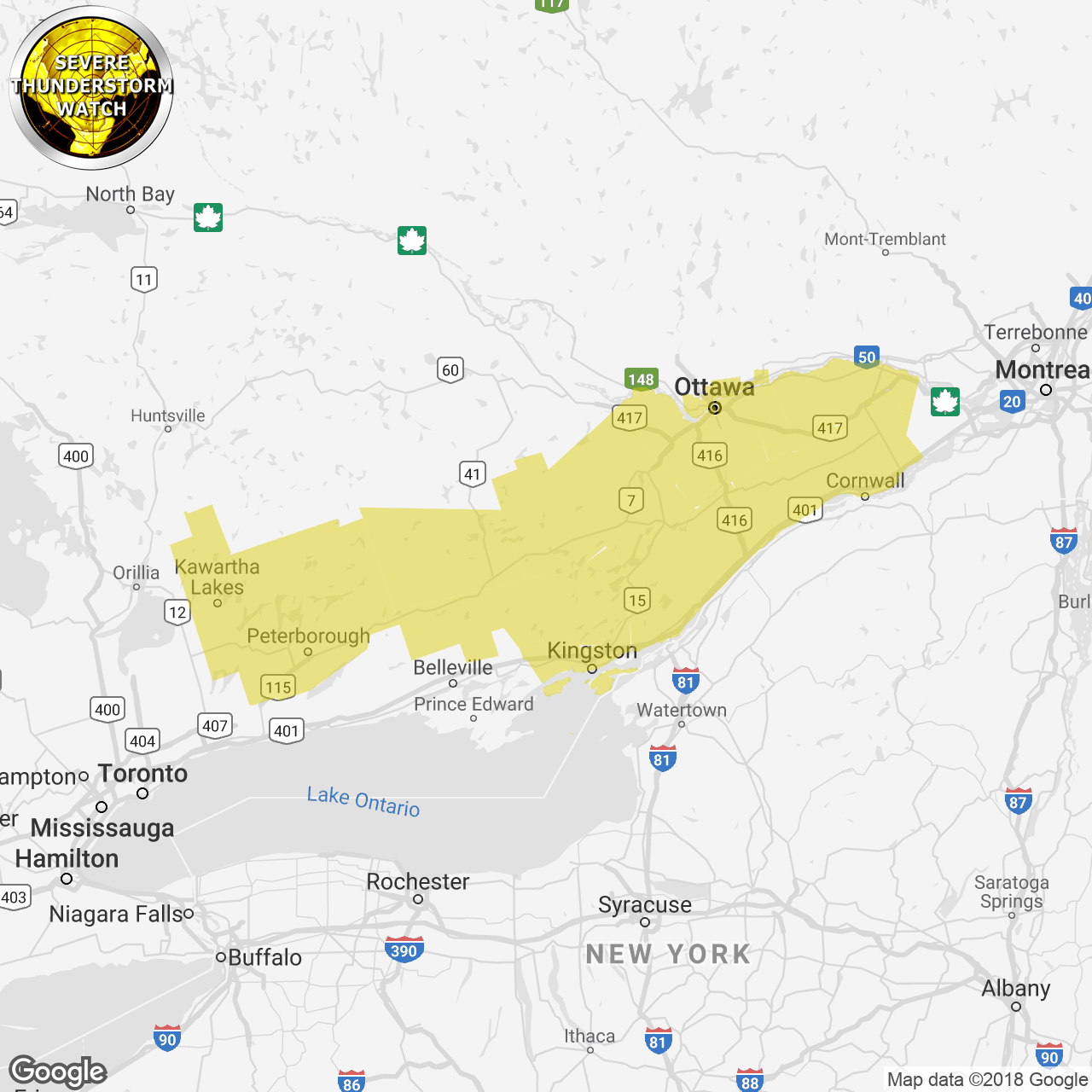
(Locations listed below description)
Conditions are favourable for the development of dangerous thunderstorms that may be capable of producing torrential rain.
Conditions will become favourable for severe thunderstorms later this afternoon and evening as a warm and humid tropical air mass remains over eastern ontario.
The main threat is torrential downpours producing 50 to 100 mm of rain in one to two hours, especially in areas that receive two or more thunderstorms in a row.
Heavy downpours can cause flash floods and water pooling on roads. Lightning kills and injures canadians every year. Remember, when thunder roars, go indoors!
The office of the fire marshal and emergency management recommends that you take cover immediately if threatening weather approaches.
Please continue to monitor alerts and forecasts issued by environment canada. To report severe weather, send an email to onstorm@canada.ca or tweet reports using #onstorm.
For more information:
http://www.emergencymanagementontario.ca/english/beprepared/beprepared.html.
ISSUED:
- Alexandria
- Apsley
- Balsam Lake Park
- Bannockburn
- Bon Echo Park
- Brockville
- Charleston Lake
- City of Ottawa
- Cornwall
- Eastern Lanark County
- Fenelon Falls
- Frontenac Islands
- Gananoque
- Gatineau
- Kaladar
- Kanata
- Kawartha Lakes
- Kemptville
- Kingston
- Lakefield
- Lanark
- Lancaster
- Leeds and Grenville
- Lindsay
- Long Sault
- Madoc
- Mallorytown
- Maxville
- Merrickville-Wolford
- Metcalfe
- Morrisburg
- Newington
- Northern Kawartha Lakes
- Northern Peterborough County
- Odessa
- Orléans
- Ottawa North
- Ottawa South
- Perth
- Peterborough
- Peterborough City
- Plevna
- Prescott
- Prescott and Russell
- Richmond
- Sharbot Lake
- Smiths Falls
- South Frontenac
- Southern Kawartha Lakes
- Southern Peterborough County
- Stirling
- Sydenham
- Tamworth
- Tweed
- Western Lanark County
- Westport
- Winchester
- Woodview