East Coast Storm to Deliver an Early Taste of Winter Across Southern Ontario Starting Thursday (Nov. 15) Afternoon; Widespread Accumulation Around 10–20cm Including the GTA, Eastern and Central Ontario
InstantWeather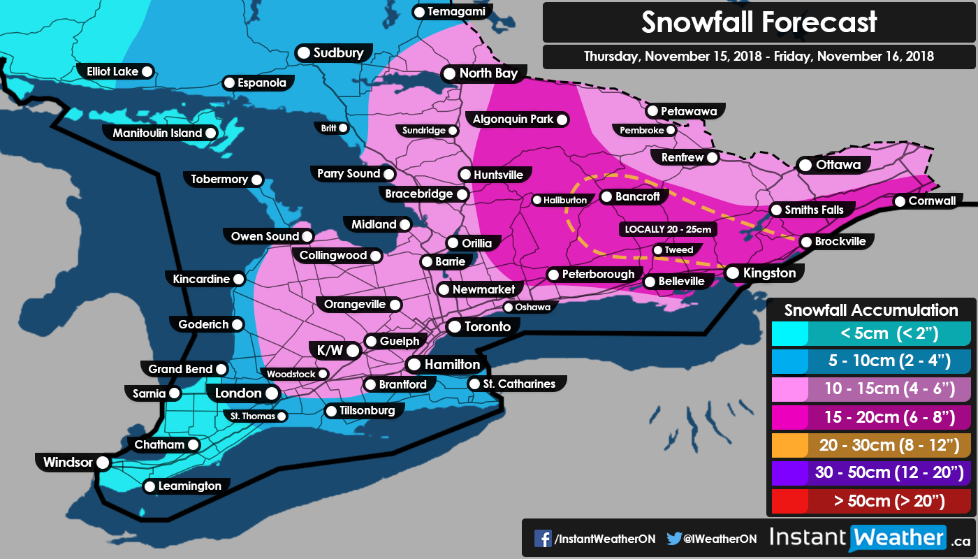
Earlier this week we were talking about snow squalls that buried Barrie and surrounding regions in over 30cm of snowfall accumulation while the rest of Southern Ontario got away with little to no accumulation. That’ll change later today as a storm pushing up the East Coast will begin to affect us with moderate to heavy snowfall spreading across the region just in time for the evening commute.
The heaviest snowfall is expected to occur during the overnight hours just before midnight for those around the GTA and after midnight for those in Eastern Ontario. We expect the snow to continue well into Friday morning while slowly clearing from the southwest to northeast. Lake effect snow could develop in the wake of the system moving out, but at this point, significant impacts aren’t expected and any lake effect snow accumulation is included in this forecast.
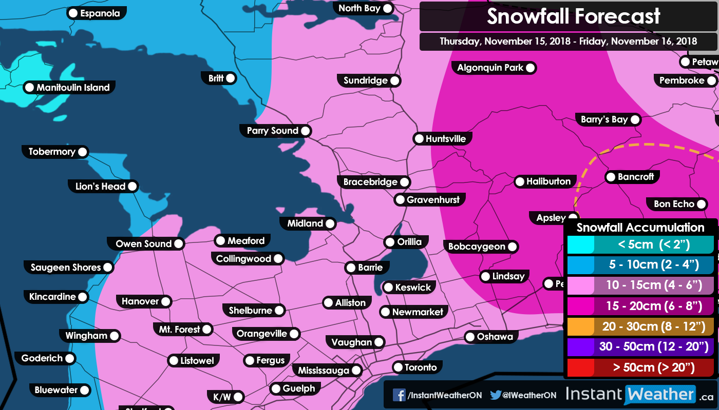
When this system fully moves out we expect that most areas will see general accumulation between 10-15cm with amounts closer to 5-10cm in Southwestern Ontario and into the Niagara region.

Out in Eastern Ontario, a broad region just north of Lake Ontario into parts of Central Ontario could see slightly more accumulation ranging from 15-20cm. We’re paying special attention to a zone extending from the international border between Kingston and Brockville and into Bancroft where local accumulation could exceed the 20cm mark. We’ve highlighted this ‘area of interest’ on our map with a hatched orange line.
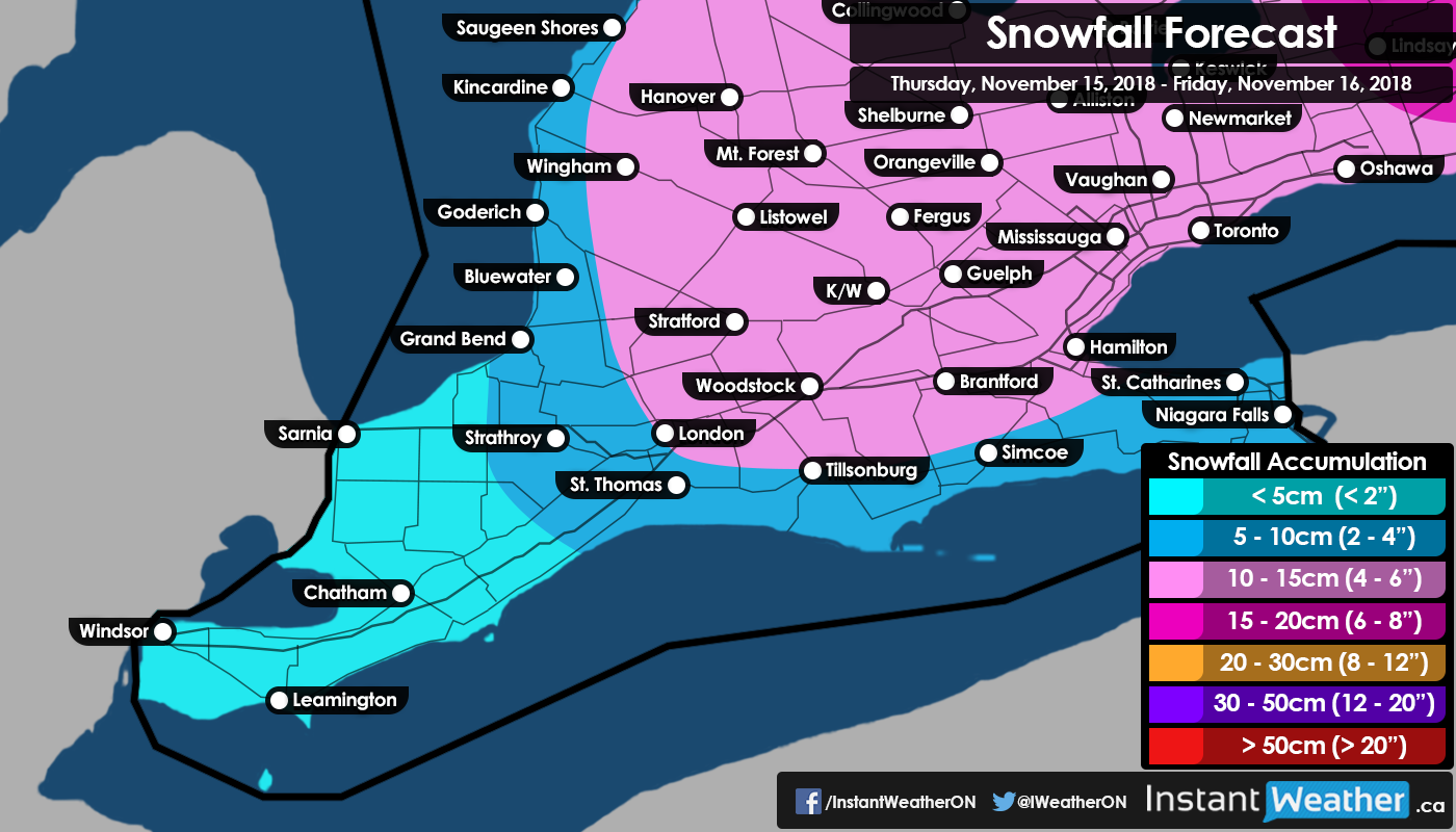
Now, when it comes to the GTA the potential accumulation is hovering near the lower end of the 10-15cm range especially closer to the lakeshore so we wouldn’t be surprised if accumulation in downtown Toronto and those closer to the lakes fall short of 10cm. Locations north and west of the GTA should easily reach the 10cm and may come quite close to 15cm in some areas.
For those wondering, we’ll be producing a snow day forecast for Friday morning. It should be out between 6-8pm this evening so be on the lookout for that! As always, we continue to monitor this and will let you know if anything changes.
- Brennen P.