Arctic Blast to Deliver Near Record-Breaking Cold Temperatures to Southern Ontario Later This Week With Wind Chills Dropping Below -20°C
InstantWeather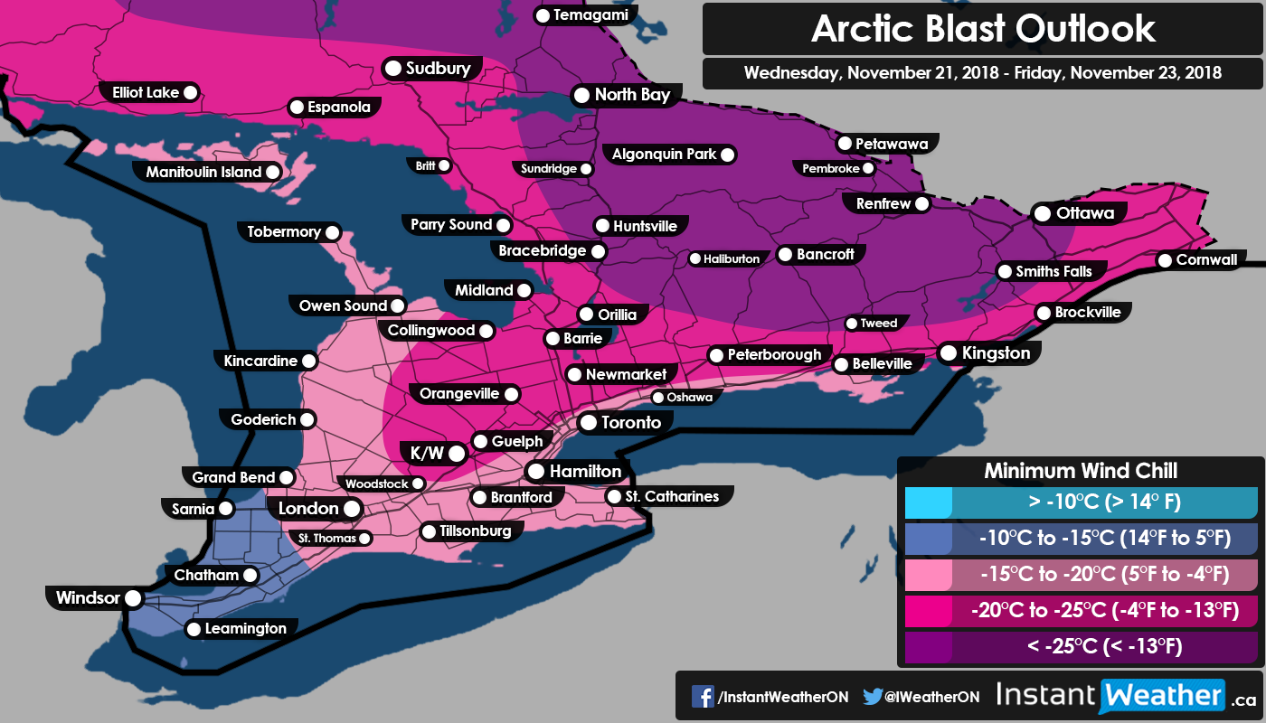
Get your parkas and winter coats out! Last week we got a taste of winter with widespread accumulating snowfall though the temperature has been mostly near seasonal or just slightly below seasonal. That’ll quickly change beginning Wednesday as we plunge into the deep freeze with air temperatures hovering in the negative mid to upper teens by Thursday morning. Once you factor in the wind chill many areas will feel like -20°C or colder, especially in Eastern and Central Ontario where the wind chill could dip below -25°C! The coldest temperatures ever recorded in this area during this time of year ranges from the mid negative teens to low twenties so we could easily see records being broken in many regions.
We’re not expecting much widespread precipitation this week with maybe some flurries and light snow on Wednesday morning (less than 5cm of accumulation for most). Lake effect snow could be an issue on and off during the week in the typical snowbelt around Lake Huron and Georgian Bay which we’ll be following. At this point, any lake effect snow should be rather unorganized with a maximum of 15-20cm expected by the end of this week mainly in Bruce-Grey counties.
By the weekend, temperatures will return back to near seasonal levels with most areas well above the freezing mark. There is also the risk of some rain as we enter an active period this weekend and into early next week. This might wipe out much of the existing snowpack and with the first ski hill (Horseshoe Resort near Barrie, Ontario) opening for the season last weekend they could be forced to close down. It’s way too early to give specifics, but we’re seeing the potential for a winter storm early next week, which could include rain, freezing rain, ice pellets, and heavy snow. We’ll keep you updated on that as it develops over the next week.
More details soon!
- Brennen P.