Messy Winter Storm for New Year’s Eve; 10–20cm of Snowfall Accumulation Possible in Parts of Southern Ontario With Heavy Rainfall for Other Areas
InstantWeather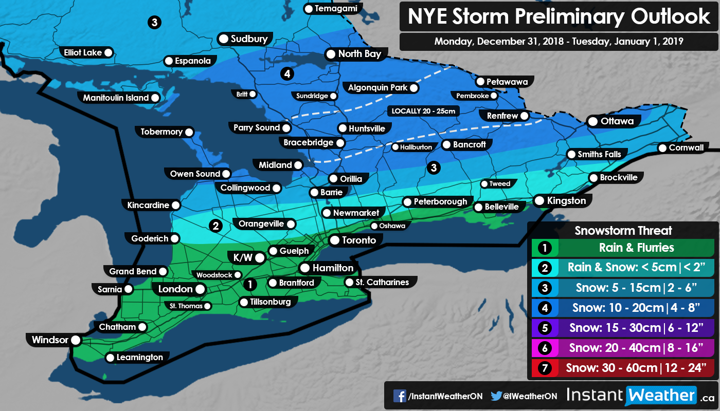
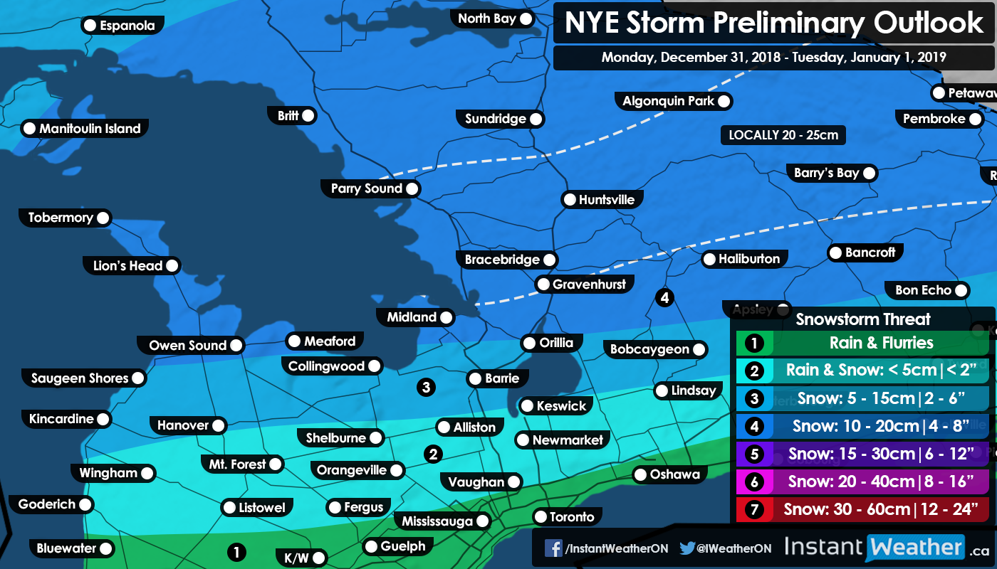
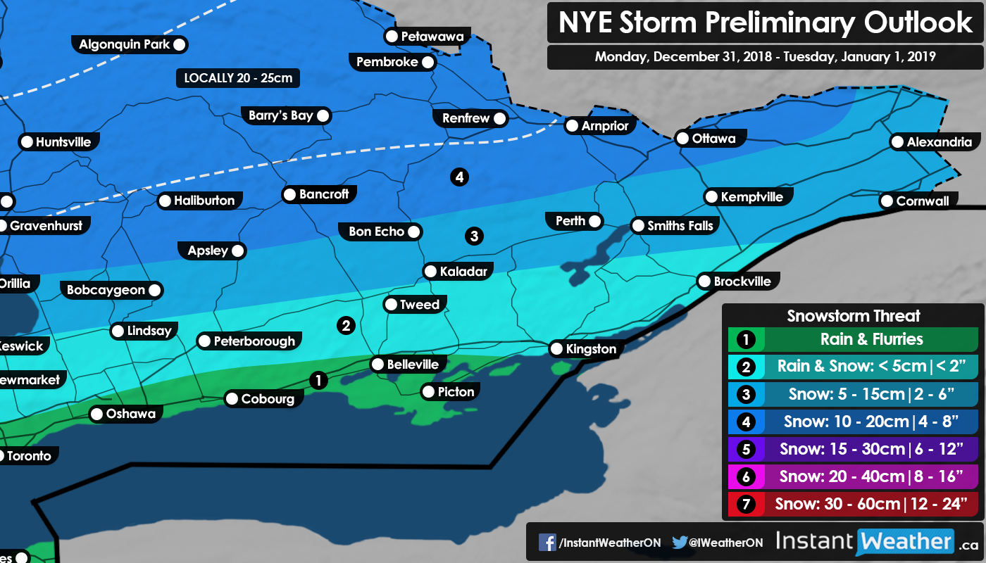
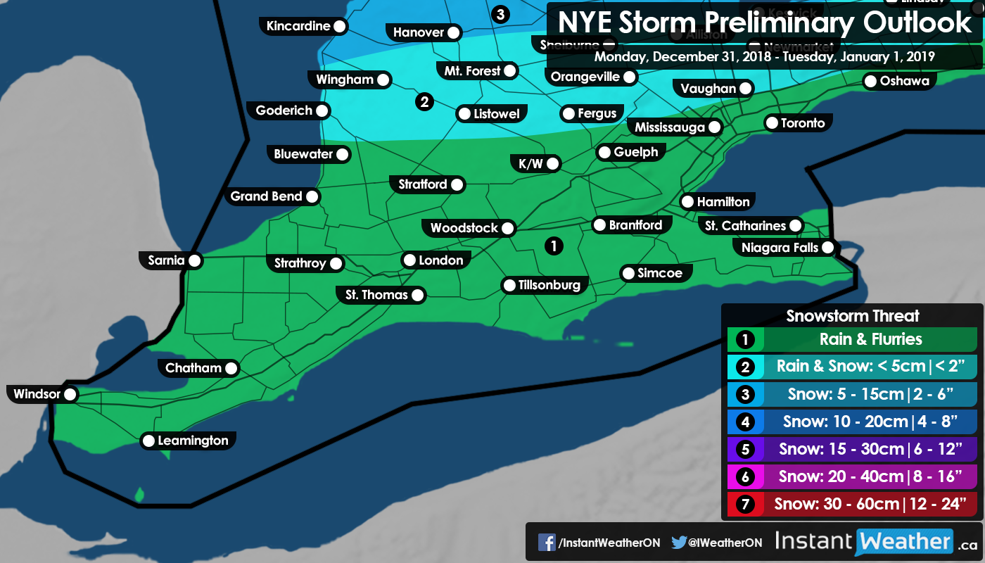
Regional maps are included at the bottom of the article.
It is not a normal New Year’s Eve in Ontario without some type of inclement weather such as extreme cold like last year. This year we are not talking about record-breaking cold, but rather a system originating out of Texas bringing a mix of rain and snow to the region just in time for the countdown to 2019. The initial bands of precipitation will begin to affect Southwestern Ontario during the early evening hours on Monday and slowly spread to the north throughout the rest of the evening. Now, the impacts will vary substantially depending on your location as a sharp mixing line meaning some areas forecasted to see heavy snow while others see heavy rainfall.
Let's begin with the snowfall, the northern section of the region including Central and Eastern Ontario will see the heaviest snow from this system with accumulation generally ranging from 10-20cm. There is a zone extending from Muskoka and east towards Bancroft/Renfrew that we believe has the potential to over-perform with local accumulation upwards of 20-25cm. Most of the snowfall will occur overnight Monday as this system is moving quite quickly and should be done by Tuesday late morning aside from some scatted lake effect snow remaining.
Further south it will be warm enough for the precipitation to be predominately rain, heavy at times. This includes areas around Lake Ontario and Erie like the GTA, Windsor and London. The timing could not be worse for those with New Year’s Eve plans that involve being outside with the heaviest precipitation occurring around midnight. Though final rainfall accumulation is expected to be rather insignificant between 8-15mm due to the limited duration of the event. As temperatures begin to drop later in the day on Tuesday, any remaining lake effect showers are expected to transition over to light snow before clearing out.
Keep in mind that this is only a preliminary forecast as we are still a few days out and things will more than likely change. We plan to issue our final forecast either tomorrow or early Monday so be sure to check back for the latest information.
- Brennen P.
Regional Maps