Ambitious Research Project Underway To Find Every Tornado In Canada This Summer
InstantWeather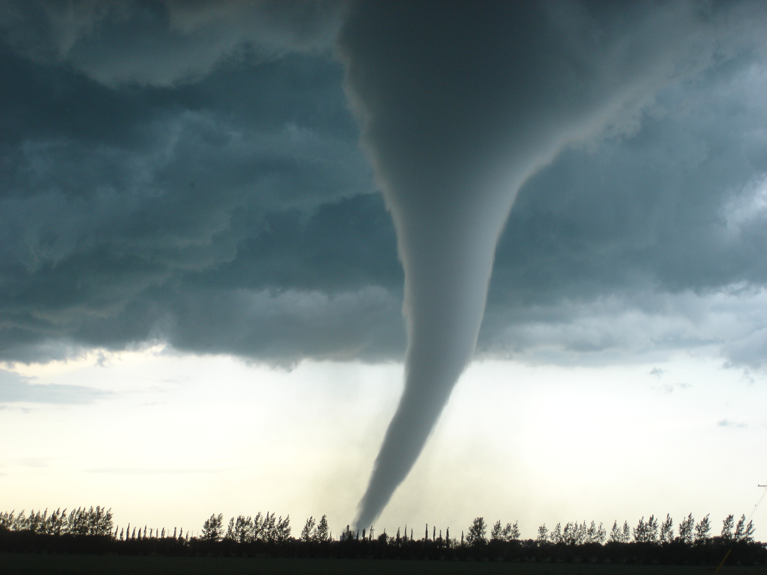
(Photo Credit: Justin Hobson, M.Sc., Senior Defense Meteorologist) The F5 Elie, Manitoba tornado on June 22, 2007 is still considered Canada’s strongest recorded tornado.)
A 2017/18 research project originally designed to only assess tornadic frequency in remote areas of Northern Ontario and Quebec is set to expand to include the rest of Canada this summer.
The Northern Tornadoes Project (NTP), lead by Professor Dr. Gregory Allan Kopp’s team at Western University’s Faculty of Engineering and Dr. David Sills, a Severe Weather Scientist from the Meteorological Research Division of Environment and Climate Change Canada (ECCC), hopes to provide solid evidence that in fact Canada does experience more tornado-related weather events than previously reported.

(Pictured Left: Professor, Dr. Gregory Allan Kopp, Faculty of Engineering, Western University. Right: Dr. David Sills, Severe Weather Scientist, Meteorological Research Division of Environment and Climate Change Canada.)
“The ambitious goal of the project in 2019 is to detect and document every tornado that occurs across the country. It’s a big country so this will be challenging. Clearly this will be easier for larger, more intense tornadoes. Weak EF0 tornadoes are harder to find – even with high-resolution data,” explains Dr. David Sills, Severe Weather Scientist with the NTP project.
In the past two years, Dr. Gregory Kopp and his team have come up with a process to accurately detect the impacts of tornadic activity in remote areas through the use of Doppler radar imagery, damage reports, ground surveys and high resolution satellite data. With this process, the team have successfully identified an additional 21 tornado touchdowns and improved data on 19 events.
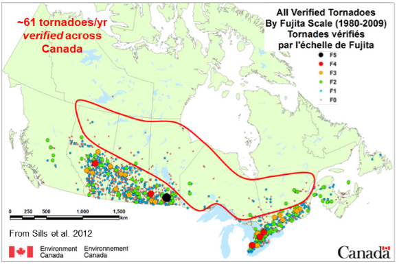
(Used with permission: The Northern Tornadoes Project) All verified tornadoes between 1980-1990, with outlined red portion indicating an area with frequent thunderstorms in summer but minimal reports or verification.)
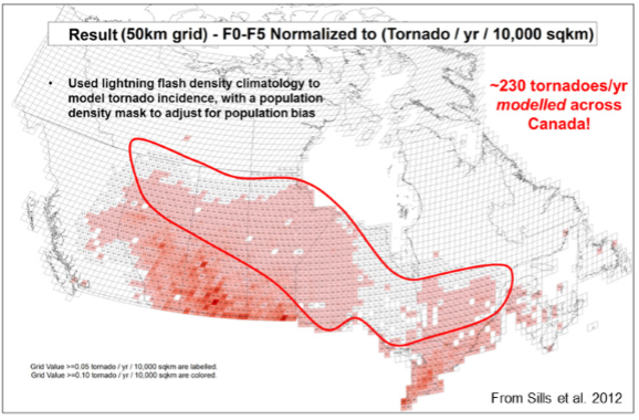
(Used with permission:The Northern Tornadoes Project)
The NTP team has found success in using a combination of several methods of determining and verifying tornadic activity. The process usually starts with producing an internal tornado forecast to prepare the team for gathering crucial data followed by using radar to identify potential tornadic storms in the region.
Once the event has occurred, a ground survey is then performed to get accurate ground-level data for assessment, however, access can be very tricky for extremely remote areas. High resolution (3-5 m) satellite imagery can be used to accurately map out the damage path, often in remote areas with densely covered forest. In addition, high-resolution aerial imagery allows for researchers to obtain geo-referenced research-quality datasets for further investigation. To conclude the investigation, all these methods are combined to come up with a final analysis of the event to present to the public.
This past summer identified a perfect example of how these methods were used to accurately assess the strength of the now rated EF-4 tornado in Alonsa, Manitoba. In this particular case, scientists did not have forest cover to rely on to provide strong visual evidence of a damage path.
“We had been gearing our techniques toward detection in forested areas so this was a good chance to see how well we could detect a tornado after the fact across a region that is mostly cropland,” adds Dr. Sills.
Satellite imagery used was considered beneficial in determining the damage path more characteristic of a higher end EF tornado. In addition, drone imagery and a thorough ground survey verified their initial assessment.
“It may be the best example we’ll have to work with for quite a while since EF4 tornadoes occur so infrequently in Canada,” Dr. Sills recalls. “Hopefully it will lead to better methods for detecting tornado damage in areas without trees and buildings.”
With additional data collected from previously undetected tornadoes, the NTP have determined Canada’s tornado totals increased by a significant percentage (between 30-50%), which was compelling enough to expand this study across Canada.
Dr. Sills is convinced this will give citizens, cities and rural municipalities much stronger evidence moving forward to better prepare for future weather related emergencies.
“Overall, this will give Canadians a better idea of tornado climatology including peak month, peak time of day and fraction of EF1 versus EF4 rated tornadoes. It will also determine tornado risk that includes regional hot spots for occurrence, emergence of new ‘tornado prone’ areas and allow for better preparedness.”
Many of these investigations are triggered by citizen reports indicating the possibility of tornadic activity in their area. Dr. Sills reveals a large part of this process includes crowd-sourcing, often from photos, video and verbal descriptions from media sources and social media, including Instant Weather.
“Such reports often provide a lead that can result in a full investigation and eventual verification of a tornadic event. So if you can do so safely – keep those witness reports coming!”
Author: Suzanne Pothe
References:
http://publish.illinois.edu/thwarts2018/files/2018/09/THWARTS-Abstract-21-Sills.pdf
https://globalnews.ca/news/4167527/quebec-tornado-outbreak-largest-ever/
https://ams.confex.com/ams/29SLS/webprogram/Paper348659.html
https://news.westernu.ca/2019/01/tornado-project-takes-national-spin/ Interview with Dr. David Sills, Severe Weather Scientist (January 10, 2019)