Major Snowstorm on the Horizon for Southern Ontario This Weekend? Potential for 25+cm of Snowfall Accompanied by Dangerously Cold Wind Chills Near -30°C to -40°C
InstantWeather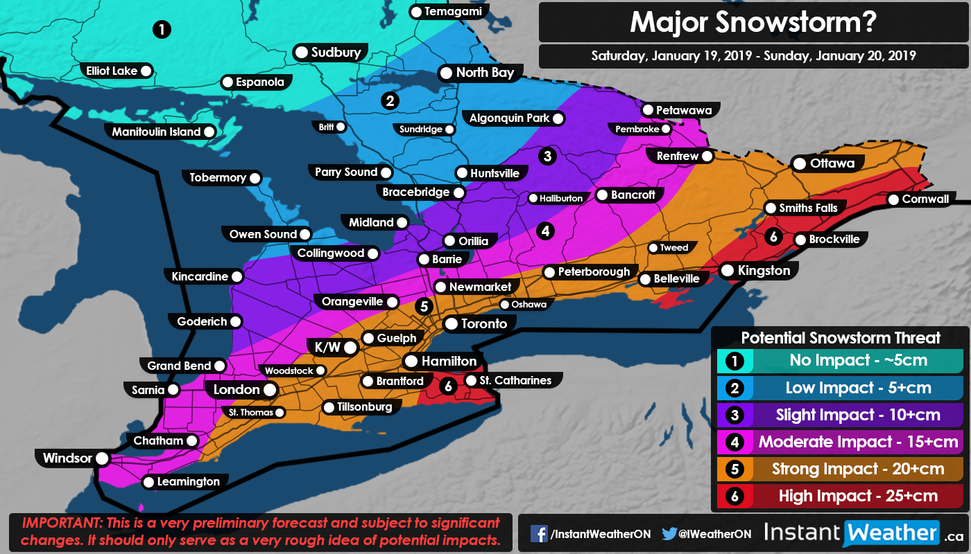
It was only a matter of time for the lack of snow this season to come to an end for Southern Ontario and that is indeed likely going to happen starting this Saturday. A low expected to rapidly develop over the US Midwest late this week will track towards our region by late Saturday, with current indications placing it just south of the Great Lakes. This scenario, currently supported by all three major weather models, will result in significant snowfall for Southern Ontario with higher amounts closer to the eastern quadrant of the province. This storm will bring a trio of potential threats: heavy snowfall, strong wind gusts and dangerously cold temperatures.
Let’s begin with the snowfall impacts from this system. It’s way too early to pinpoint exact accumulation, though it’s likely that this system will put down at least 30-40cm somewhere. The question is if that swath of 30-40+cm snowfall will be on our side of the border or end up in the US through Pennsylvania and New York. We can say with some certainty that at least 15-20cm (with 25cm near the New York border) seems probable throughout the GTA and into Eastern Ontario, even if the track of the system shifts further south.
Now, we’re still several days away so it’s plausible that the track of system makes either a sudden northerly or southerly shift, resulting in a drastic increase or decrease in expected snowfall amounts. Don’t get too concerned with the exact numbers at this point as there’s a heavy emphasis on the ‘+’ in our legend and rather prepare for the worst.
Wind gusts up to 40-60km/h at times will certainly enhance the impact of the heavy snowfall throughout the evening and overnight hours on Saturday. Blowing snow and even blizzard-like conditions can’t be ruled out which will create very dangerous driving conditions. Don’t go cancelling your plans yet, but do keep in mind that travel might be impossible in some areas through Saturday and into Sunday.
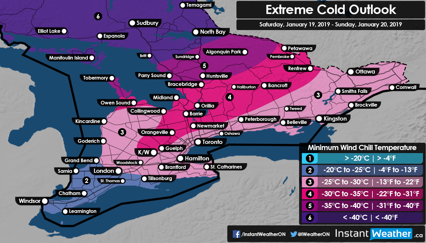
Probably the most dangerous aspect of this storm, that will likely get little coverage compared to the excessive snowfall, is the extremely cold temperatures that will be present throughout the duration of the event. It’s actually quite rare to see a snowstorm (excluding lake effect snow events) where air temperatures are in the upper negative teens to lower -20’s, so this is a unique event. Wind chills ranging from -30°C to -40°C will present an extreme danger for those who get stranded due to the weather conditions and may be life-threatening if not prepared. Should you decide to travel, which wouldn’t be recommended if this pans out as expected, it’s crucial you prepare an emergency kit with warm clothing should you get stranded for an extended period of time and emergency officials can’t reach you.
We’ll continue to persistently look over the latest weather data in the coming day and provide a more detailed forecast soon.
- Brennen P.