Winter Storm Warning Issued
Environment Canada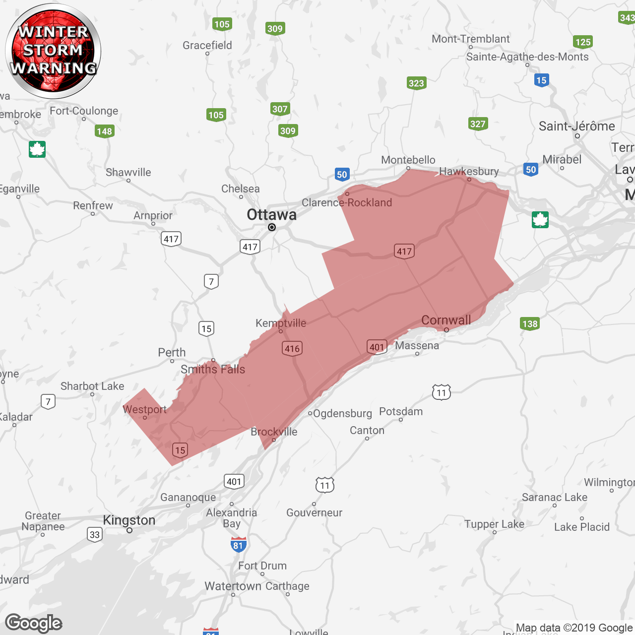
(Locations listed below description)
Winter storm conditions expected later today into sunday.
Snow will advance into eastern ontario today and become heavier this evening. The snow will taper off from west to east on sunday.
The latest analysis is suggesting higher snowfall amounts than originally anticipated. Total snowfall amounts of 15 to 25 cm are looking increasingly likely, particularly for regions close to the st. Lawrence river and lake ontario.
In addition, northeast winds gusting to 60 km/h will develop this evening and generate widespread blowing snow along with cold wind chill values near minus 30.
Consider postponing non-essential travel until conditions improve. Surfaces such as highways, roads, walkways and parking lots may become difficult to navigate due to accumulating snow. Visibility will be suddenly reduced to near zero at times in heavy snow and blowing snow.
Please continue to monitor alerts and forecasts issued by environment canada. To report severe weather, send an email to onstorm@canada.ca or tweet reports using #onstorm.
ISSUED:
- Alexandria
- Brockville
- Charleston Lake
- Cornwall
- Kemptville
- Lancaster
- Long Sault
- Maxville
- Merrickville-Wolford
- Morrisburg
- Newington
- Prescott
- Prescott and Russell
- Westport
- Winchester