Video Update with Forecast Maps and Environment Canada's Long Range Forecast Maps for Sun, Mon, & Tue
InstantWeatherBelow is Jennifer Fergusson's video update for today, Friday, January 25th, 2019. Please click the play button to watch it!
We're working hard to build up our YouTube channel so please click the "Subscribe" button and the bell icon to get notified the next time we post a video! To find the red subscribe button, visit our channel at https://YouTube.com/InstantWeatherOntario
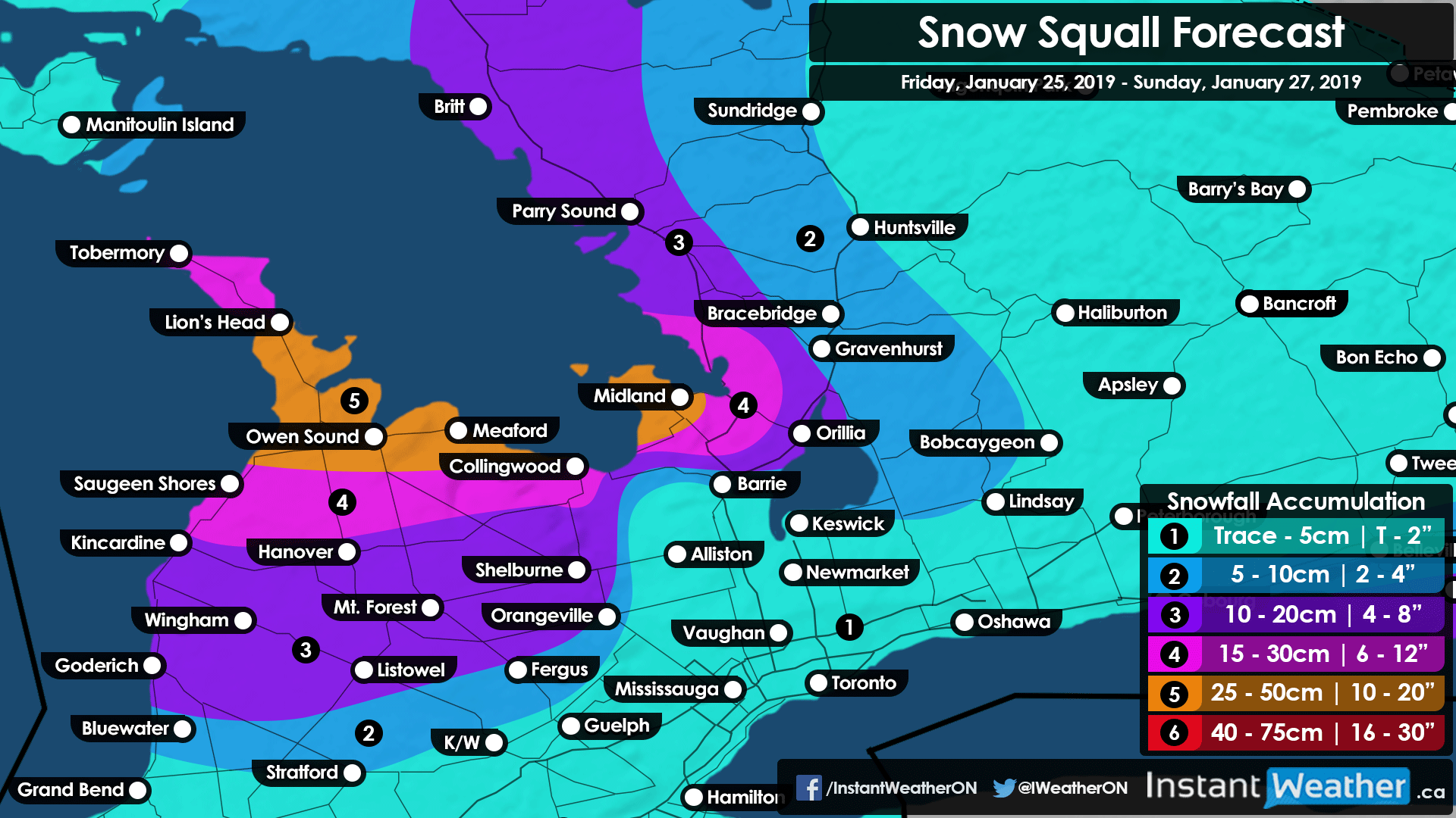
Above is the current forecast map for areas close to Georgian Bay and Lake Huron regarding these snow squalls and some pretty intense accumulation totals!
Please be careful on the commute this evening as it could get dicey, especially in areas affected by these squalls.
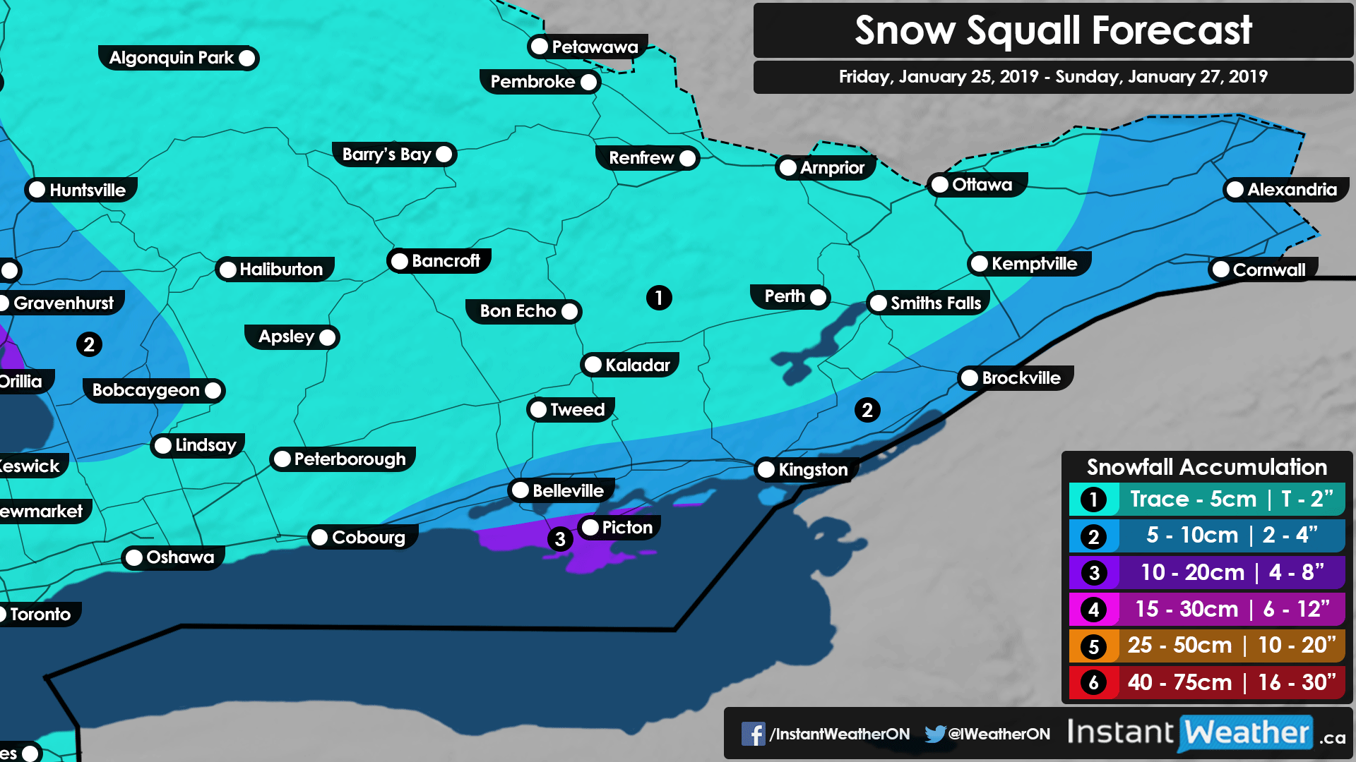
The above image is for eastern Ontario showing significantly lower accumulation totals but Prince Edward County and areas close to the US border in the east could see quite a bit.
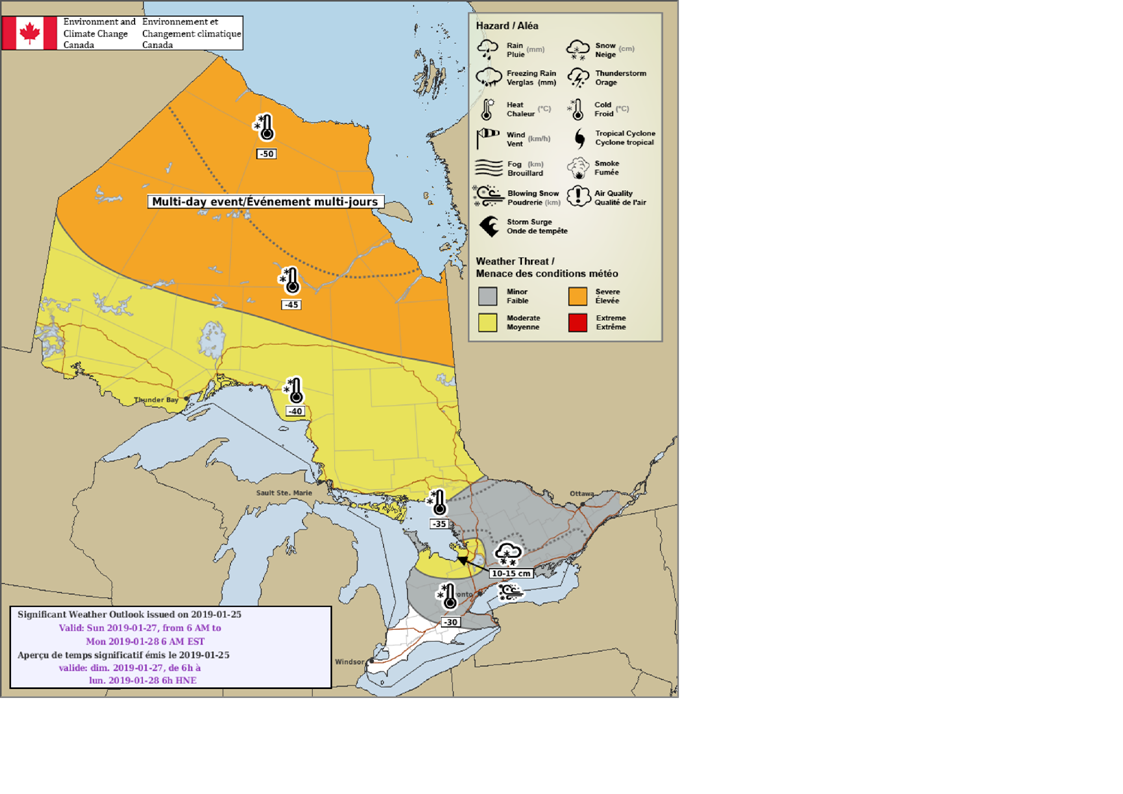
Above is Environment Canada's forecast map for Sunday showing 15cm for the same regions near Georgian Bay and some extreme cold in Northern Ontario with colder temperatures for parts of the south.
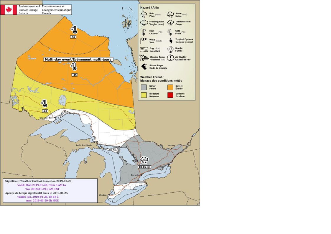
Above is Environment Canada's forecast map for Monday showing lower snow accumulations across a larger swath of the region in grey.
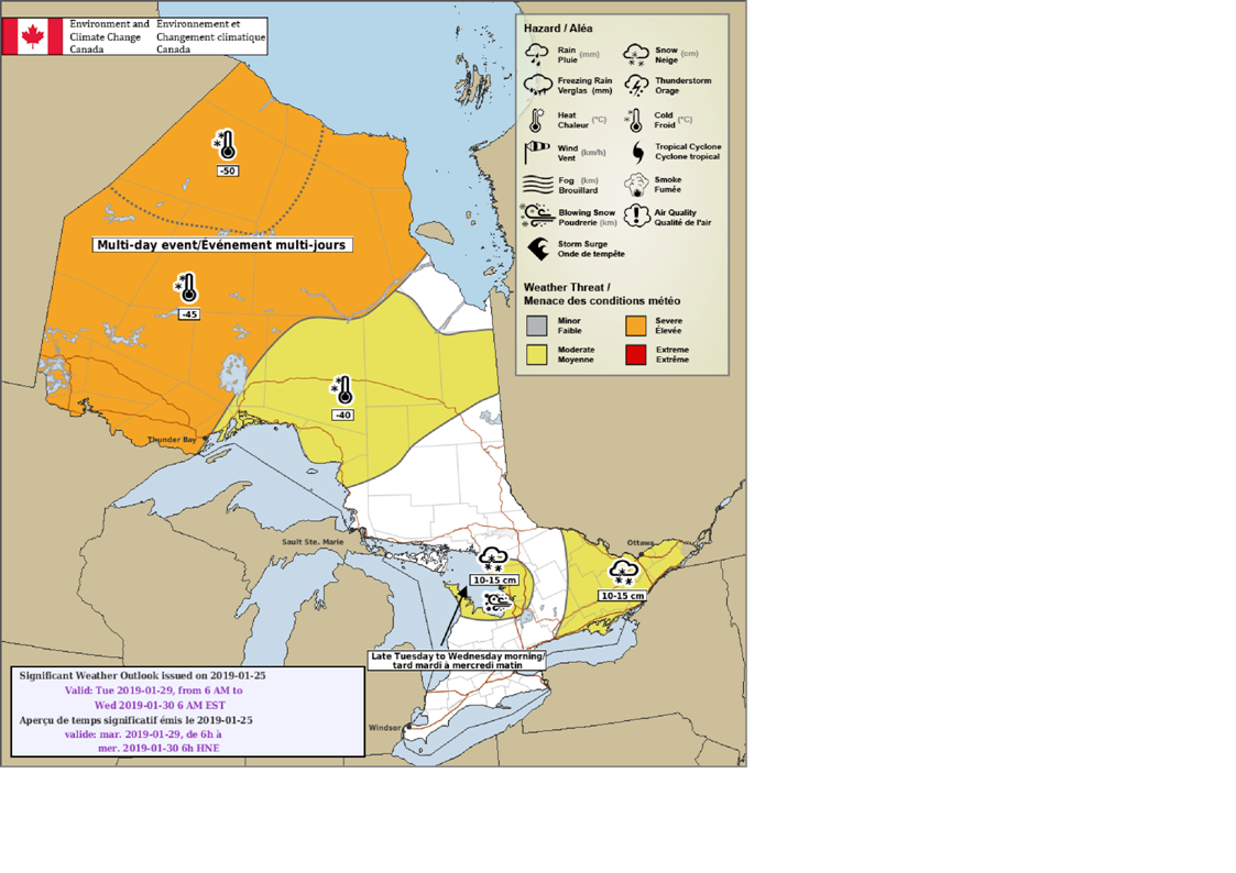
And above is Environment Canada's forecast map for Tuesday showing 15cm possible again for the Georgian Bay regions with 10-15cm possible in eastern Ontario.
More videos and forecast updates coming soon! We also appreciate the feedback you've provided us and we'll do our best to include forecast imagery along with the videos! We're listening! <3
- Jennifer F., Brennen P., & Adam S.
P.S. If you like these videos, please consider joining our Patreon campaign. For more details, visit https://Patreon.com/InstantWeather - There are cool rewards there like t-shirts and coffee mugs, etc! Thank you!