FEBRUARY, 11TH, 2019: Dangerous Blizzard Conditions Increasingly Likely for Southern Ontario Starting Tuesday; Snow Accumulation Between 20–40+cm Throughout Central & Eastern Ontario and the GTA; 5–10mm of Freezing Rain for Windsor, Hamilton, Kitchener/Waterloo regions
InstantWeather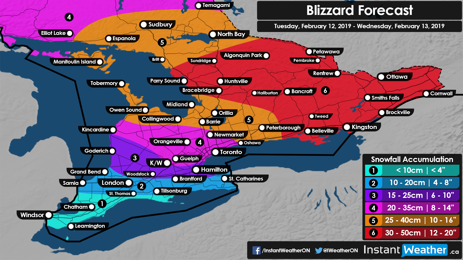
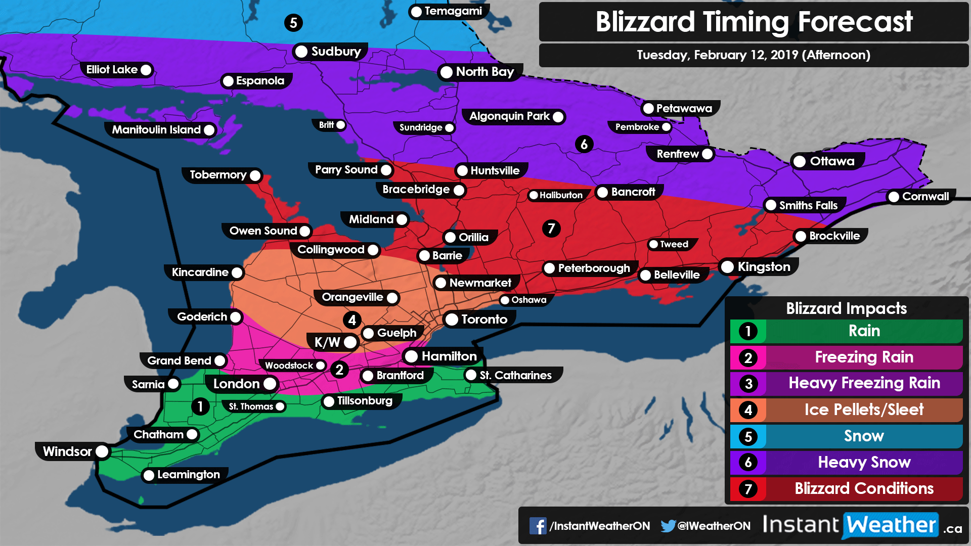
Confidence is growing in a highly impactful winter storm that will bring dangerous blizzard conditions and prolonged freezing rain to all of Southern Ontario between Tuesday and Wednesday. Everyone will be affected by this system in some way with conditions rapidly deteriorating beginning Tuesday morning or afternoon. Although, some areas will be harder hit than other and impacts will range from strong to near crippling depending on your location. Travel could become near impossible throughout the day on Tuesday into Wednesday so avoid non-essential travel if possible.
There was some uncertainty in our preliminary forecast on how far north the warmer air would get which would dictate what the main precipitation type. If warm air was able to infiltrate further north it would result in more ice pellets than snow and reduce the actual snowfall totals. The latest high-resolution models indicate that this should not be a problem for the most part and the forecasted snowfall from our preliminary forecast is still fairly accurate. With this, we are now able to be more precise by reducing the ranges for expected snowfall (other than the highest level which remains at 30-50cm) as shown in our map above. Ice pellets will certainly still mix in at times (especially later in the day on Tuesday), but snow will be the more dominant precipitation type.
It looks like the highest snow accumulation will extend from Muskoka through the Haliburton Highlands and basically all of Eastern Ontario (roughly east of Peterborough). Common accumulation will range from 30-40cm with a few localized areas picking up over 40cm and perhaps close to 50cm. Further southwest, snowfall accumulation will still be significant ranging from 25-35cm and perhaps as much as 40cm. This would include northern sections of Grey-Bruce counties, Simcoe County and parts of the Northeastern GTA (Durham, York Regions etc,) along with the rest of Eastern Ontario. The rest of the GTA and further west including Guelph and Kincardine can expect to see 20-30cm with locally 35cm. Accumulation will continue to drop off as more freezing rain/ice pellets are expected to mix in which is reflected in our forecast. Almost everyone will see at least 10cm aside from Extreme Southwestern Ontario, but this also includes the initial snowfall before any freezing rain or regular rain so totals after the storm might be less.
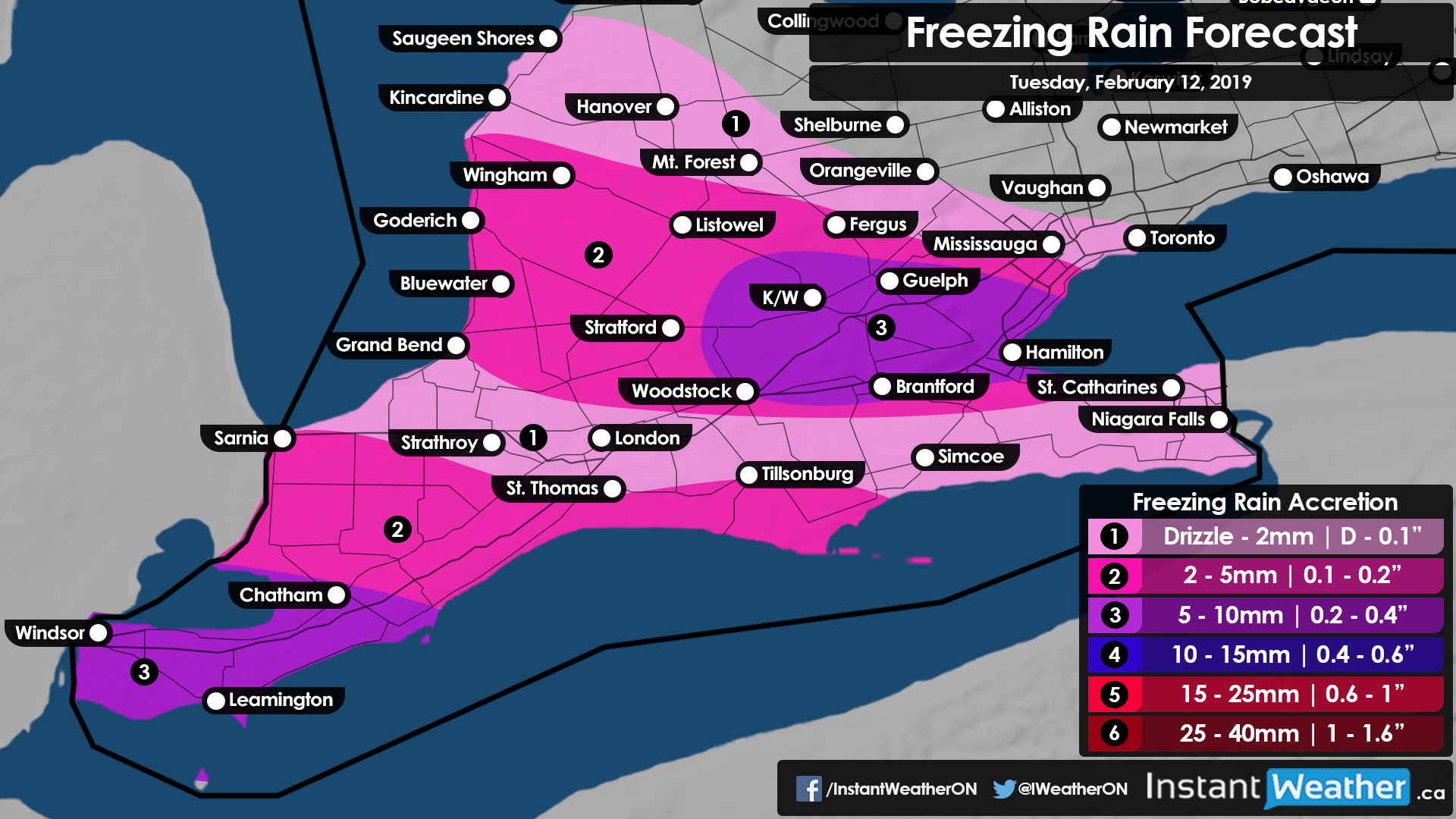
The freezing rain risk from this storm will be very localized with two main zones of heavy ice accumulation including Windsor, Chatham-Kent, Hamilton and Kitchener/Waterloo. Freezing rain accumulation will end up around 5-10mm though actual accretion (what sticks to the surface) will vary due to factors that are hard to account for. In between these two zones such as Sarnia, London and the Niagara Region won’t see as intense precipitation during the timeframe when the environment for freezing rain is favourable. Very strong wind gusts will also be a big concern in this area due to the potential for power outages caused by the ice accretion on power lines and tree branches that are already weakened without the wind.
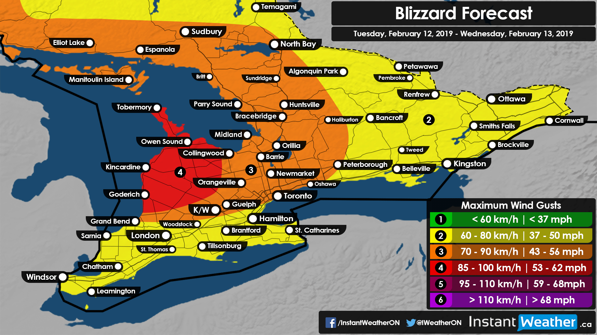
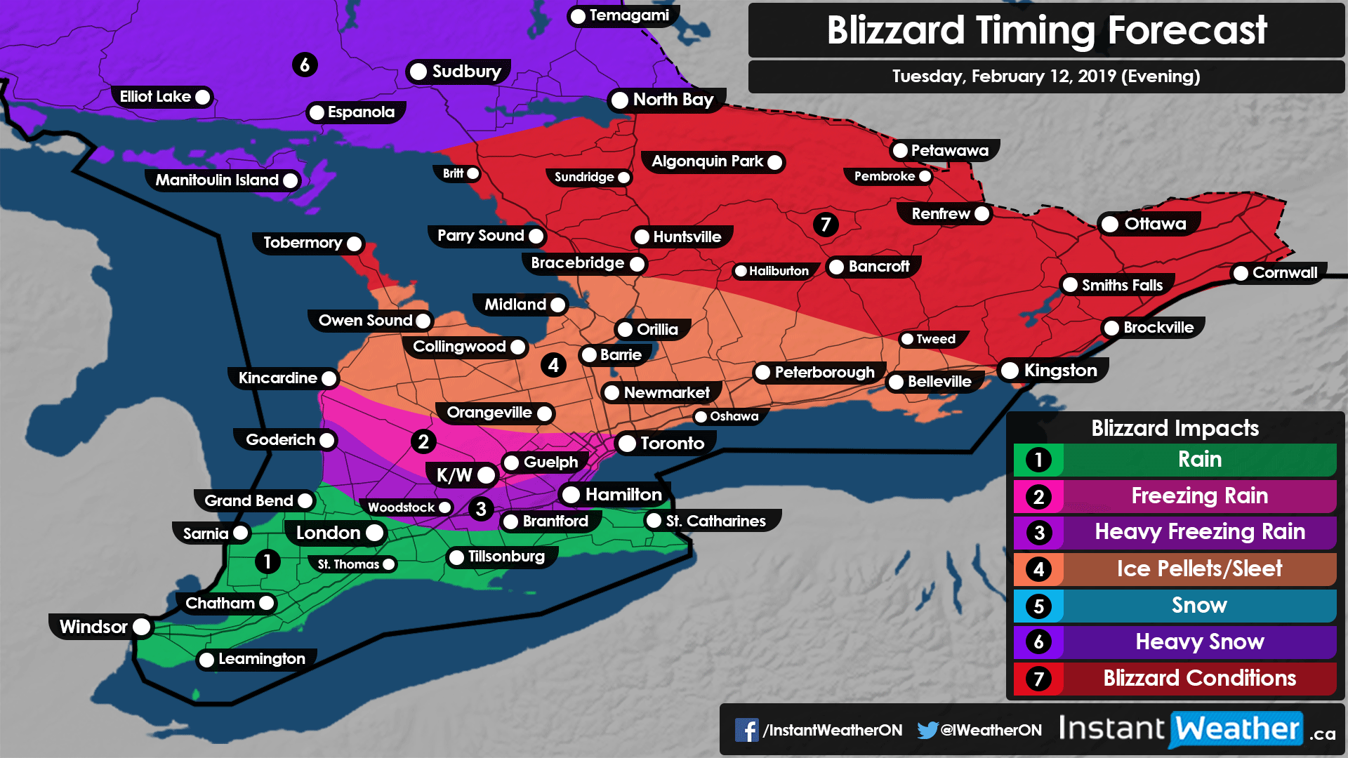
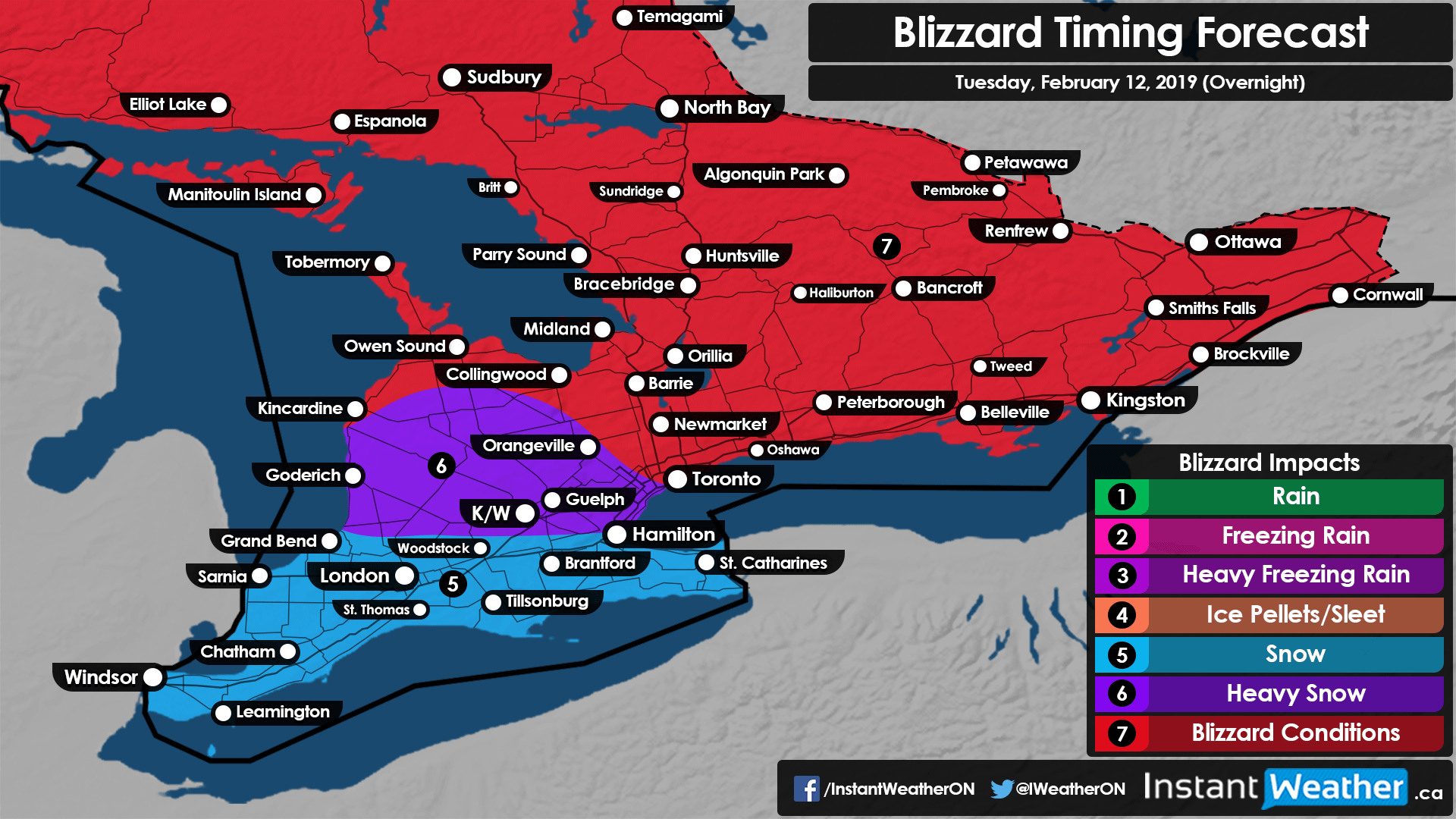
As mentioned, this storm will also bring strong wind gusts between 70-90km/h across much of our region. This combined with very heavy snowfall beginning Tuesday morning will likely result in the criteria for a blizzard begin met in many areas including highly populated regions like the GTA and Barrie. The blizzard potential will begin to ramp up during the evening in Eastern Ontario although the winds won’t be as strong as areas further southwest. Many hours of near-zero visibility due to the blizzard and blowing snow will make conditions downright dangerous for many hours throughout Tuesday and into Wednesday. Road closures are very likely, especially in rural areas that have limited resources to keep roads in a safe condition.
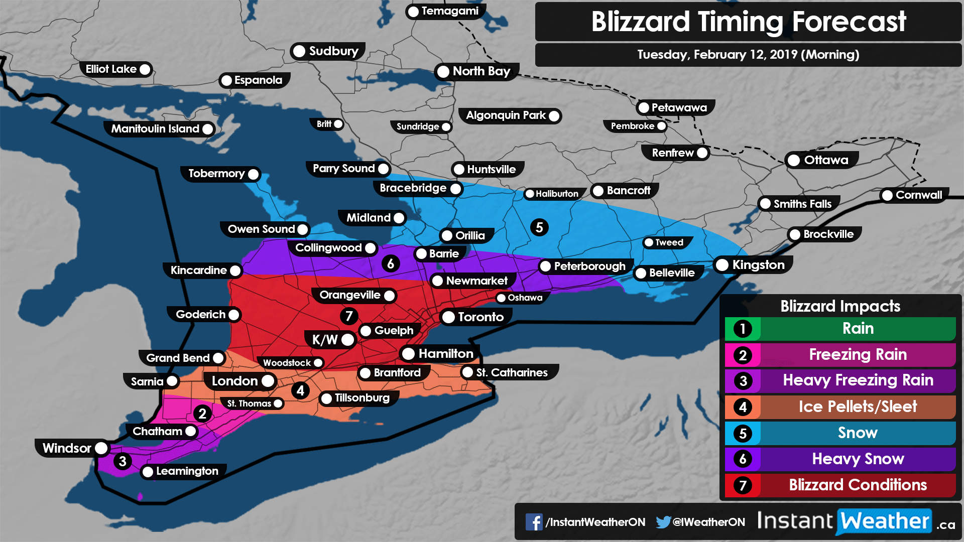
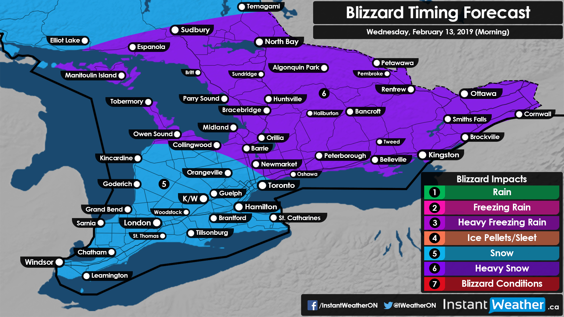
A common question we get during these events is in regards to timing so we have put together several maps below to give you an idea when the worst conditions will happen in your area. The storm will begin to die down after Wednesday morning with only some snow lingering around throughout the day.
Stay safe!
- Brennen P.