UPDATE: Significant Winter Storm Expected to Continue to Create Blizzard and Icy Conditions Throughout Tuesday and Into Wednesday Across Southern Ontario
InstantWeather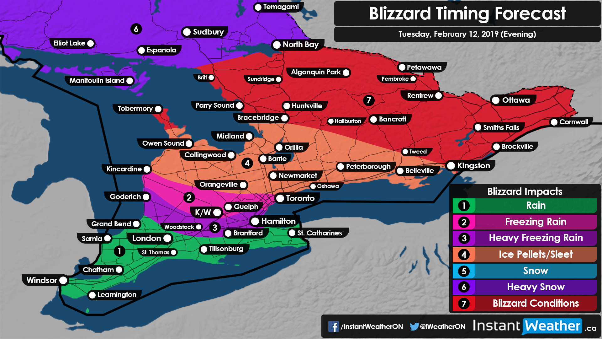
If you’ve taken a look at the radar recently you might notice a lack of precipitation to our west. Don’t be tricked by this as this storm is far from over as more precipitation works its way up from the south. Heavy snow, ice pellets or freezing rain will continue into the evening hour. Those that have already transitioned from snow will see it return later today as colder air flows into the region.

Blizzard conditions will also continue throughout Central and Eastern Ontario for the foreseeable future. Good thing all the school boards cancelled buses or closed school for this afternoon! (Oh wait...)
If you can, please just stay off the roads today because conditions are quite dangerous in some areas!
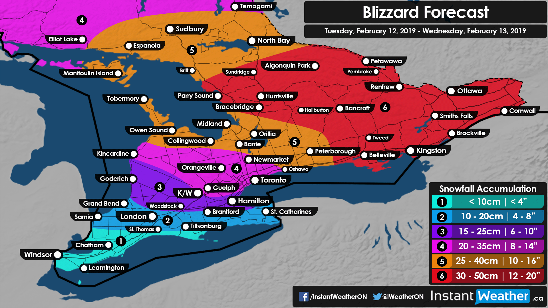
You may also notice that some areas will have received less snowfall than expected once the transition to ice pellets occur. This is because we expect more snowfall accumulation (about 10-15cm for the GTA and surrounding regions) later today when the snow returns which should push totals above the forecasted 20cm mark combined with earlier snowfall and ice pellets. Central and Eastern Ontario is still on track for 25-40cm (Maybe up to 50cm) by tomorrow.
Hearing of some significant icing due to freezing rain around Lake Erie and Extreme SW Ontario. That should begin to come to an end in the next few hours as temperatures climb above the freezing mark.
We’ll continue to monitor this and let you know of any changes.
- Brennen P.