Messy System to Dump Heavy, Wet Snow Across Alberta This Weekend
InstantWeather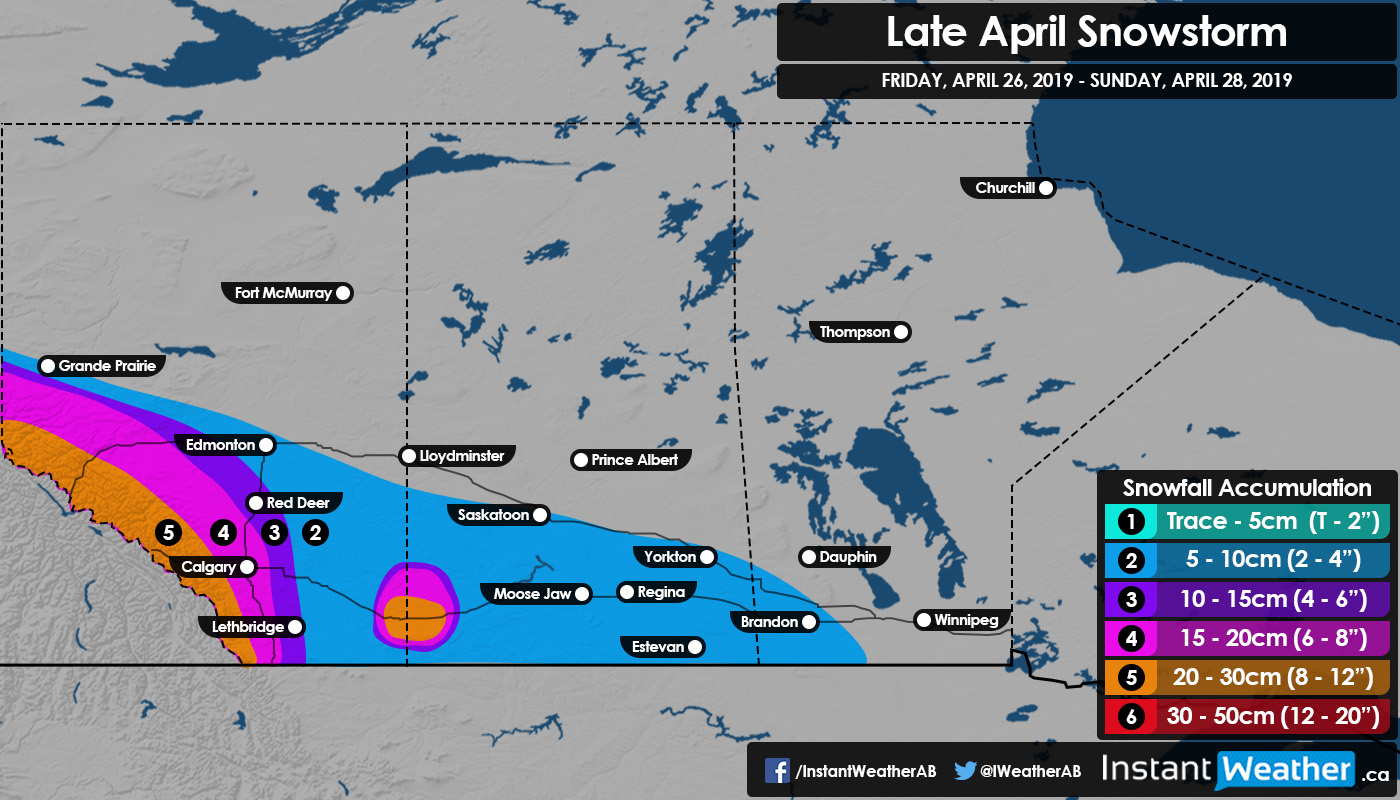
While we have seen some warmer weather throughout the Prairies, and even the start of storm season in some areas, it seems that Mother Nature has different plans. We are currently watching a system that is set to bring widespread snowfall, snow showers, and event the odd thunderstorm to Alberta and Saskatchewan this weekend.
The snow will begin this afternoon south of Grande Prairie and the Jasper region before spreading southeast into Banff and the Foothills. The snow will likely intensify overnight tonight in the mountains and foothills before moving east throughout the day on Saturday. Snowfall totals in the south will be dependent on temperature; warm air will likely result in a change over from snow to rain and the potential for scattered thunderstorms before changing back over to snow.
By Sunday morning, the storm will begin to taper off in Alberta as it continues to move southeast through southern Saskatchewan. Accumulation in Saskatchewan is questionable as models are in disagreement regarding which areas could receive larger amounts of snow. However, there is a general consensus among the models that a small pocket of higher accumulation may occur in the Medicine Hat area and east into Saskatchewan. Accumulation amounts will be the highest in the mountains, with up to 30cm falling and the potential of localized higher amounts.
Strong winds will also be a factor this weekend, with wind gusts of up to 70 km/h expected Saturday afternoon along with the heavy snowfall. This combination will likely result in whiteouts and treacherous travelling conditions.
- Alannah C