VIDEO UPDATE: Flood Emergencies in Cottage Country Likely to Worsen With More Rain on Friday
InstantWeatherHere's Jennifer Fergusson's video update on the ongoing major flooding in Cottage Country and rain on Friday that could worsen the situation:
Written Forecast
The spring flooding this year has been particularly severe with several municipalities as of Thursday declaring state of emergencies including Bracebridge, Huntsville, Minden Hills and most recently, Ottawa. Water levels in local waterways have reached or exceeded the levels that occurred in 2013 when these same areas experienced the worst flooding in over 100 years.
Unfortunately, it appears that the situation will get much worse before it gets better because more rain is in the forecast on Friday and Saturday. And because this is Canada, there is also have the chance of seeing a late April snowfall on Saturday in some areas though little to no accumulation is expected.
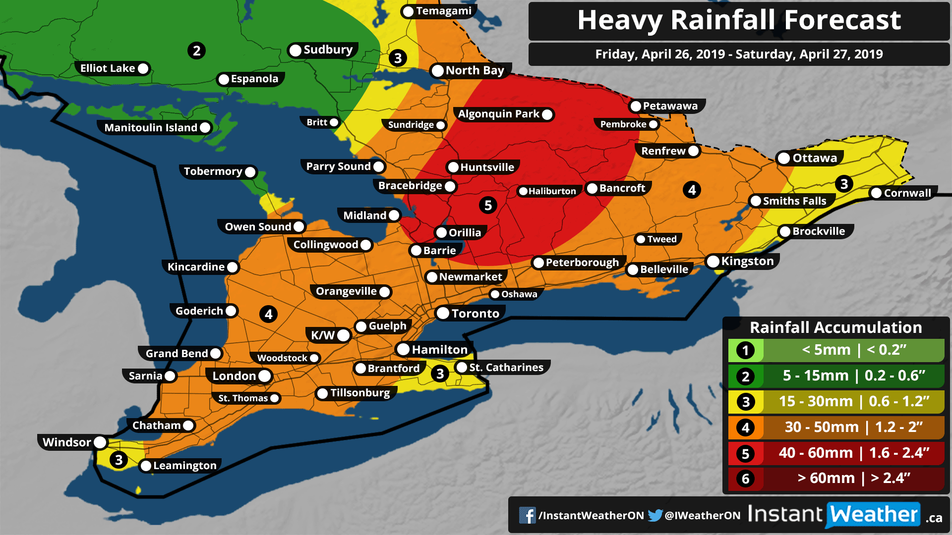
The rainfall will reach areas south of Lake Simcoe around midnight tonight with those close to Lake Erie possibly seeing it a few hours before midnight. Central and Eastern Ontario should see the rain begin early Friday morning. The heaviest rainfall is expected to occur during the overnight and morning hours with lingering showers and light rain continuing throughout the day on Friday. By Friday evening the rain will be coming to an end for most areas with the exception of Central and Eastern Ontario.
In regard to the total rainfall accumulation expected by Saturday, the heaviest rainfall is sadly targeting the same areas being hardest hit by flooding currently throughout Central Ontario including the Muskoka region. As much as 60mm of rainfall accumulation can be expected in Central Ontario with between 30-50mm possible in much of Southern Ontario. Some locations may see less than 30mm which we have shown on our forecast map.
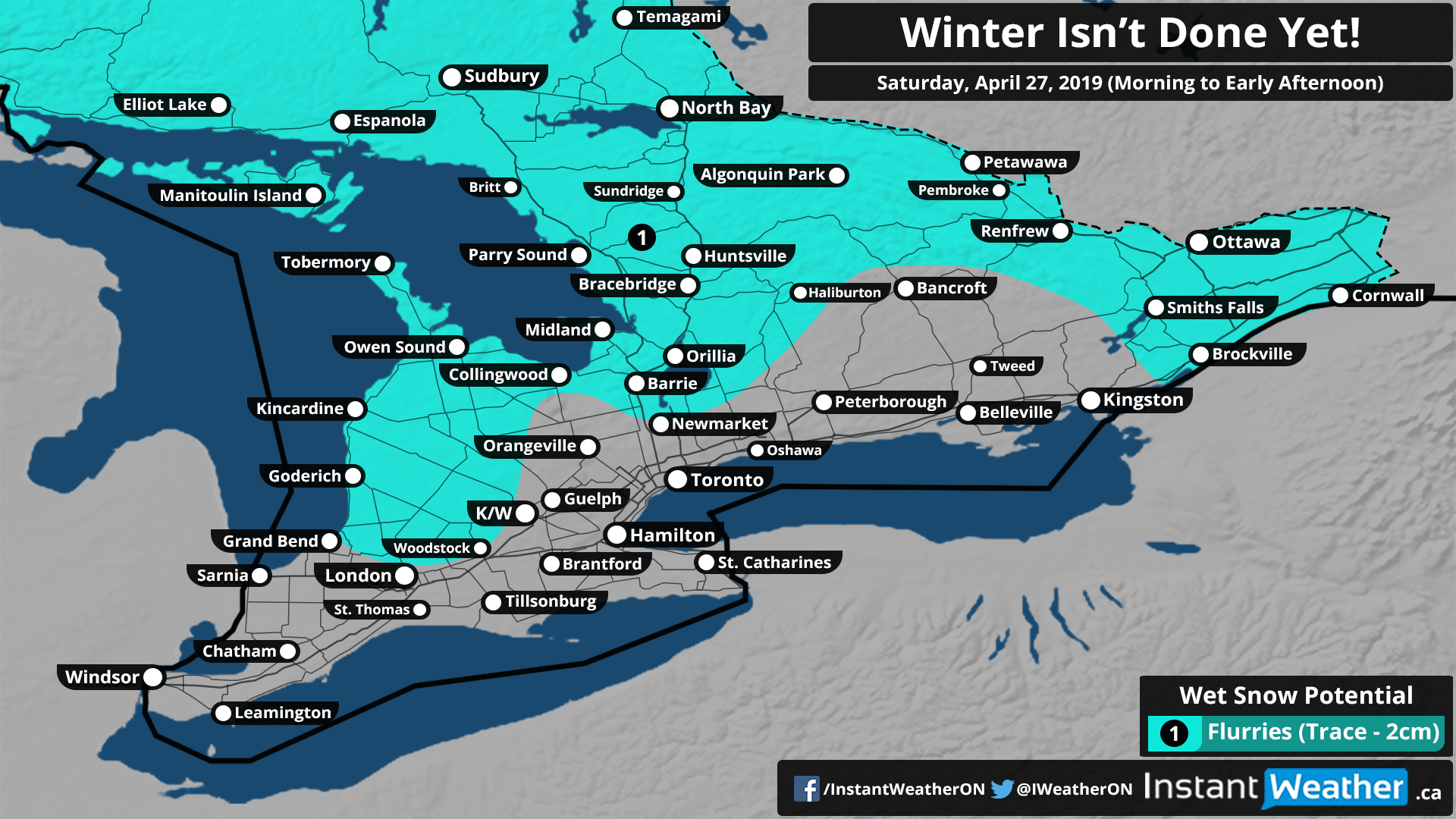
Colder air is expected to be ushered into Southern Ontario overnight Friday and early Saturday morning with many areas dropping to near or below the freezing mark. As a result, any remaining rain will transition over to some light snow with the highest chance of seeing snow being around Lake Huron, Georgian Bay and near the Quebec Border. Since temperatures will be near the freezing mark and the ground wet from previous rainfall, we don’t expect any significant accumulation with 2cm at most.
We’ll continue to follow this and provide the latest updates as necessary including more information on the unfolding flooding emergencies throughout Central Ontario and parts of Eastern Ontario.
Forecaster: Brennen Perry