Risk of Severe Thunderstorms Throughout Southwestern Ontario and Around Lake Simcoe This Afternoon Into the Evening; Main Risks Include 100+km/h Wind Gusts, Up to Quarter Size Hail and Possibly 1 or 2 Tornadoes
InstantWeather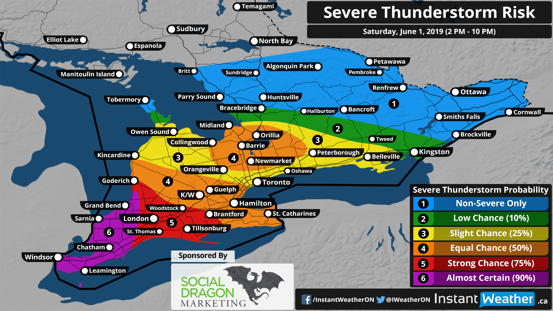
This forecast is sponsored by Social Dragon Marketing! Are you a business owner? You probably already have enough on your plate. Social Media Marketing shouldn’t be one of them. The good news… you don’t have to do it all! Social Dragon Marketing can manage your day-to-day social media marketing activities by using the right tools designed for your business needs. You can find out more here: socialdragonmarketing.com
If you're interested in connecting your organization with our amazing community by sponsoring a forecast map, please visit: instantweatherinc.com/sponsor
A cluster of severe warned thunderstorms near Windsor as of 3:00 pm is expected to track into Southwestern Ontario this afternoon. The environment is favourable for these storms to continue to produce severe weather with a focus on damaging wind gusts in excess of 100km/h and the risk of flash flooding due to the extensive amount of rainfall in a short time period. Hail up to Quarter size (2.5cm) and even 1 or 2 tornadoes can’t be ruled out, but it’s not the main risk given the linear storm mode.
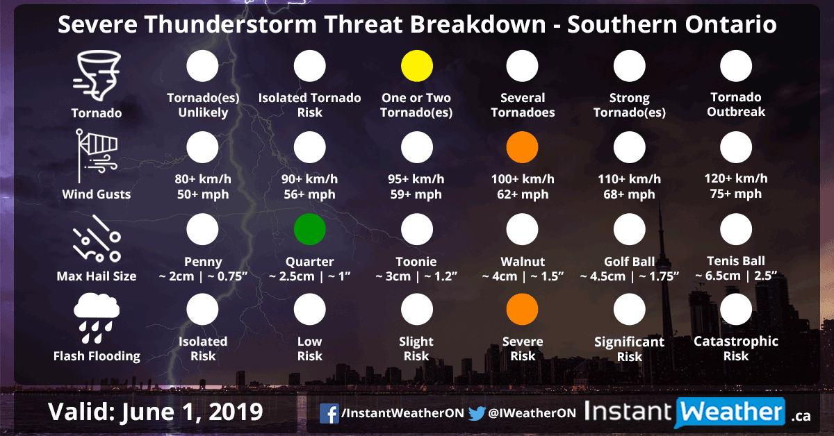
The complex of storms will continue to track to the east throughout the late afternoon into the evening with the severe probability decreasing over time as the storms decay. There are some indications that a pop-up isolated storm may show up around or just south of Lake Simcoe between 5-7pm ahead of the decaying line of storms from the west. Though the exact strength of the storm is questionable, so we’ve stuck with a 50/50 change on our map. All severe threats are on the table (wind, hail and flash flooding) including possibly a tornado if the storm is strong enough.
The severe threat will come to an end later this evening as the storms move out of the province. More rainfall with embedded non-severe thunderstorm are possible overnight into Sunday morning. General rainfall amounts will range between 5-15mm with up to 50-75mm possible in localized areas that get into the thunderstorms.
As always, we’ll be watching the radar closely all day and will keep you updated on any potential severe storms.
Forecaster: Brennen Perry