STRONG SEVERE THUNDERSTORM RISK for Medicine Hat, Brooks, & Taber; Large Hail 2-5cm, Damaging Wind Gusts 110km/h+, Isolated Tornadoes, Isolated Flooding, & Frequent Lightning
InstantWeather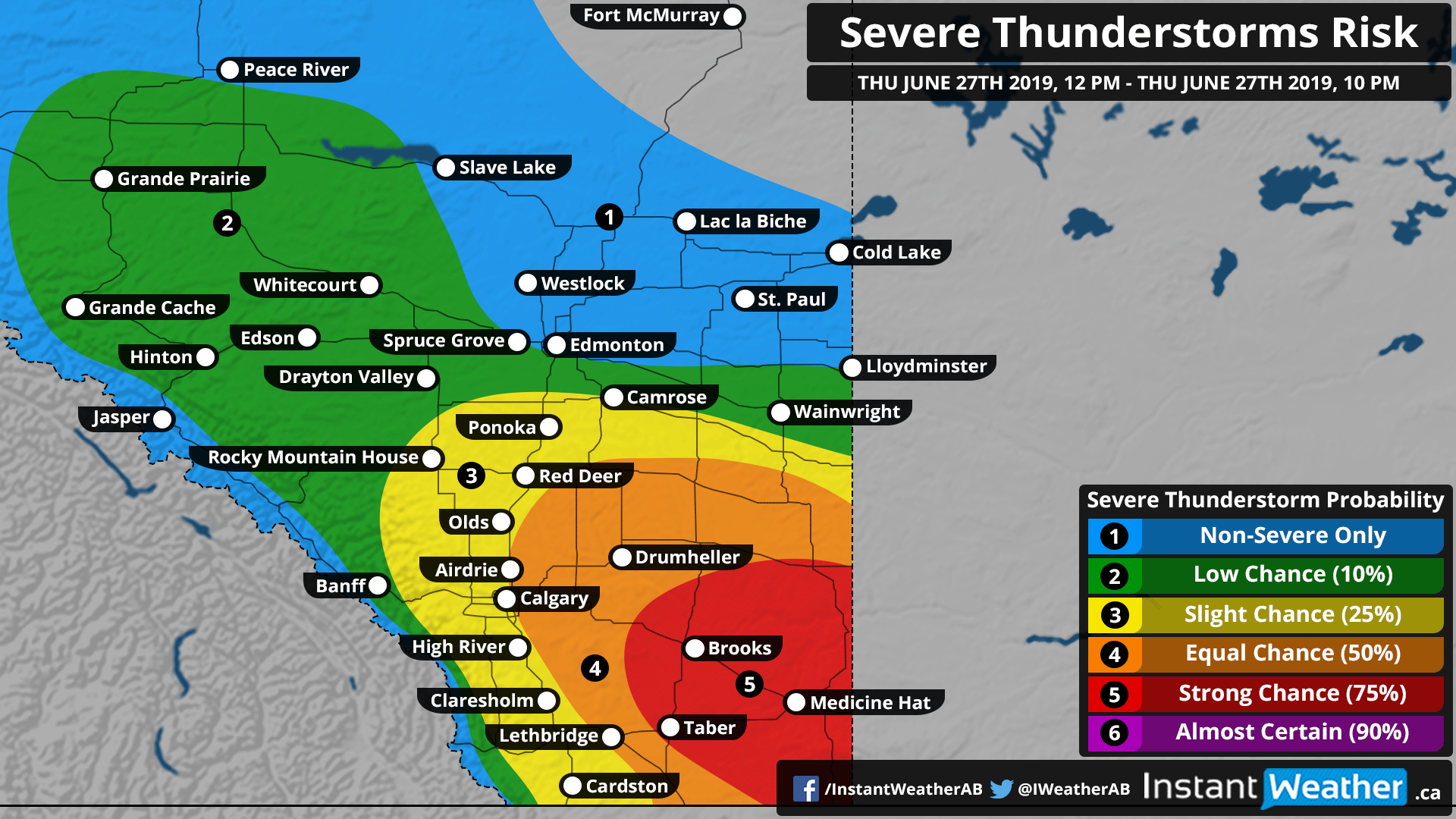
There is a strong risk for severe thunderstorms this afternoon/evening (Thu, June 27th, 2019), especially in southeastern Alberta, which is highlighted in red. The focus of the risk is in areas like Medicine Hat, Brooks, Taber, and the surrounding communities.
The risk will begin in the afternoon closer to the international border and track east, northeast towards Saskatchewan in the evening.
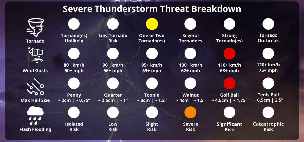
Damaging wind gusts reaching 110km/h+ (perhaps upwards of 120km/h in the most intense storms), large hail 2-5cm, torrential rain with the potential for isolated flooding, and of course, as with many severe thunderstorms, frequent lightning strikes. The tornado risk is more likely in the red region with the strongest storms, especially those that develop closer to the Saskatchewan border.
There is also a risk for funnel cloud development again today and this is why Grande Prairie and surrounding regions are highlighted in a low-risk (green). In rare cases, these weaker funnel clouds can touchdown and produce brief landspout tornadoes.
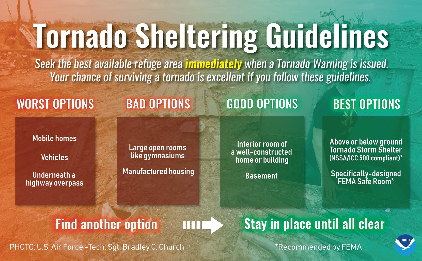
Please have a plan in place folks. The National Weather Service in the US has produced the infographic below and we feel it's definitely something to take into consideration during severe events:
Environment Canada has also produced a forecast map for today's severe weather risks, and have mentioned the risk for tornado development:
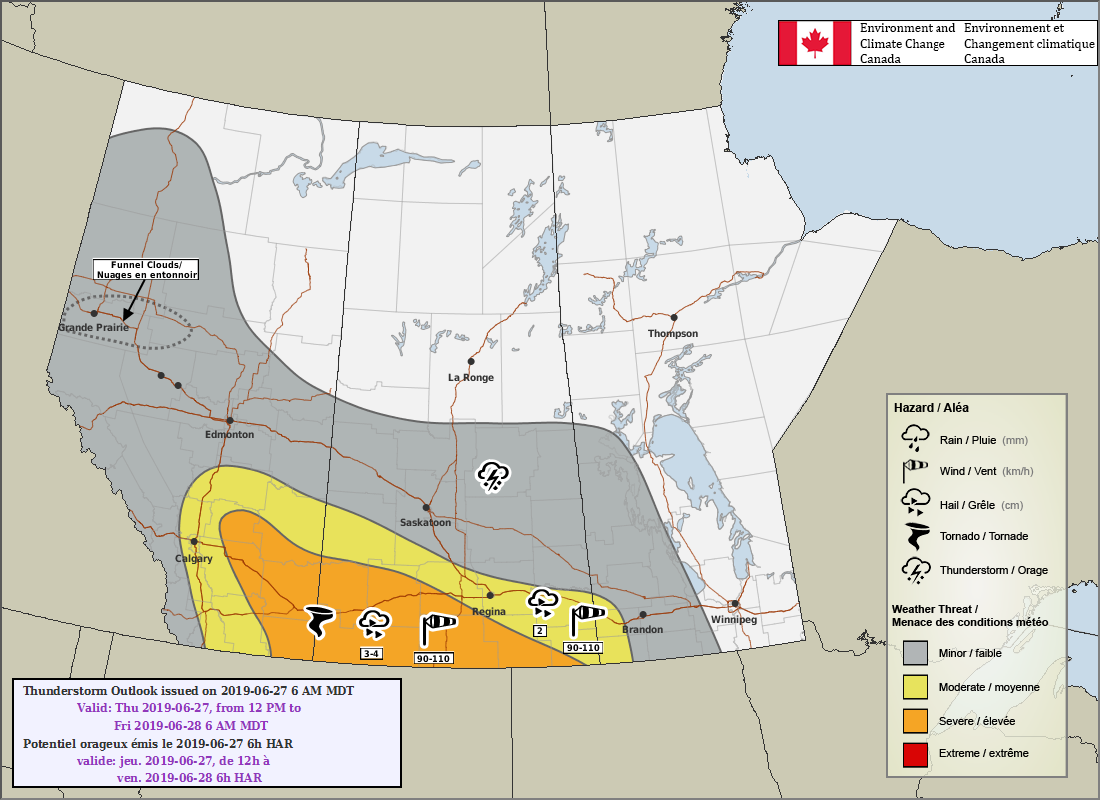
Here's what they wrote in their forecast:
"Area(s): Central and Southern Alberta
Timing: Thursday afternoon and evening
Threats: 2-4 cm hail, wind gusts 90-100 km/h, tornado risk over the southeastern regions. Funnel clouds possible over the west central regions.
Scattered thunderstorms are likely over central and southern Alberta Thursday, with severe thunderstorms likely over southeastern Alberta Thursday afternoon and evening. Thunderstorms that develop to the northeast and east of Calgary will have the potential to produce 2-4 cm hail and 90-100 km/h wind gusts as well as locally heavy downpours. A slight risk of a tornado exists in a corridor from the Drumheller region to the southwestern portion of the Coronation region. Over the Grande Prairie region and in regions immediately to the east, there is the risk of a funnel cloud developing in the afternoon hours."
These forecast maps are not available on Environment Canada's website but the University of Manitoba is hosting them here: http://umanitoba.ca/faculties/environment/envirogeog/weather/conv_otlk/ and you can find them on Environment Canada's twitter account: @ECCCweatherAB
More details ASAP!
- Adam