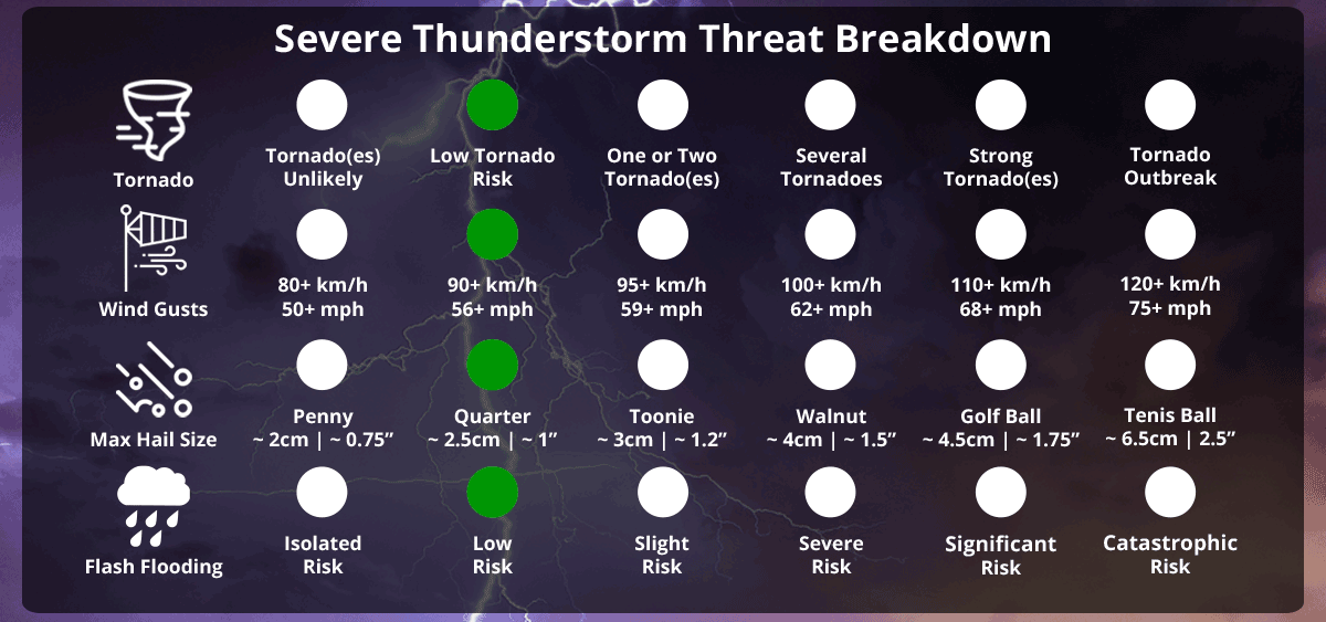
Slight Severe Thunderstorm Risk For Isolated Parts of Eastern Ontario & Northeastern Ontario; Damaging Wind Gusts 90km/h+, 2cm Hail, Isolated Flash Flooding, Frequent Lightning, & An Isolated Tornado Cannot Be Ruled Out
InstantWeather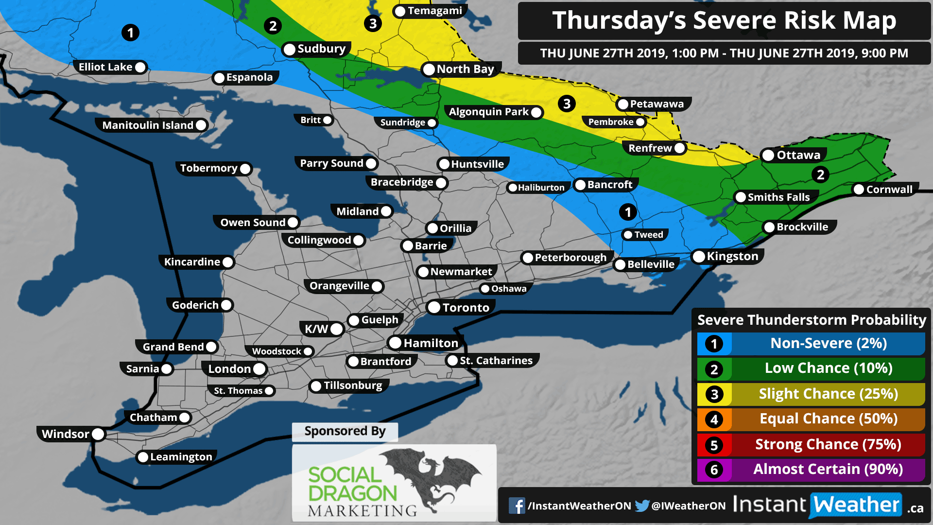
Sponsor:
This forecast is sponsored by Social Dragon Marketing! Are you a business owner? You probably already have enough on your plate. Social Media Marketing shouldn’t be one of them. The good news… you don’t have to do it all! Social Dragon Marketing can manage your day-to-day social media marketing activities by using the right tools designed for your business needs. You can find out more here: socialdragonmarketing.com
If you're interested in connecting your organization with our amazing community by sponsoring a forecast map or video, please visit: instantweatherinc.com/sponsor
Today's (Thursday) Forecast:
We're watching for the slight risk of severe thunderstorms in eastern Ontario again, and northeastern Ontario this afternoon and evening. Main risks are damaging wind gusts up to 90km/h or perhaps slightly higher in the strongest storms. 2cm hail is possible or slightly larger in northeastern Ontario. Isolated flash flooding and frequent lightning are also possible. An isolated tornado cannot be ruled out with these storms but the overall risk is marginal (low).
Friday's Forecast
Friday continues to look like a strong environment for severe weather, however, some of the latest data is showing the strongest storms holding off until later in the evening and only focused in parts of southwestern Ontario and perhaps parts of central Ontario. Storms will continue into the overnight for many of us but the severe risks will diminish the further into the overnight we get. More details ASAP!
Saturday's Forecast
Saturday looks great at this point! Storms have vanished from the models besides some isolated rain in eastern Ontario. The environment still has quite a bit of strength so if storms do end up showing up, there could be a severe risk. However, it's looking more and more unlikely. We'll continue to watch but so far, so good.
Sunday's forecast
Sunday also looks clear and toasty! More details ASAP.
As always, we’ll be watching the radar closely and please let us know what you're experiencing and only when it's safe to do so! <3
Forecaster: Adam Skinner