CANADA DAY: STRONG SEVERE THUNDERSTORM RISK for Saskatoon, Shaunavon, Assiniboia, Melfort, Etc.;Dangerous Damaging Wind Gusts 120km/h+, Large Hail 2-5cm, Isolated Flooding, Frequent Lightning, etc.
InstantWeather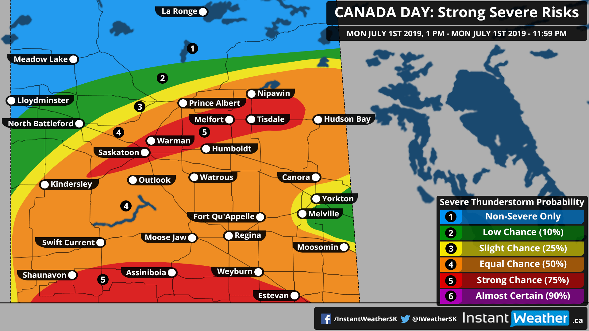
CANADA DAY
There is a strong risk for widespread severe thunderstorms this afternoon/evening (Mon, July 1st, 2019), in populated regions of Saskatchewan. Although the risk chances change quite a bit in our map, there is a legitimate threat for violent, damaging wind gusts reaching 120km/h+ in the strongest storms today. The focus of the risk is located (but not limited to) areas like Saskatoon, Shaunavon, Assiniboia, Melfort, and surrounding communities. This risk will carry into the evening for some areas, especially in the east as these storms track towards the Manitoba border.
Damaging wind gusts reaching 120km/h+ (perhaps higher in the most intense storms), large hail 2-5cm, torrential rain with the potential for isolated flooding, especially in areas closest to the international border, and of course, as with many severe thunderstorms, frequent lightning strikes. The tornado risk is low but if one was to occur, it would likely be in the southeast later in the day, perhaps towards the evening.
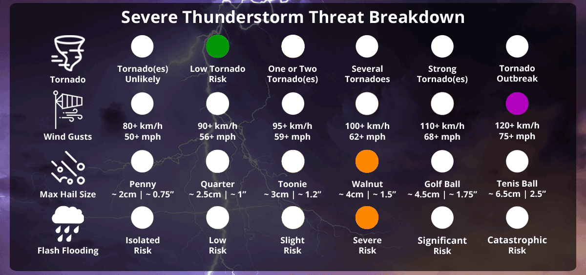
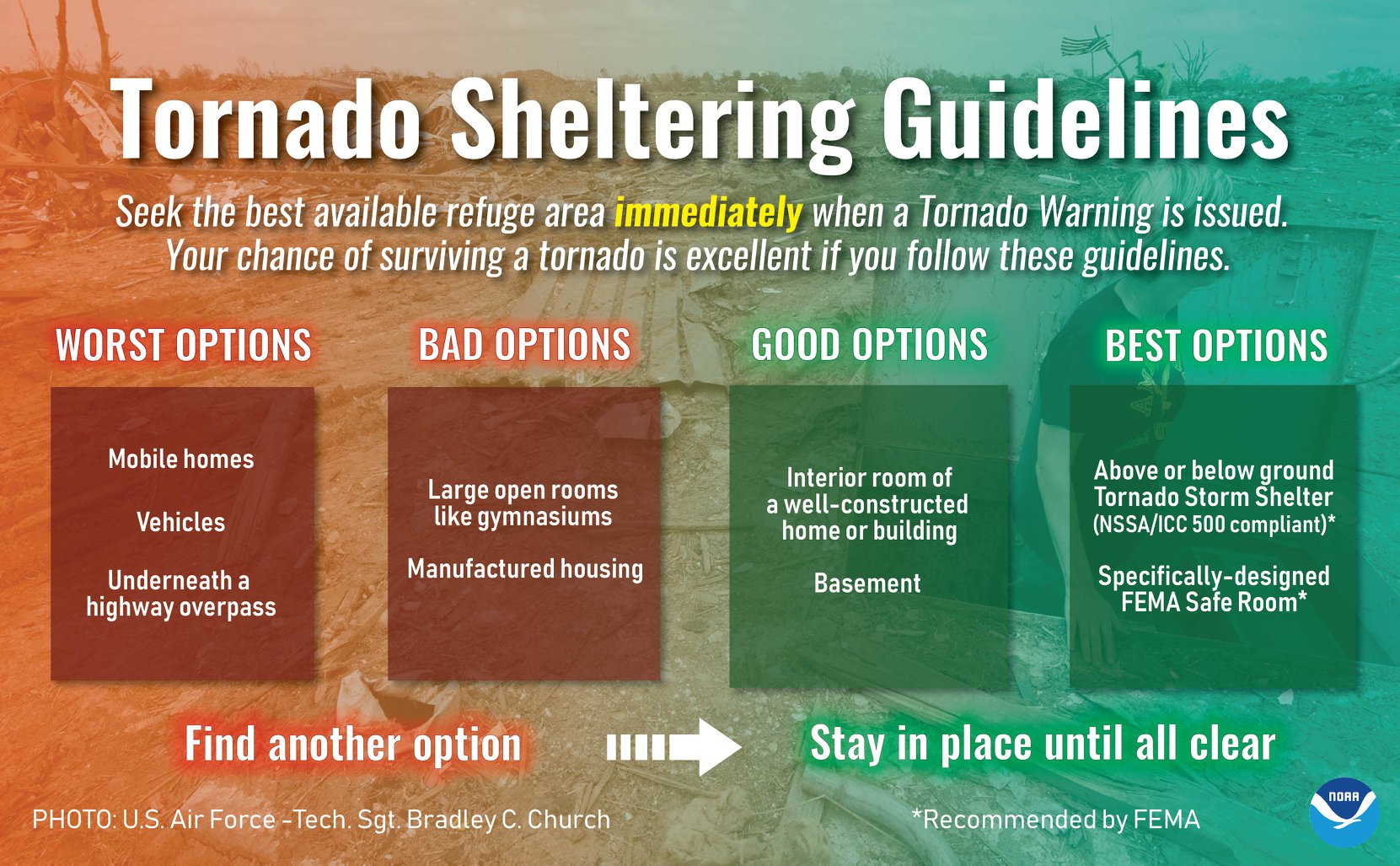
Please have a plan in place folks. The National Weather Service in the US has produced the infographic below and we feel it's definitely something to take into consideration during severe events:
Environment Canada has also produced a forecast map for today's severe weather risks, and have mentioned the risk for tornado development:
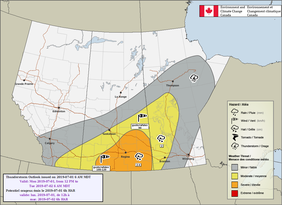
Here's what they wrote in their forecast:
"Saskatchewan
Area(s): Central and Southern
Timing: Monday afternoon and evening
Threats: Wind gusts to 120 km/h, Hail 2-4 cm
Widespread showers and thunderstorms will develop Monday afternoon as a trough and cold front quickly advance across southern and central Saskatchewan. Strong wind gusts will be the largest concern as all thunderstorms will be moving quickly eastward through the day; better organization and higher intensity storms are possible towards the international border. Activity will move east into Manitoba Monday evening."
These forecast maps are not available on Environment Canada's website but the University of Manitoba is hosting them here: http://umanitoba.ca/faculties/environment/envirogeog/weather/conv_otlk/ and you can find them on Environment Canada's twitter account: @ECCCweatherSK
More details ASAP!
- Adam