Severe Thunderstorm Watch Issued
Environment Canada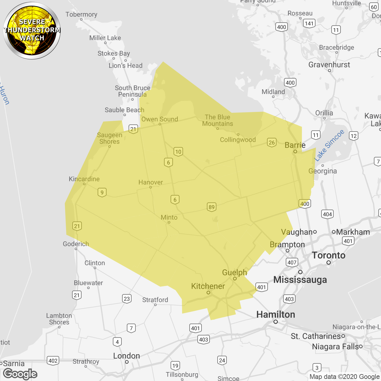
(Locations listed below description)
Conditions are favourable for the development of severe thunderstorms capable of producing localized flash flooding.
Severe thunderstorms are possible this afternoon or early this evening.
The main threats are heavy downpours and there may be a few storms that produce hail up to 3 centimetres in diameter.
Lightning kills and injures canadians every year. Remember, when thunder roars, go indoors!
Severe thunderstorm watches are issued when atmospheric conditions are favourable for the development of thunderstorms that could produce one or more of the following: large hail, damaging winds, torrential rainfall.
The office of the fire marshal and emergency management recommends that you take cover immediately if threatening weather approaches.
Please continue to monitor alerts and forecasts issued by environment canada. To report severe weather, send an email to onstorm@canada.ca or tweet reports using #onstorm.
For more information: http://www.emergencymanagementontario.ca/english/beprepared/beprepared.html.
ISSUED:
- Angus
- Arthur
- Barrie
- Blue Mountains
- Blyth
- Caledon
- Cambridge
- Collingwood
- Dundalk
- Erin
- Grand Valley
- Guelph
- Hanover
- Hillsdale
- Innisfil
- Kincardine
- Kitchener
- Listowel
- Mansfield
- Milverton
- Mount Forest
- New Tecumseth
- Northern Dufferin County
- Northern Grey County
- Northern Huron County
- Northern Perth County
- Northern Wellington County
- Orangeville
- Owen Sound
- Region of Waterloo
- Saugeen Shores
- Shelburne
- Southern Bruce County
- Southern Dufferin County
- Southern Grey County
- Southern Wellington County
- Wingham