Severe Thunderstorm Warning Continued
Environment Canada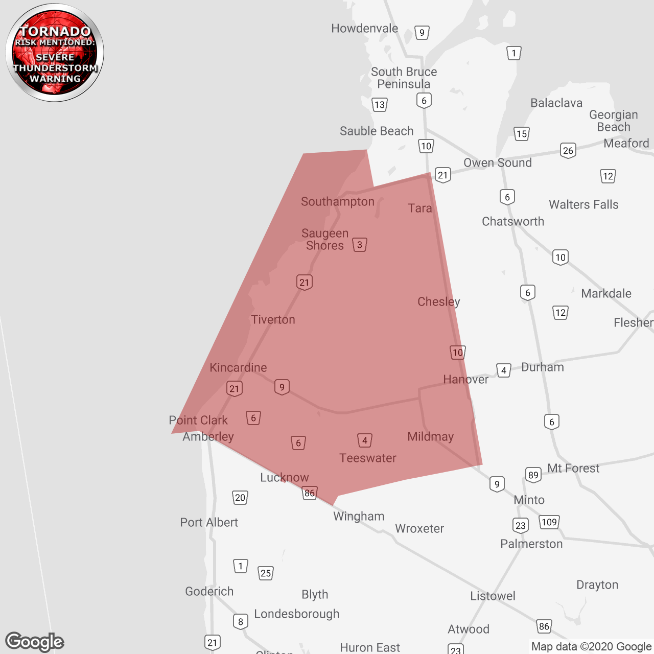
(Locations listed below description)
Updated or ended by 12:50 a.m. Edt.
At 10:12 p.m. Edt, environment canada meteorologists are tracking a severe thunderstorm capable of producing very strong wind gusts, up to nickel size hail and heavy rain.
Severe thunderstorms developing over the region late this evening. Locally heavy downpours and wind gusts to 90 kilometers per hour are likely into the overnight. There is also the risk of a tornado.
A line of thunderstorms extends eastward from near point clark, moving east at 35 km/h.
Locations impacted include: point clark, amberley, ripley, kinlough, lurgan beach, reid's corners, pine river, verdun, clarks church, millarton, purple grove, bervie, kingarf, kinloss, glammis, little egypt and riversdale.
Take cover immediately, if threatening weather approaches. Heavy downpours can cause flash floods and water pooling on roads. Strong wind gusts can toss loose objects, damage weak buildings, break branches off trees and overturn large vehicles. Lightning kills and injures canadians every year. Remember, when thunder roars, go indoors!
Severe thunderstorm warnings are issued when imminent or occurring thunderstorms are likely to produce or are producing one or more of the following: large hail, damaging winds, torrential rainfall.
The office of the fire marshal and emergency management recommends that you take cover immediately if threatening weather approaches.
Please continue to monitor alerts and forecasts issued by environment canada. To report severe weather, send an email to onstorm@canada.ca or tweet reports using #onstorm.
For more information: http://www.emergencymanagementontario.ca/english/beprepared/beprepared.html.
CONTINUED:
- Kincardine
- Saugeen Shores
- Southern Bruce County