Winter Storm Warning Ended
Environment Canada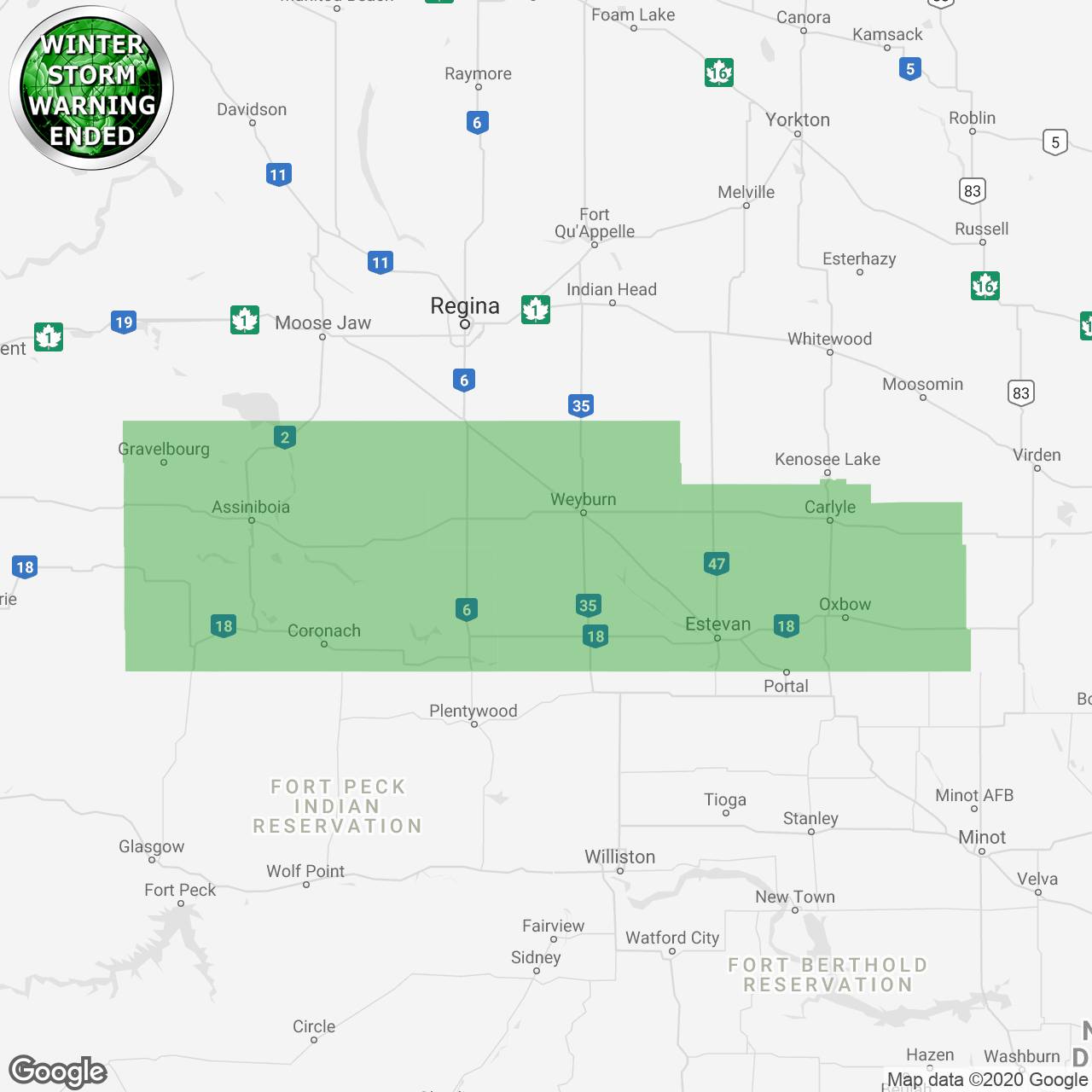
(Locations listed below description)
Poor visibility in snow and blowing snow is expected or occurring in some locations.
A strong Arctic cold front will work its way across the prairies later this afternoon and this evening. As it crosses the Region strong northerly winds, gusting up to 70 km/h, will combine with falling snow to create poor visibilities in blowing snow. Near blizzard condition may be possible at times especially late this afternoon and early this evening in open areas.
In addition to the strong winds, heavy snowfall is also expected. However the heaviest snowfall is expected to fall North of the trans-Canada and Yellowhead highways where 15 to 25 cm is likely by Wednesday morning. South and along the trans-Canada Highway snowfall amounts of 5 to 10 are possible. Conditions throughout the Region are expected to improve overnight into Wednesday morning.
Visibility may be significantly and suddenly reduced to near zero. Be prepared to adjust your driving with changing road conditions. If visibility is reduced while driving, slow down, watch for tail lights ahead and be prepared to stop. Consider postponing non-essential travel until conditions improve.
Blowing snow advisories are issued when winds are expected to create blowing snow giving poor visibility to 800 metres or less for at least 3 hours.
Please continue to monitor alerts and forecasts issued by Environment Canada. To report severe weather, send an email to skstorm@Canada.ca or tweet reports using #SKStorm.
end/paspc
ENDED:
- R.M. of Antler including Redvers Antler and Wauchope
- R.M. of Argyle including Gainsborough and Carievale
- R.M. of Bengough including Bengough
- R.M. of Benson including Benson
- R.M. of Brock including Arcola and Kisbey
- R.M. of Brokenshell including Trossachs
- R.M. of Browning including Lampman
- R.M. of Caledonia including Milestone and Parry
- R.M. of Cambria including Torquay and Outram
- R.M. of Coalfields including Bienfait and North Portal
- R.M. of Cymri including Midale Macoun and Halbrite
- R.M. of Elmsthorpe including Avonlea and Truax
- R.M. of Enniskillen including Oxbow and Northgate
- R.M. of Estevan including Estevan and Hitchcock
- R.M. of Excel including Viceroy Ormiston and Verwood
- R.M. of Fillmore including Fillmore Creelman and Osage
- R.M. of Gravelbourg including Gravelbourg and Bateman
- R.M. of Griffin including Griffin and Froude
- R.M. of Happy Valley including Big Beaver
- R.M. of Hart Butte including Coronach
- R.M. of Key West including Ogema and Kayville
- R.M. of Lake Alma including Lake Alma and Beaubier
- R.M. of Lake Johnson including Mossbank and Ardill
- R.M. of Lake of The Rivers including Assiniboia
- R.M. of Laurier including Radville
- R.M. of Lomond including Colgate and Goodwater
- R.M. of Moose Creek including Alameda
- R.M. of Moose Mountain including Carlyle and Manor
- R.M. of Mount Pleasant including Carnduff
- R.M. of Norton including Pangman and Khedive
- R.M. of Old Post including Wood Mountain and Killdeer
- R.M. of Poplar Valley including Rockglen and Fife Lake
- R.M. of Reciprocity including Alida
- R.M. of Scott including Yellowgrass Lang and Lewvan
- R.M. of Souris Valley including Tribune and Oungre
- R.M. of Stonehenge including Limerick and Congress
- R.M. of Storthoaks including Storthoaks and Fertile
- R.M. of Surprise Valley including Minton and Regway
- R.M. of Sutton including Mazenod Palmer and Vantage
- R.M. of Tecumseh including Stoughton Forget and Heward
- R.M. of Terrell including Spring Valley and Cardross
- R.M. of The Gap including Ceylon and Hardy
- R.M. of Waverley including Glentworth and Fir Mountain
- R.M. of Wellington including Cedoux Colfax and Tyvan
- R.M. of Weyburn including Weyburn and McTaggart
- R.M. of Willow Bunch including Willow Bunch and St Victor
- R.M. of Wood River including Lafleche Woodrow and Melaval