Special Weather Statement Continued
Environment Canada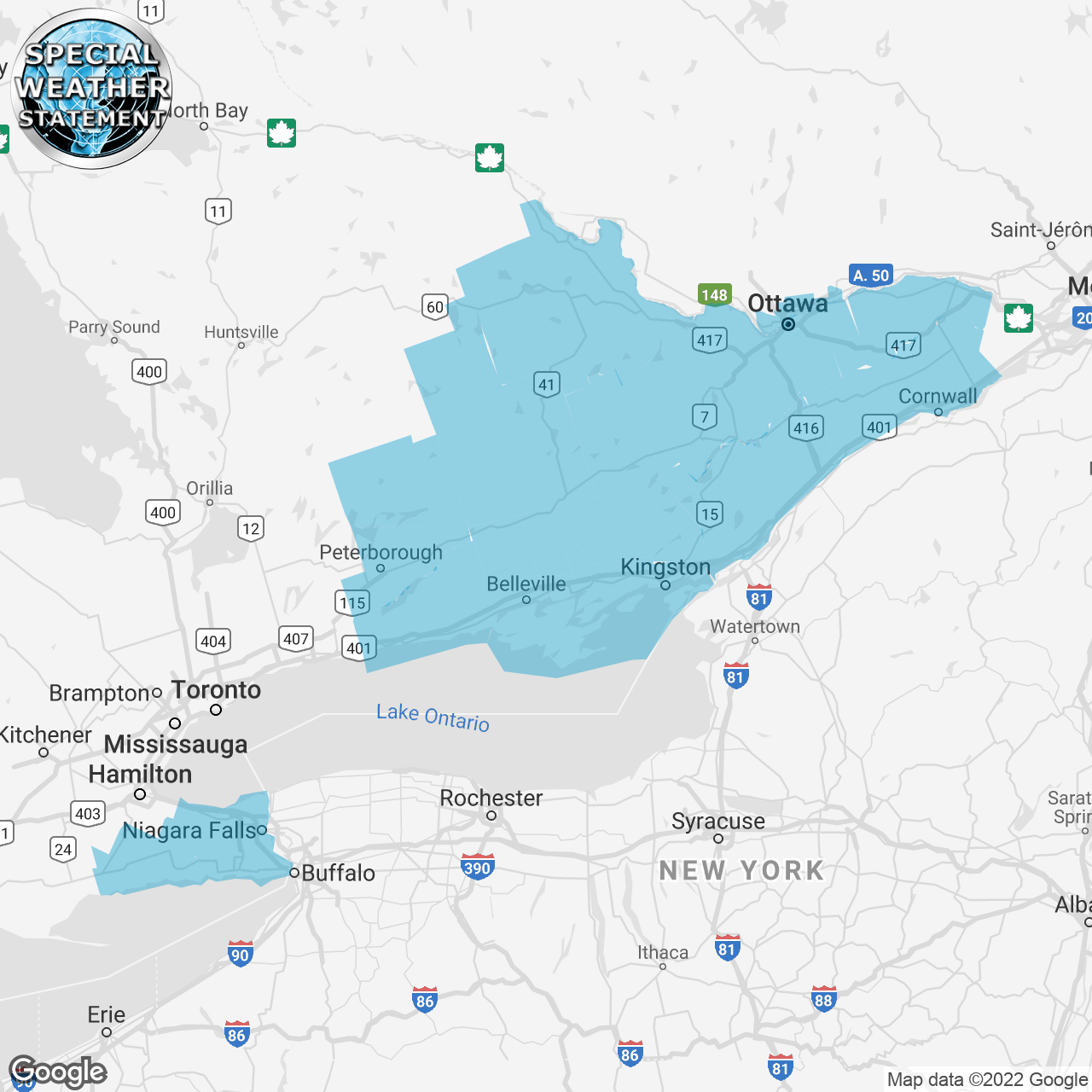
(Locations listed below description)
Significant snowfall expected Sunday night and Monday.
What: Significant snowfall with amounts of 20 to 35 cm expected.
When: Sunday night into Monday night.
Discussion: There remains some uncertainty in the exact track of the storm system which will affect the westward extent of accumulating snowfall. As well, snowfall amounts are expected to decrease sharply along the Western edge of the storm system towards Central Ontario and the greater Toronto area.
Please continue to monitor alerts and forecasts issued by Environment Canada. To report severe weather, send an email to onstorm@ec.gc.ca or tweet reports using #ONStorm.
CONTINUED:
- Alexandria
- Apsley
- Arnprior
- Bancroft
- Bannockburn
- Barry's Bay
- Belleville
- Bon Echo Park
- Brockville
- Calabogie
- Caledonia
- Charleston Lake
- Cobden
- Cobourg
- Colborne
- Consecon
- Cornwall
- Denbigh
- Dunnville
- Eastern Lanark County
- Eastern Northumberland County
- Frontenac Islands
- Gananoque
- Gatineau
- Grimsby
- Haldimand
- Hastings Highlands
- Kaladar
- Kanata
- Kemptville
- Killaloe
- Kingston
- Lakefield
- Lancaster
- Long Sault
- Madoc
- Mallorytown
- Maxville
- Merrickville-Wolford
- Metcalfe
- Morrisburg
- Napanee
- Newington
- Niagara Falls
- Northern Niagara Region
- Northern Peterborough County
- Odessa
- Orléans
- Ottawa North
- Ottawa South
- Pembroke
- Perth
- Petawawa
- Peterborough City
- Picton
- Plevna
- Prescott
- Prescott And Russell
- Quinte West
- Renfrew
- Richmond
- Sandbanks Park
- Sharbot Lake
- Smiths Falls
- South Frontenac
- Southern Niagara Region
- Southern Peterborough County
- St. Catharines
- Stirling
- Sydenham
- Tamworth
- Tweed
- Welland
- Western Lanark County
- Western Northumberland County
- Westport
- Winchester
- Woodview