Snowfall Warning Continued
Environment Canada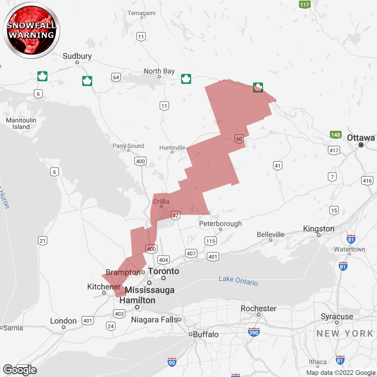
(Locations listed below description)
Significant snowfall beginning tonight.
Hazards: Total snowfall amounts of 15 to 20 cm. Snow, at times heavy, with peak snowfall rates up to 2 to 4 cm per hour possible Monday morning, which could significantly reduce visibilities. Local blowing snow at times due to winds gusting up to 60 km/h.
When: Tonight through Monday evening.
Discussion: A low pressure system tracking South of the Great Lakes will bring significant snowfall to the Region. Local blowing snow is also possible Monday afternoon and evening due to gusty northerly to northwesterly winds.
Impacts:
rapidly accumulating snow could make travel difficult over some locations. Visibility may be suddenly reduced at times in heavy snow. Surfaces such as highways, roads, walkways and parking lots may become difficult to navigate due to accumulating snow. Take frequent breaks and avoid strain when clearing snow.
Please continue to monitor alerts and forecasts issued by Environment Canada. To report severe weather, send an email to onstorm@ec.gc.ca or tweet reports using #ONStorm.
CONTINUED:
- Angus
- Balsam Lake Park
- Caledon
- Deep River
- Eastern Algonquin Park
- Erin
- Fenelon Falls
- Fort Irwin
- Guelph
- Haliburton
- Innisfil
- Lagoon City
- Minden
- New Tecumseth
- Northern Haliburton County
- Northern Kawartha Lakes
- Orillia
- Oxtongue Lake
- Southern Haliburton County
- Southern Wellington County
- Washago
- Whitney