Blizzard Warning Issued
Environment Canada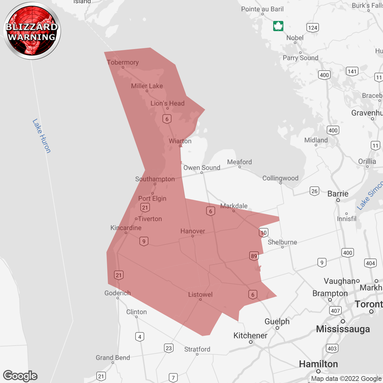
(Locations listed below description)
Blizzard conditions expected Saturday.
Hazards: Very strong winds gusting between 70 and 90 km/h. Hazardous blizzard conditions with areas of near zero visibility in snow and blowing. Snow accumulations of 6 to 12 cm possible.
Timing: Saturday morning and afternoon.
Discussion: An Alberta clipper will bring strong winds and snow to southern Ontario on Saturday. Snow will begin across the Region tonight. With the passage of a cold front in the morning, very strong northwesterly winds are expected to develop causing blizzard-like conditions. Conditions will begin to gradually improve Saturday evening.
Impacts:
travel is expected to be hazardous due to reduced visibility. Visibility will be suddenly reduced to near zero at times in heavy snow and blowing snow. If visibility is reduced while driving, turn on your lights and maintain a safe following distance. If you do travel and become lost, remain where you are until the blizzard has passed. Protect yourself from wind, cold and disorientation by staying sheltered, indoors or with your vehicle. If you become stranded in a vehicle do not leave. The vehicle offers a form of protection from the cold. A single person walking through the snow is harder to find than a stranded car or truck.
Blizzard warnings are issued when widespread reduced visibilities of 400 metres or less are expected for at least 4 hours.
Please continue to monitor alerts and forecasts issued by Environment Canada. To report severe weather, send an email to onstorm@ec.gc.ca or tweet reports using #ONStorm.
ISSUED:
- Arthur
- Blyth
- Bruce Peninsula
- Dundalk
- Hanover
- Kincardine
- Listowel
- Milverton
- Mount Forest
- Northern Huron County
- Northern Perth County
- Northern Wellington County
- Sauble Beach
- Saugeen Shores
- Southern Bruce County
- Southern Grey County
- Tobermory
- Wingham