Blizzard Warning Replaces Winter Storm Watch
Environment Canada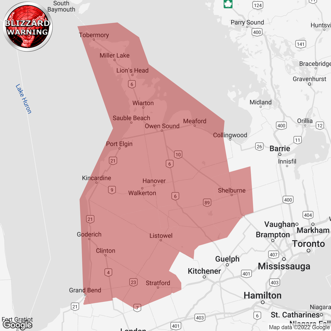
(Locations listed below description)
Crippling blizzard Friday into Saturday.
Travel will become dangerous and is not advised.
Hazards: Blizzard conditions with wind gusts of 90 to 100 km/h. Snowfall amounts of 25 to 50 cm by Sunday morning. Additional snowfall is possible Sunday. Wind chill values into the minus 20s. Flash freeze producing icy and slippery surfaces.
Timing: Strong winds and blizzard conditions developing Friday morning and continuing into Saturday. Very cold wind chills are expected to develop Friday and persist into the weekend. Flash freeze possible Friday morning.
Discussion: Precipitation may begin as rain or snow late this afternoon before transitioning to rain in many areas tonight. Temperatures are expected to plummet on Friday morning leading to a potential flash freeze for locations that receive rainfall. Rapidly falling temperatures will be accompanied by strong to damaging winds along with snow heavy at times. Blizzard conditions will develop Friday morning. lake effect snow will result in variability of snowfall amounts through the weekend.
Visibility will be suddenly reduced to near zero at times in heavy snow and blowing snow. Protect yourself from wind, cold and disorientation by staying sheltered, indoors or with your vehicle. Anyone who is not dressed warmly is at risk of frostbite and hypothermia in cold weather. Ensure that shelter is provided for pets and outdoor animals. Public safety Canada encourages everyone to make an emergency plan and get an emergency kit with drinking water, food, medicine, a first-aid kit and a flashlight. For information on emergency plans and kits go to http://www.getprepared.gc.ca .
Please continue to monitor alerts and forecasts issued by Environment Canada.
To report severe weather in Ontario, send an email to onstorm@ec.gc.ca or tweet reports using #ONStorm.
ISSUED:
- Arthur
- Blue Mountains
- Bluewater
- Blyth
- Bruce Peninsula
- Dundalk
- Goderich
- Grand Valley
- Hanover
- Kincardine
- Listowel
- Mansfield
- Milverton
- Mitchell
- Mount Forest
- Northern Dufferin County
- Northern Grey County
- Northern Huron County
- Northern Perth County
- Northern Wellington County
- Orangeville
- Owen Sound
- Sauble Beach
- Saugeen Shores
- Shelburne
- Southern Bruce County
- Southern Dufferin County
- Southern Grey County
- Southern Huron County
- Southern Perth County
- Stratford
- Tobermory
- Wingham