Winter Storm Warning Replaces Winter Storm Watch
Environment Canada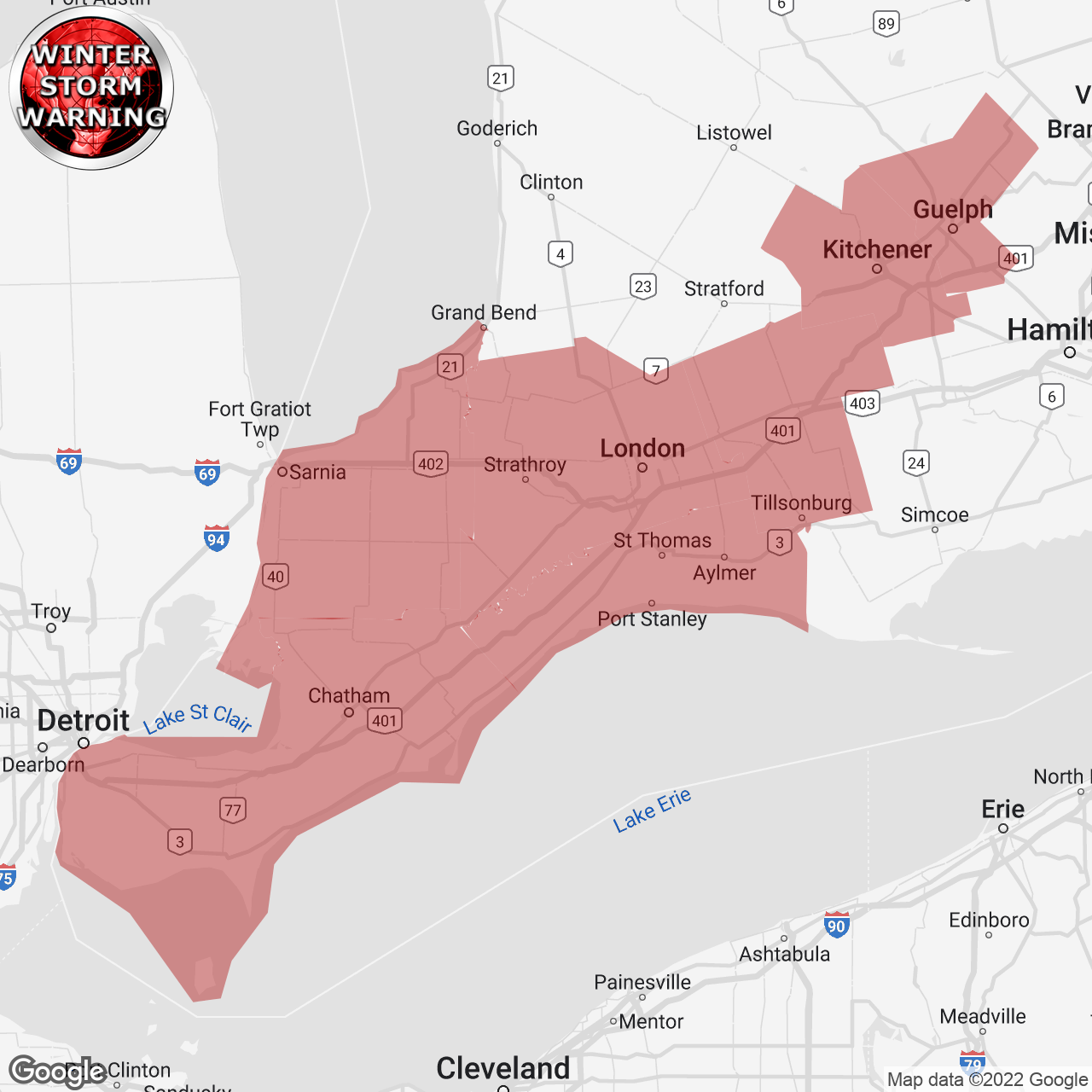
(Locations listed below description)
Major winter storm expected Friday into Saturday.
Hazards: Wind gusts of 90 to 100 km/h creating widespread blowing snow which will significantly reduce visibility. Snowfall amounts of 5 to 15 cm by Friday night. Wind chill values into the minus 20s. Flash freeze producing icy and slippery surfaces.
Timing: Damaging winds developing Friday morning and continuing into Saturday. Snow and extensive blowing snow developing Friday morning and continuing into Saturday. Very cold wind chills are expected to develop on Friday and persist into the weekend. Flash freeze possible Friday morning.
Discussion: Precipitation is expected to begin as rain or snow late this afternoon or early this evening before transitioning to rain for many areas tonight. Temperatures are expected to plummet on Friday morning leading to a potential flash freeze. Rapidly falling temperatures will be accompanied by damaging winds along with snow, heavy at times. Extensive blowing snow will develop Friday morning.
Consider postponing non-essential travel until conditions improve. Visibility will be suddenly reduced to near zero at times in heavy snow and blowing snow. If visibility is reduced while driving, slow down, watch for tail lights ahead and be prepared to stop. Public safety Canada encourages everyone to make an emergency plan and get an emergency kit with drinking water, food, medicine, a first-aid kit and a flashlight. For information on emergency plans and kits go to http://www.getprepared.gc.ca .
Please continue to monitor alerts and forecasts issued by Environment Canada.
To report severe weather in Ontario, send an email to onstorm@ec.gc.ca or tweet reports using #ONStorm.
ISSUED:
- Aylmer
- Cambridge
- Chatham-Kent
- Eastern Elgin County
- Eastern Lambton County
- Eastern Middlesex County
- Erin
- Essex County
- Guelph
- Kitchener
- Komoka
- Leamington
- London
- Oxford County
- Parkhill
- Petrolia
- Pinery Park
- Region Of Waterloo
- Rodney
- Rondeau Park
- Sarnia
- Shedden
- Southern Wellington County
- St. Thomas
- Strathroy
- Tillsonburg
- Watford
- Western Elgin County
- Western Lambton County
- Western Middlesex County
- Windsor
- Woodstock