Special Weather Statement Issued
Environment Canada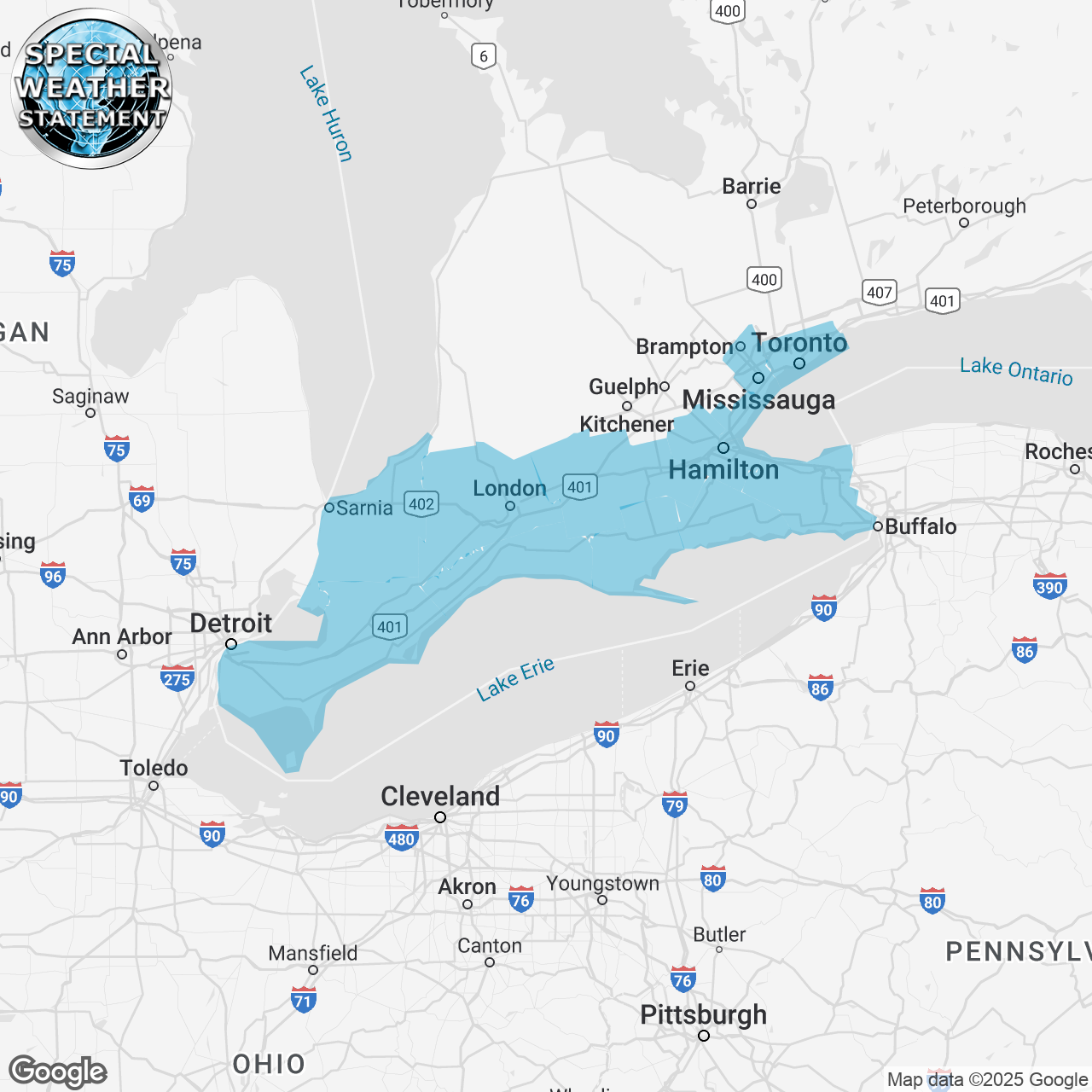
(Locations listed below description)
Significant rainfall midweek.
What: Rain, at times heavy. Total rainfall amounts of 30 to 50 mm. Locally higher amounts are possible in thunderstorms.
When: Wednesday morning through early Thursday morning.
Additional information: Rain begins Wednesday morning over extreme Southwestern Ontario before reaching the Golden horseshoe Wednesday afternoon. With thunderstorms expected, rainfall amounts may exceed 50 mm over some areas, particularly over Southwestern Ontario. Rain will end from West to East Wednesday night into early Thursday morning.
Rainfall warnings may be required for some areas as the event draws nearer.
Localized flooding in low-lying areas is possible.
For information concerning flooding, please consult your local Conservation Authority or Ontario Ministry of Natural Resources office. Visit Ontario.ca/floods for the latest details.
Please continue to monitor alerts and forecasts issued by Environment Canada.
To report severe weather in Ontario, send an email to onstorm@ec.gc.ca or post reports on x using #ONStorm.
ISSUED:
- Aylmer
- Brampton
- Brantford
- Burlington
- Caledonia
- Chatham-Kent
- City Of Hamilton
- City Of Toronto
- County of Brant
- Delhi
- Dunnville
- Eastern Elgin County
- Eastern Lambton County
- Eastern Middlesex County
- Essex County
- Grimsby
- Haldimand
- Komoka
- Leamington
- London
- Mississauga
- Niagara Falls
- Norfolk
- Northern Niagara Region
- Oakville
- Oxford County
- Parkhill
- Petrolia
- Pinery Park
- Rodney
- Rondeau Park
- Sarnia
- Shedden
- Simcoe
- Southern Niagara Region
- St. Catharines
- St. Thomas
- Strathroy
- Tillsonburg
- Watford
- Welland
- Western Elgin County
- Western Lambton County
- Western Middlesex County
- Windsor
- Woodstock