Winter Storm Watch Issued
Environment Canada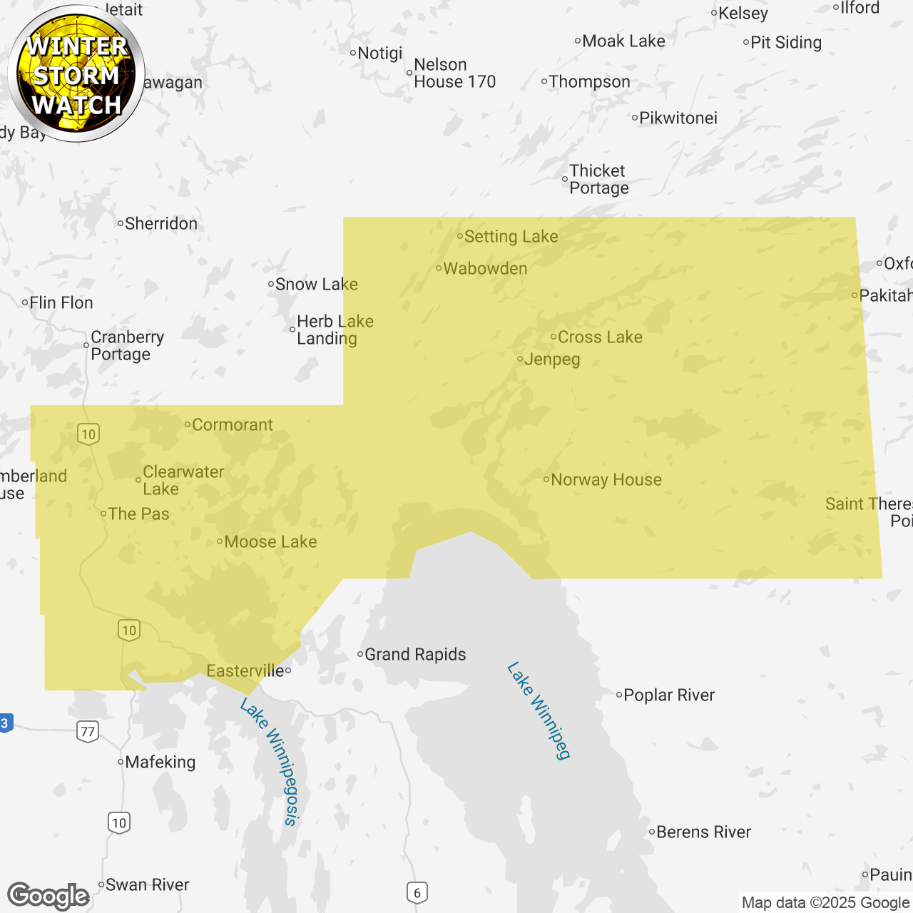
(Locations listed below description)
A strong fall weather system with an uncertain wintry mix of precipitation is poised to impact Manitoba beginning very early on Sunday morning through Tuesday. This system will enter Manitoba from Saskatchewan with the precipitation likely as rain before transitioning to snow. There is considerable uncertainty regarding the timing and location when the type of precipitation will change. If the transition occurs early, then areas under this watch may warrant an upgrade to a snowfall warning. However, if the transition occurs later, then there is potential for regions in this watch to get upwards of 30 to 50 mm of rain before the transition to snow.travel is expected to be hazardous due to reduced visibility in some locations. Surfaces such as highways, roads, walkways and parking lots may become icy and slippery. Localized flooding in low-lying areas is possible. Please continue to monitor alerts and forecasts issued by Environment Canada. To report severe weather, send an email to mbstorm@ec.gc.ca, call 1-800-239-0484 or post reports on x using #MBStorm.end/paspc
ISSUED:
- Cross Lake and Jenpeg
- Hwy 6 between Little Limestone Lake and Ponton
- Molson Lake and Bear Lake
- North and South Moose Lake incl. Moose Lake Res.
- Norway House
- The Pas Cormorant Westray and Wanless
- Wabowden