Freezing Rain Threat Across the Province Friday Afternoon and Evening
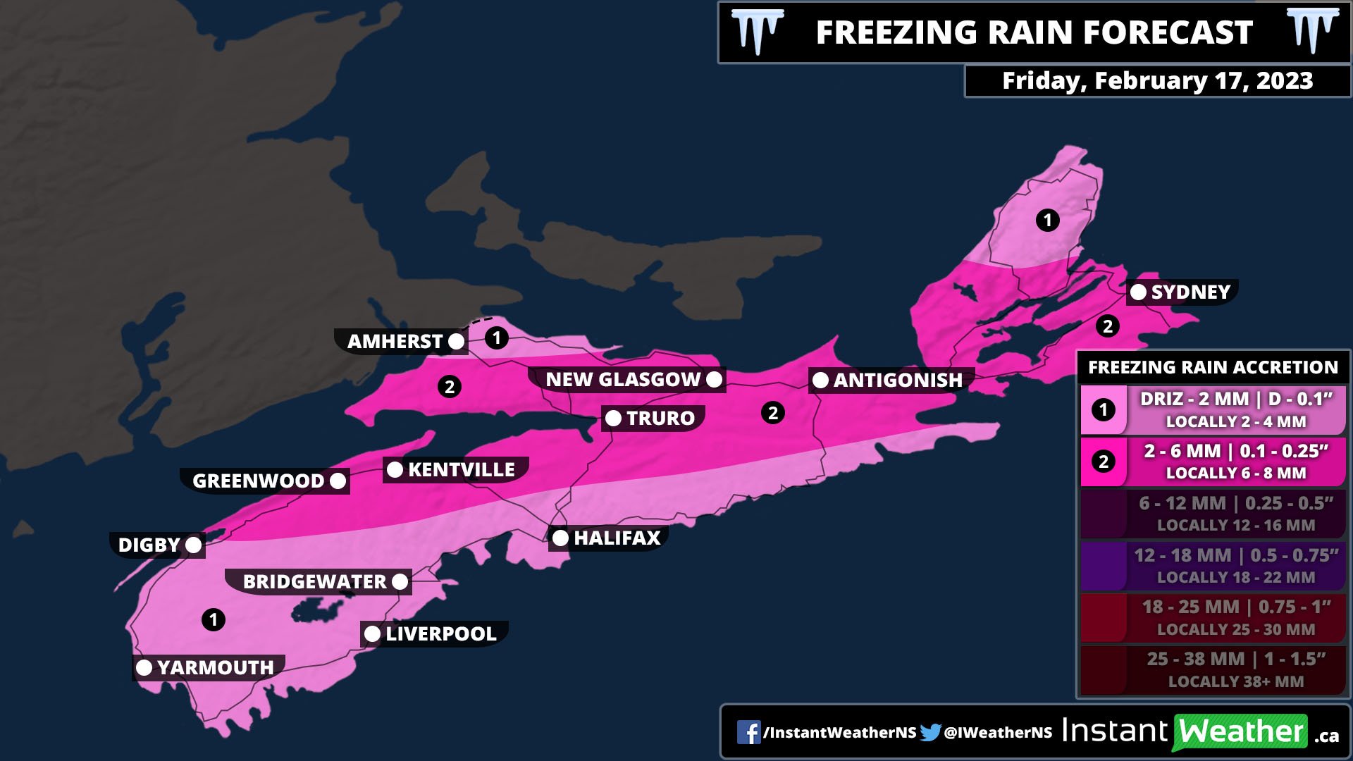
/The latest winter storm to hit Nova Scotia will move in from the west beginning tomorrow morning. It will start off with snow and ice pellets for Northern Nova Scotia and Western Cape Breton Island and rain for the Annapolis Valley and South Shore. By the early afternoon, a considerable band of freezing rain will develop, replacing the snow as the temperature rises and approaches the freezing mark. The most prolonged freezing rain will occur from Digby through to Eastern Cape Breton Island and northward. This region could see up to 6mm, or 0.5”, of ice buildup on surfaces from this storm. South of this line, rain will fall for most of the day, but the band of freezing rain will push southeastward, resulting in a transition of precipitation type later in the afternoon and into the evening as the temperature falls. The storm will continue to track southeast overnight and into the morning, with the freezing rain followed by ice pellets and then snow before clearing up.
The northern tip of Cumberland County and the Cape Breton Highlands may see trace amounts of freezing rain from this event, but will mostly see snow and ice pellets. In the Highlands, up to 30cm of snow and ice pellets is possible, while the rest of Cape Breton Island will be in the 10-15cm range. Most of the rest of the province can expect 5-10cm of snow and pellets, with the exception of Cumberland County and the Northumberland Shore where the snow starts early tomorrow and will persist with ice pellets in some areas.
With the risk of freezing rain, ice buildup becomes a concern with untreated surfaces as well as on tree limbs and power lines. Wind gusts throughout the day will be 30-50km/h so it won’t be a major ice storm by any means, but there still may be some power outages across the province.


