Weekend Snow Squalls: Lake Effect Snow Brings Wintry Blast to Southern Ontario
/Forecaster: Brennen Perry
Published: Thursday, March 16, 2023
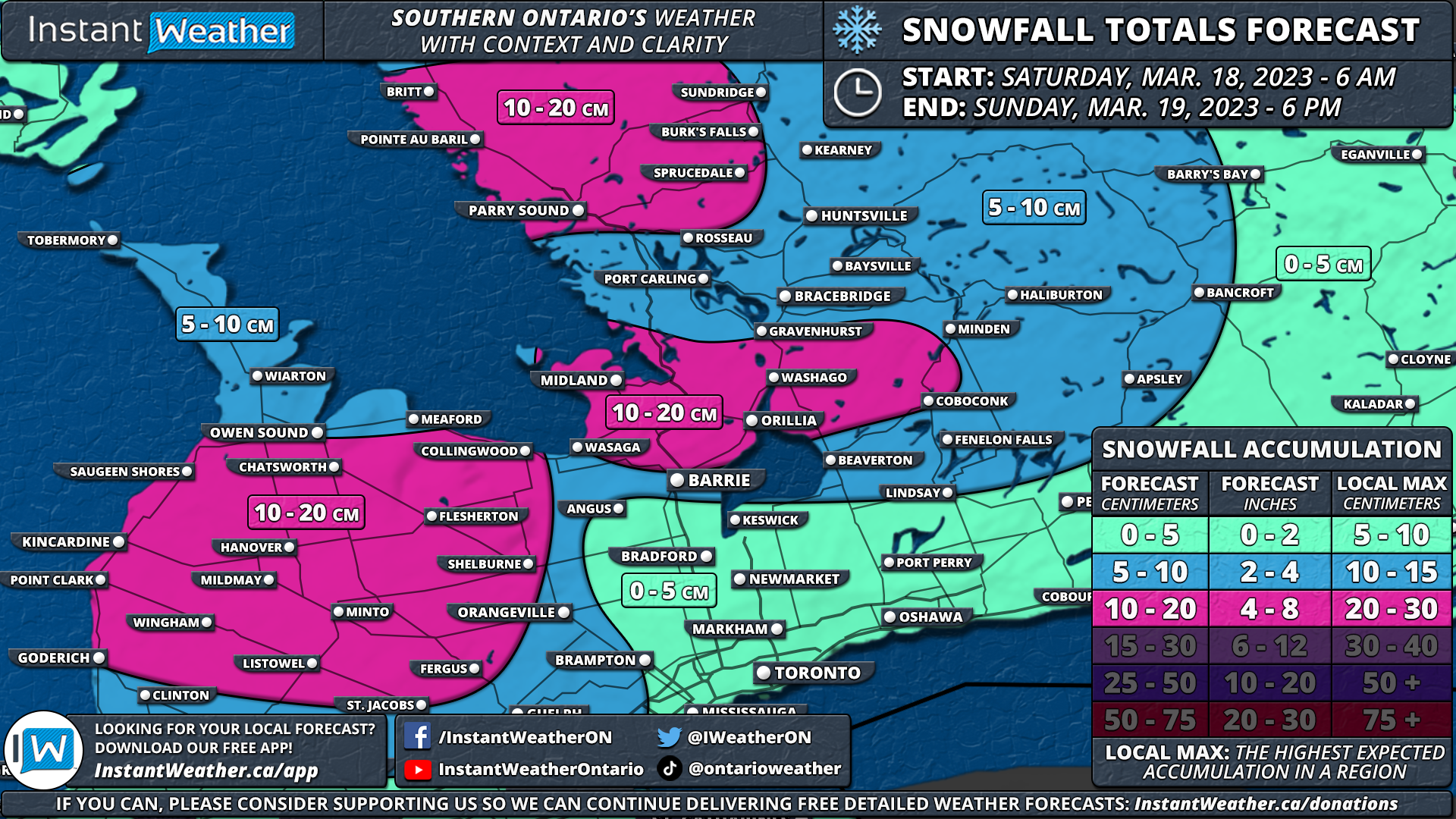
Prepare for a snowy and blustery weekend as snow squalls are set to develop east of Lake Huron and Georgian Bay. Early Saturday morning, strong southwesterly winds will form two snow squall bands – one off Lake Huron, stretching from Kincardine to Meaford, and another impacting areas northwest of Georgian Bay, such as Parry Sound, Britt, Sundridge, and surrounding communities.
As the day progresses, watch for these bands to shift southward, thanks to northwesterly winds. Grey-Bruce and Simcoe counties will find themselves in the crosshairs, with brief but intense pockets of heavy snow potentially drifting into the Greater Toronto Area (GTA) and Eastern Ontario during the afternoon and evening. Expect poor driving conditions in traditional snowbelt regions.
Snowfall totals will vary across the region. Hard-hit areas, including Grey-Bruce counties, Midland, Wasaga Beach, Orillia, Parry Sound, Britt, Sundridge, and nearby communities, can expect 10-20cm, with local accumulations up to 25cm. Central and Southwestern Ontario, as well as the western GTA, such as Kitchener-Waterloo, Guelph, and Mississauga, will likely see 5-10cm. The City of Toronto, Eastern Ontario, and Deep Southwestern Ontario are predicted to receive less than 5cm.
By Sunday morning, warmer temperatures will help ease the snow squalls, but not before they leave their mark.
Here is an advertisement so we can pay the bills:


