Widespread Dusting of Snow Possible Across Alberta, Greater Accumulations in the Northeast, By Sunday
/
NOTE: YOU CAN CLICK ON THE MAP TO OPEN A ZOOMABLE IMAGE
The stretch of pleasant weather we’ve been seeing this week will be interrupted by the return of snow for a majority of Alberta as the week comes to an end and we move into the weekend. This will be courtesy of a cold front that will track through the province from the north, bringing with it a shock of cold Arctic air, a widespread combination of rain and snow, and some strong wind gusts.
Precipitation will begin to fall later this evening, starting in the Northern Rockies, but gradually expanding through the mountain parks overnight. This precipitation will predominantly fall as snow through the Rockies, but as it progresses eastward, a leading edge of rain will develop, which will then quickly transition over to wet snow and the system tracks from west to east.
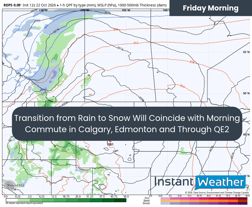
The rdps model showing precipitation type and intensity at 6am on Friday, courtesy of WeatherBell.
This switch over is slated to occur around the morning rush hour in Calgary, Edmonton, and along the QE2 corridor, resulting in a brief blast of snow that could greatly reduce visibility for commuters. Luckily, the warm ground means that most of this snow will melt on contact and only a couple of centimetres of accumulation. The mixture of rain and snow will track eastward across the province through the day, and it is expected to reach the Saskatchewan border by the afternoon.
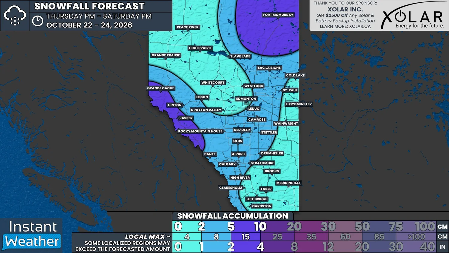
The area of precipitation will then get pushed northward Friday evening as a strong low pushes into the region from south of the border. The snowfall will begin to intensify in Northeastern Alberta, but the heaviest of the snow is expected in Northern Saskatchewan and Manitoba, where upwards of 50cm could fall by the end of the weekend! Thankfully for Fort McMurrary and the surrounding area, only up to 10cm is expected, but there’s the possibility for locally higher amounts closer to the provincial border, where light snow could persist through the day Saturday.
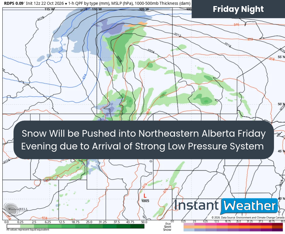
The rdps model showing precipitation type and intensity at 7Pm on Friday, courtesy of WeatherBell.
Outside of this pocket of greater snowfall accumulation, most of the province can expect less than 5cm of snow thanks to how warm the ground still is. The only other exception will be in the higher elevations of the Rockies, where there is a possibility of a bit of additional snow on Saturday, along with maybe a bit of light snow that could fall in the Foothills in the evening.
Some strong wind gusts will be associated with the snowfall on Friday, with gusts expected to climb into the 60-80km/h range and the possibility that the odd gust could be as high as 90km/h. While this is not as strong as the gusts we saw last weekend, these winds could still be able further damage already weak trees, and potentially dislodge previously broken branches, in areas that were heavily impacted.
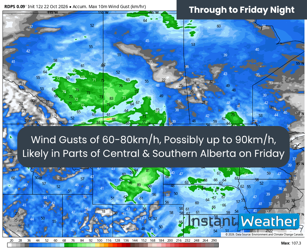
The rdps model showing Peak wind gusts through to Friday Night, courtesy of WeatherBell.