Southern Alberta in the Crosshairs for up to 15cm of Snow Beginning Tuesday Morning
/
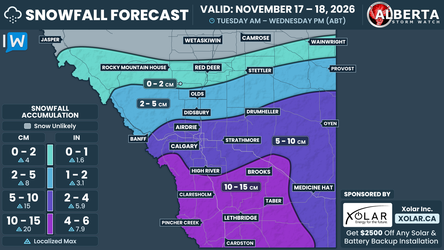
NOTE: YOU CAN CLICK ON THE MAP TO OPEN A ZOOMABLE IMAGE
It was only a matter of time, but the extended period of mild weather in Southern Alberta will be coming to as a low pressure system from south of the border will bring widespread snow, along with rain and some mixed precipitation, to the region.
The leading edge of the system will cross into Southern Alberta starting Tuesday morning, roughly around sunrise, as a mixture of snow in the west and rain in the east. This precipitation will gradually spread northward, eventually reaching the Calgary area by the late afternoon or early evening, and likely impacting the evening commute.
From there, the snow will continue to spread only a bit further through the evening, only reaching as far north as the Red Deer area, and maybe even up to Wainwright, overnight.
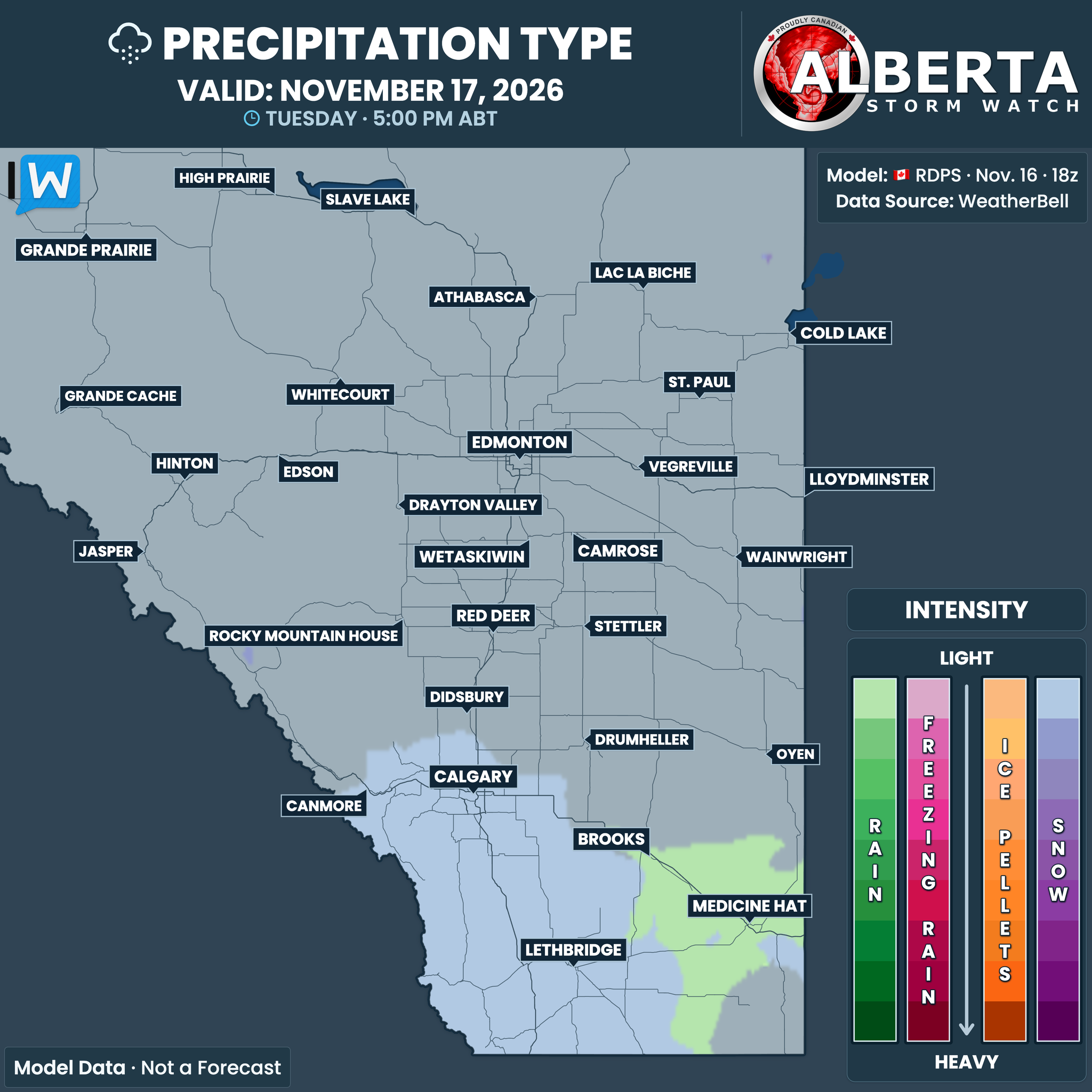
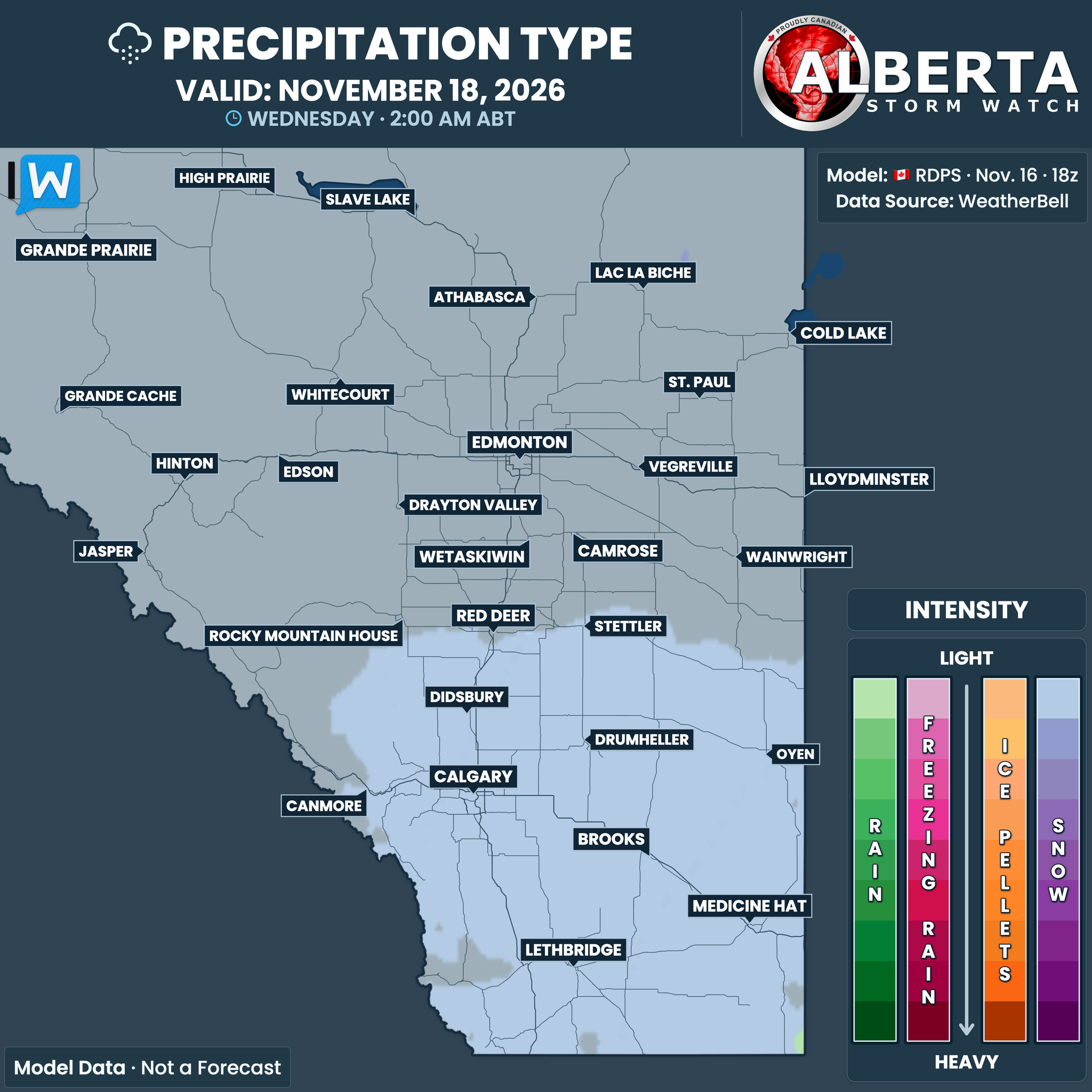
Through the evening and into overnight hours, the rain in Southeastern Alberta is expected to transition over to snow as the temperatures fall below the freezing mark in this area, and steady snow, at a rate of up to 2cm/hr, will fall across the region into the mid-morning of Wednesday.
It’s at that time that we’ll begin to see the snow tapering off from west to east as the system tracks eastward. This tapering off will continue into the evening and the snow is expected to completely exit the province by midnight.
Given how mild the temperatures have been lately, the ground is still quite warm, meaning that the snow will certainly melt on contact at first. This will also be exacerbated in Southeastern Alberta, where there will be rain before a transition to snow. As a result, it’s a bit tricky to nail down how much snow will end up eventually accumulating from this event.
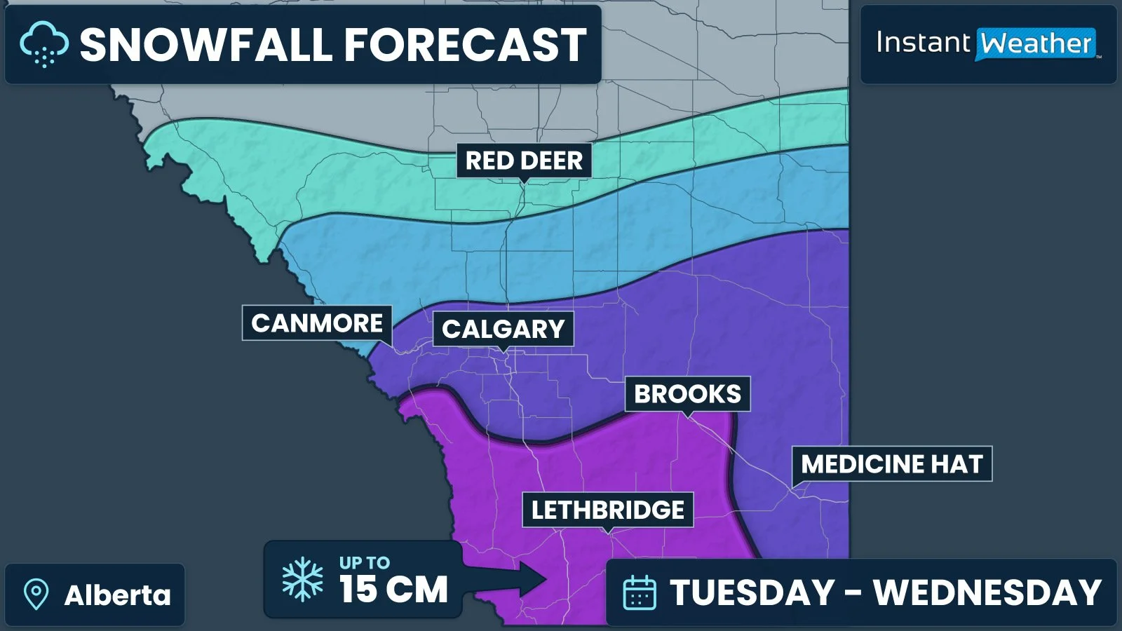
We expect that the entirety of Southern Alberta will receive at least 5cm of snow by the end of Wednesday. Areas closer to the Saskatchewan border, where the rain is expected to persist the longest, will be closer to the 5cm mark. Meanwhile, much of Southwestern Alberta will see steady snowfall for the greatest amount of time and snow totals are expected be as high as 15cm, with the possibility of up to 20cm accumulating locally in areas of higher elevation.
Moving northward into Central Alberta, the snowfall totals will decrease; Didsbury, Olds, and Provost can expect 2-5cm of snow, while Red Deer, Rocky Mountain House, and Stettler should receive less than 2cm. Whether or not the snow ends up reaching Wainwright is still a bit of a question mark, which is why it is included just inside the polygon for 0-2cm.
There is a bit of good news with this system: the low has not been developing very quickly and should remain fairly weak, meaning that strong winds and blowing snow are not expected to be a major concern over the next couple of days. At most, wind gusts could be as high as 50km/h on Wednesday and while this could blow a bit of snow around, prolonged whiteout conditions aren’t expected to be an issue.