Dumping of Heavy Wet Snow Coming to Alberta & Saskatchewan from the First Clipper of the Week
/Two Clippers will bring snowfall to the Prairies this week, the first of which will develop late Wednesday afternoon and continue into late Thursday as it blasts eastward. This first system could result in the first measurable snowfall of the season for some areas, but accumulation could be limited by the mixing of rain that is expected to occur along the southern edge of the precipitation.
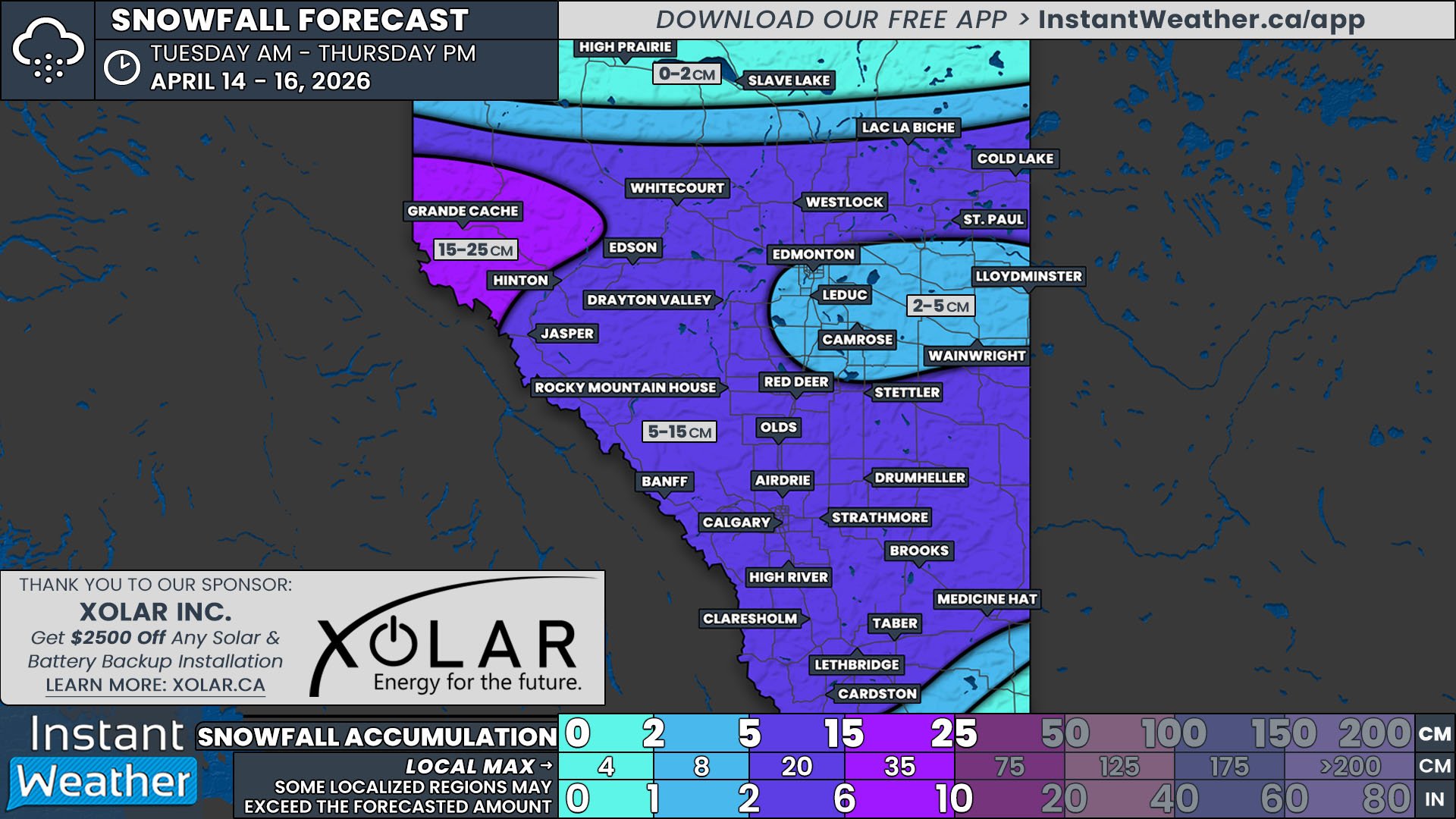
Snow will begin to fall around the Grande Cache area late Wednesday afternoon and quickly spread eastward across Alberta through the evening. There is a slight possibility of freezing rain along the boundary between rain and snow during the evening, but it will be short-lived. The snow will continue to fall throughout most of the day Thursday before it tapers off in the late afternoon and early evening.
The rdps model showing precipitation type and intensity at 5am, courtesy of WeatherBell.
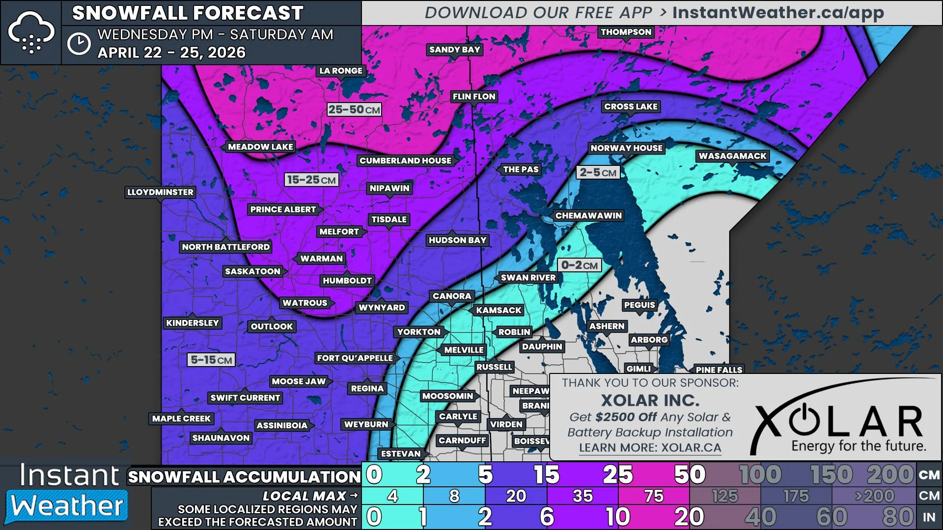
The snow will start to move into Saskatchewan Wednesday evening and cross the province through the overnight and early morning hours Thursday. However, as the system tracks into Eastern Saskatchewan, precipitation rates are expected to decrease and will more likely fall as rain instead of snow. The precipitation will begin to taper off from west to east late Thursday afternoon, ending in Southeast Saskatchewan by midnight.
Overall, this large band of snow is expected to dump 5-10cm of wet, heavy snow across Alberta and Saskatchewan, especially along the Yellowhead Highway, from Grande Prairie, through Lloydminster and Prince Albert, to Kamsack. There is also the possibility of some local intensification that could lead to up to 15cm, particularly from High Prairie to Cold Lake. This quick accumulation could make travel in the area difficult so make sure to take your time.
The next Clipper will arrive early Friday and we will have more details Thursday.


