
Fast-Moving System To Bring Southern Ontario’s First Widespread Snowfall of the Season Between Sunday and Monday
/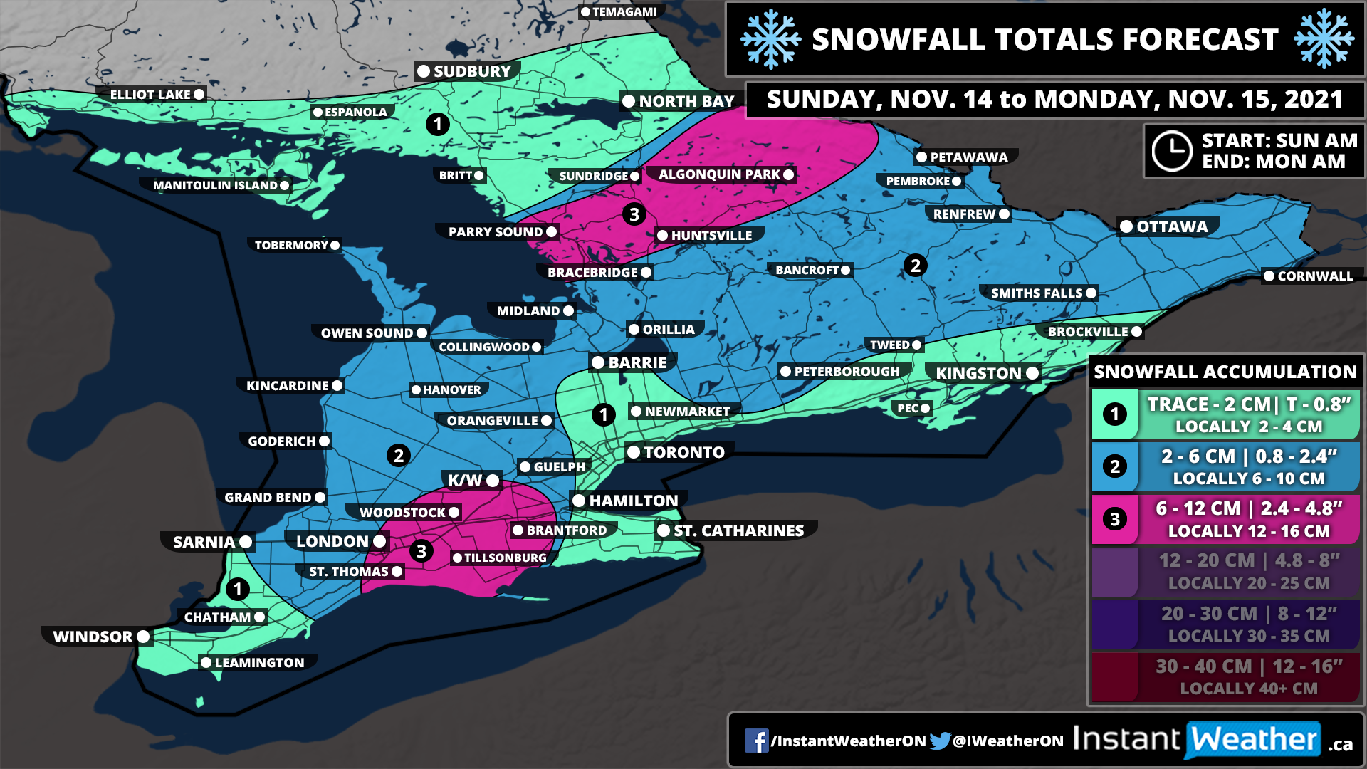
We’re now getting deep into November and it was only a matter of time before Mother Nature started to throw some wintery weather at Southern Ontario. And just that is in store for our region starting Sunday morning as an approaching weak system brings a mix of winter weather including rain and wet snow. For areas away from the lakeshore, we could be looking at several slushy centimetres of snow over the next 36 hours.
Now, this generally wouldn’t be considered a significant snowfall, but it will be quite wet and may make for some slippery driving conditions so you should drive according to the conditions. Less snow is expected through Extreme Southwestern Ontario, Niagara, GTA and in Eastern Ontario northeast of Lake Ontario. This is due to slightly warmer temperatures which will allow for more melting and some rain to mix in which would reduce overall accumulation.
This system is lacking in moisture which explains the lower snow totals across the region, however, a few pockets including to the northeast of Lake Erie east of London and through Central Ontario from Parry Sound into Algonquin Park may experience some lake enhancement. This could boost up the expected snow totals to near 10cm, but it’s not guaranteed especially in that Lake Erie zone which could be reduced by some rain mixing in.
The system will move out of the province by the mid-morning hours on Monday. We may see some lake effect snow develop off Georgian Bay and Lake Huron in the wake of the system later Monday although the exact intensity of this is unclear so it’s not included in the forecast.
