Forecast Discussion
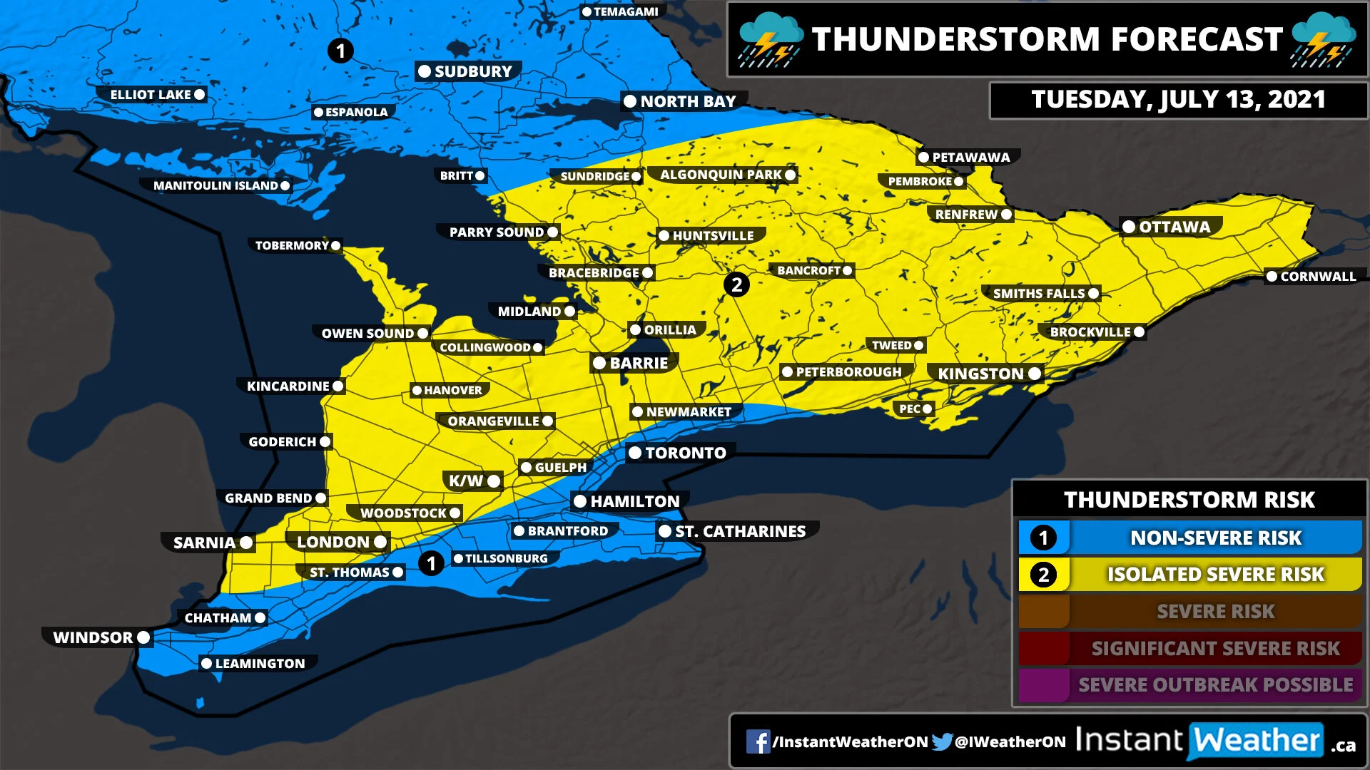
A line of thunderstorms may track into Southwestern Ontario and perhaps around Georgian Bay during the early morning hours on Monday. They should remain sub-severe although can’t rule out localized damaging wind gusts and some flash flooding due to the potential for ‘training’ storms. It’s possible that a few locations could see 2-4 hours of persistent thunderstorm activity with rainfall totals near 25-50mm/hour so it could quickly add up. The exact location and timing of this line of storms are still unclear so who sees the heaviest rainfall still needs to be narrowed down.
There is also a second round of storms could develop later in the afternoon and into the evening as a cold front sweeps across the region. The best chance for storm development appears to be over Eastern Ontario and into the Niagara region as storms pop up and track eastward across the American border. If the cold front is later than expected it could shift the risk further west into the GTA and areas around Lake Simcoe/Georgian Bay. The environment would be favourable for any storm that develops to quickly become severe with damaging wind gusts and large hail. The risk of a tornado is low, but can’t be ruled out. Storms will move out of the province by the late evening making for a quiet Monday night.


