Dust Your Shovels Off! Winter Makes its Long-Awaited Return to Central and Southern Alberta
/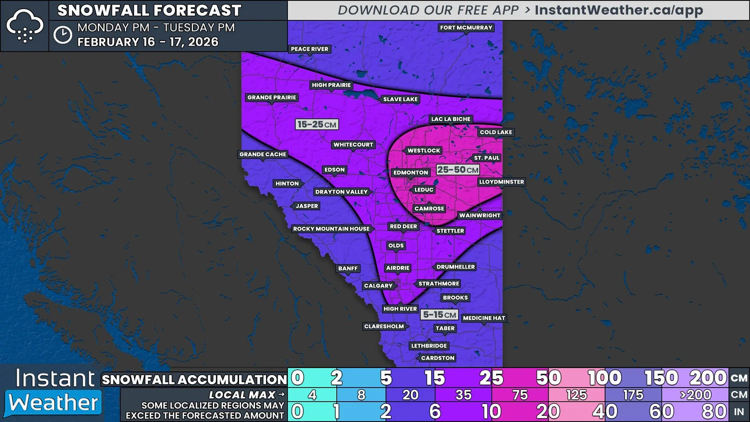
NOTE: if you click or tap on this image you can zoom in
It’s been a quiet week across Alberta and even quieter across much of Central and Southern Alberta since New Years. For many Albertans, their shovels and snowblowers have been gathering dust while temperatures have climbed into the double digits. This is all about to change with the arrival of a system that is set to dump a widespread 10-35cm of snow to start the week.
Scattered light flurries are expected to occur from Grande Prairie to Slave Lake on Monday morning before the snow becomes more organized starting in the early afternoon. As the afternoon progresses, snow from a system to the southwest will begin to move into the Southern Rockies.
This low pressure system, and its associated snowfall, will continue to track northeastward into the province during the afternoon and into the evening, merging with the area of more organized snowfall to the north. Combined, this widespread snow will spread eastward through the evening and overnight hours. The snow could be heavy at times, falling at rates above 3cm/hr for several hours and leading to rapid accumulation.
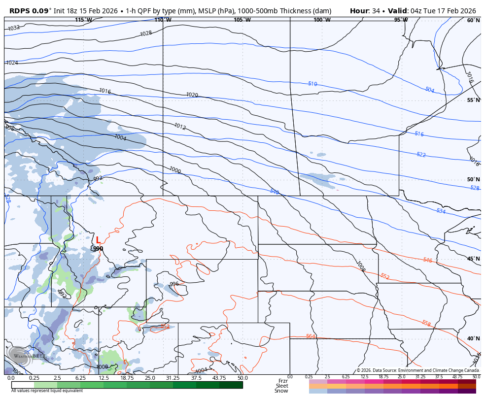
The rdps model showing precipitation type and intensity for Monday at 9pm mt. courtesy of WeatherBell.
During this time, the snow will be mostly falling over parts of Central and Northern Alberta, bypassing the majority of Southern Alberta.
The snow for this region is slated to begin Tuesday morning, as an additional band of snowfall crosses into the province from the US and joins up with the rest of the system. This later start will lead to lower snowfall totals here than further north, however, it’s likely that there will be some localized intensification through the morning and early afternoon. This will result in with pockets of heavier snowfall, that will quickly drive up the accumulations in impacted areas.
The snow will start to taper off, from west to east, in the mid to late morning hours on Tuesday. The snow will persist across Eastern Alberta throughout the afternoon before it begins to dissipate through the evening and exit the province by midnight.
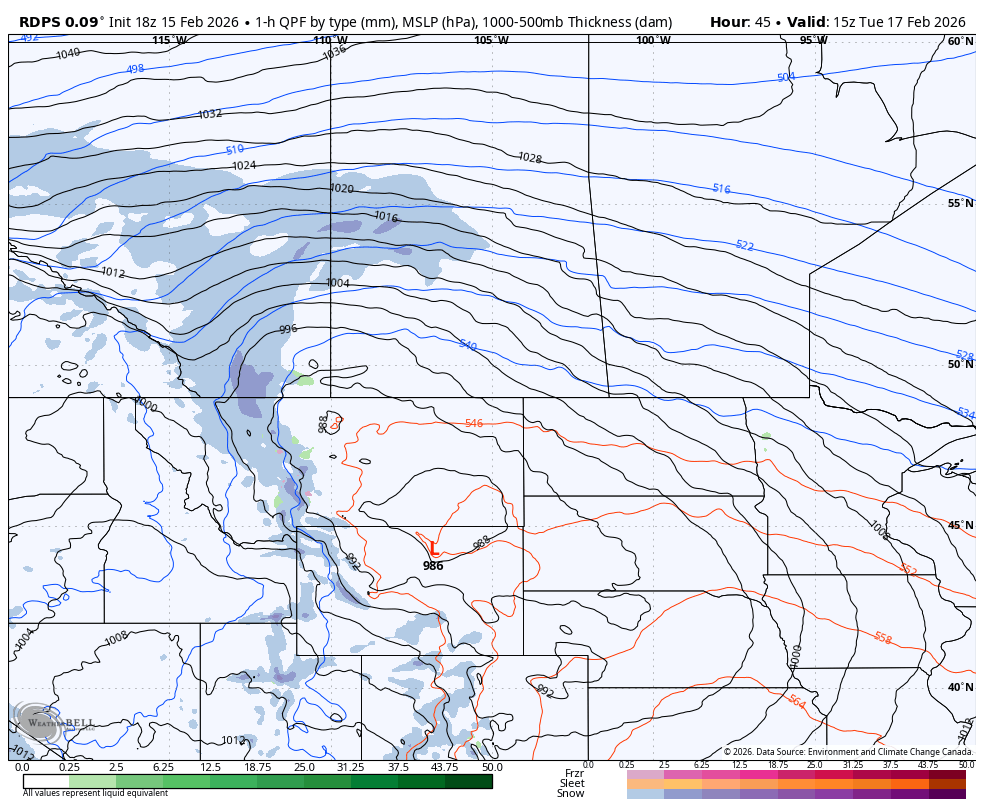
The rdps model showing precipitation type and intensity for Tuesday at 8am mt. courtesy of WeatherBell.
Overall, Southern and Central Alberta, and into Northern Alberta, can expect at least 5cm of snow by Wednesday morning. A considerable swath of this region, stretching from Calgary to Slave Lake and from Grande Prairie to Lloydminster, will see prolonged snow and possibly periods of heavier rates of snowfall. This will result in over 15cm of snow accumulating. East Central Alberta, from Edmonton to the Saskatchewan border, can expect more than 25cm of snow, with the possibility of locally higher amounts approaching 40cm,
As mentioned above, since Southern Alberta can expect the snow to begin much later than to the north, snowfall totals will be reduced. Snow is still expected to fall for several hours and with embedded areas of heavier snowfall, many areas will likely approach the 15cm mark by the end of Tuesday.
Reduced visibility from blowing snow will also be a concern with this system. Wind gusts up to 60km/h are expected to develop Monday afternoon and continue through the overnight hours. As the additional area of snow moves into Southern Alberta on Tuesday morning, the winds are expected to strengthen, with gusts up to 80km/h continuing into the evening before dying down.
When combined with the fresh and falling snow, not only will visibility be reduced, but there’s also the possibility for periods of blizzard-like conditions across the eastern portions of Southern and Central Alberta. This will make travel very hazardous so please take extra caution on the roads over the next couple of days.
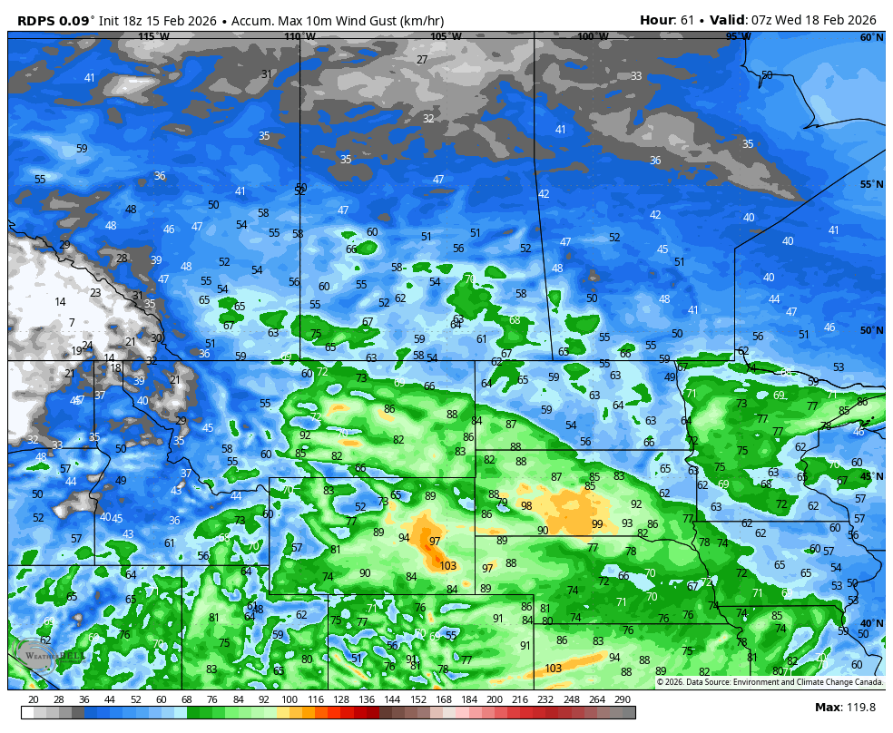
The rdps model showing peak wind gusts for Monday and Tuesday. courtesy of WeatherBell.


