⛈️Severe Thunderstorm Risk, More Freezing Rain, Heavy Rain, Snow, and Strong Wind Gusts on Wednesday in Ontario
/Spring storms are here, and this one is bringing a bit of everything. It will begin Wednesday morning delivering heavy rain, freezing rain, strong wind gusts, severe thunderstorms and snow depending on your location. Southwestern Ontario will see significant rainfall and a severe thunderstorm risk, while parts of central, eastern, the golden horseshoe and northeastern Ontario could face a messy mix of freezing rain, ice pellets, rain, snow and strong wind gusts, again, depending on your location. For those still recovering from last weekend’s ice storm, this storm could certainly add to the challenges. There’s also a risk for substantial snowfall in northwestern Ontario, specially in the Thunder Bay region. Further details on each area below.
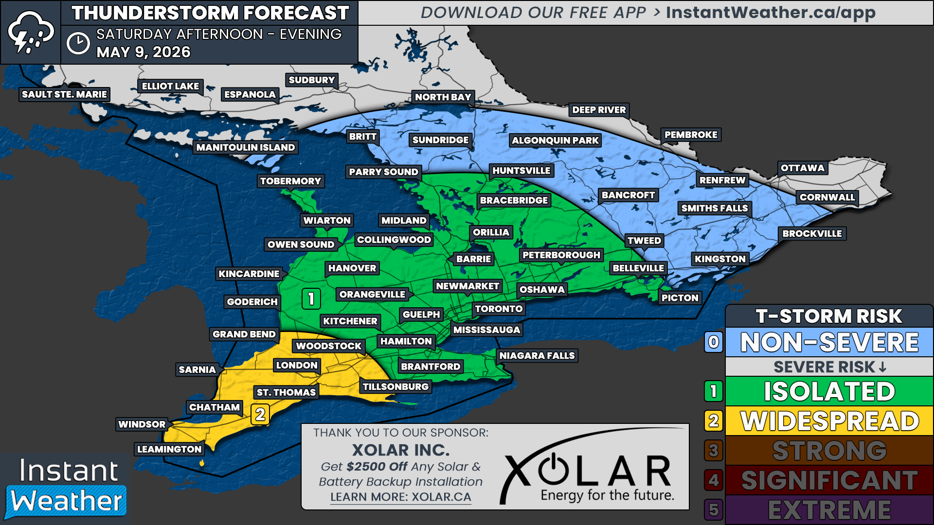
⛈️Severe Thunderstorm Risk
💨🌪️ Hazard(s): Wind, Tornado, Thunderstorms
📍 Location: Extreme southwestern Ontario
⏳ Timing: Late Wednesday afternoon and evening.
⚠️ Impact(s): Loose objects may be tossed, possible power outages
🔎 Confidence: Low
💥 Impact: High
A line of severe thunderstorms could cross into the province from Michigan, possibly producing wind gusts up to 100 km/h. A brief tornado is also possible on this line. There is lots of uncertainty in this occurring as ingredients to form these thunderstorms are located well south of the border and will rely on the thunderstorms being able to develop there and reach southwestern Ontario before weakening. Refer to the Wednesday Significant Weather discussion for rainfall information.
🌧️ Heavy Rain, 🧊 Ice, 💨 Strong Wind Gusts, and ❄️ Snow
📍 Location: Southwestern Ontario
🌧️ Hazard(s): Rain
📍 Location: Southwestern Ontario
⏳ Timing: Wednesday morning into Thursday morning
⚠️ Impact(s): Possible flooding in low-lying areas
🔎 Confidence: Moderate
💥 Impact: High
Rain is expected and may be accompanied by thunderstorms. Rainfall amounts up to 60 mm are possible by late Wednesday evening, with additional amounts expected on Thursday. Totals will vary, with areas east of Lake Huron receiving up to 60 mm, while regions near Lake Erie will likely see 10 to 20 mm.
📍 Location: Grey and Bruce Counties east to Peterborough
🧊🌧️ Hazard(s): Ice, Rain
📍 Location: Grey and Bruce Counties east to Peterborough
⏳ Timing: Wednesday midday into Thursday morning
⚠️ Impact(s): Possible flooding in low-lying areas, broken tree branches from ice build-up
🔎 Confidence: High
💥 Impact: High
Freezing rain, possibly mixed with ice pellets, is expected to bring 4 to 8 mm of ice accretion on some surfaces, particularly over higher terrain. Rain will follow and may be accompanied by thunderstorms. Rainfall amounts up to 40 mm are possible by late Wednesday evening, with more rain on Thursday.
⚠️ Impacts in this area may be enhanced due to recovery efforts from last weekend’s ice storm.
📍 Location: East of Lake Huron to portions of the Greater Golden Horseshoe
🌧️🧊 Hazard(s): Rain, Ice
📍 Location: East of Lake Huron to portions of the Greater Golden Horseshoe
⏳ Timing: Wednesday midday into Thursday morning
⚠️ Impact(s): Possible flooding in low-lying areas, possible icy surfaces on roads and walkways.
🔎 Confidence: Moderate
💥 Impact: High
A brief period of freezing rain is expected Wednesday afternoon, bringing 1 to 2 mm of ice accretion on some surfaces, particularly over higher terrain. Rain will follow and may be accompanied by thunderstorms. Rainfall amounts up to 50 mm are possible by late Wednesday evening, with more rain on Thursday.
📍 Location: Parts of Central, Eastern and Northeastern Ontario
❄️🧊 Hazard(s): Snow, Ice
📍 Location: East of Lake Huron to portions of the Greater Golden Horseshoe
⏳ Timing: Wednesday midday into Thursday morning
⚠️ Impact(s): Broken tree branches from ice build-up, possible difficult travel conditions
🔎 Confidence: Moderate
💥 Impact: High
A messy mix of winter precipitation is expected. Snow mixed with ice pellets will develop near midday Wednesday, with up to 5 cm possible before transitioning to freezing rain. A period of freezing rain Wednesday evening could bring 3 to 6 mm of ice accretion, especially over higher terrain.
📍 Location: North shore of Lake Ontario
🧊🌧️ Hazard(s): Ice, Rain
📍 Location: North shore of Lake Ontario
⏳ Timing: Wednesday midday into Thursday
⚠️ Impact(s): Possible icy surfaces on roads and walkways, possible flash flooding and water pooling on roads
🔎 Confidence: Moderate
💥 Impact: Low
A brief period of ice pellets or freezing rain is possible Wednesday afternoon. Rain will follow and may be accompanied by thunderstorms. Rainfall amounts up to 20 mm are possible by late Wednesday evening, with additional amounts expected on Thursday.
📍 Location: Southern portions of Northeastern Ontario and portions of Eastern Ontario
❄️🧊 Hazard(s): Snow, Ice
📍 Location: Southern portions of northeastern Ontario and portions of eastern Ontario
⏳ Timing: Beginning midday Wednesday
⚠️ Impact(s): Difficult travel conditions
🔎 Confidence:
💥 Impact:
A messy mix of winter precipitation is expected. Snow mixed with ice pellets will develop Wednesday afternoon, with up to 5 cm possible before transitioning to a brief period of freezing rain.
⚠️ Confidence in ice accretion amounts is low. However, accretion is expected to remain fairly low as the freezing rain transitions to rain Wednesday night.
📍 Location: West of Lake Superior
❄️🌬️ Hazard(s): Snow, Blowing Snow
📍 Location: West of Lake Superior
⏳ Timing: Wednesday morning into Thursday morning
⚠️ Impact(s): Difficult travel conditions, reduced visibility, possible road closures
🔎 Confidence:
💥 Impact:
Snowfall amounts up to 25 cm are possible, with locally higher totals over elevated terrain. Gusty winds could lead to local blowing snow, especially near Lake Superior. Additional snowfall is expected Thursday.
📍 Location: Northwestern Ontario and north of Lake Superior
❄️ Hazard(s): Snow
📍 Location: Northwestern Ontario and north of Lake Superior
⏳ Timing: Wednesday morning into Thursday morning
⚠️ Impact(s): Difficult travel conditions
🔎 Confidence:
💥 Impact:
Snowfall amounts up to 15 cm are possible, with additional snowfall expected Thursday.
Final Thoughts:
This is shaping up to be a potentially strong system with widespread rain, ice, and snow affecting much of Ontario. Flooding, icy roads, tree damage, and power outages are all possible. For areas still recovering from last weekend’s ice storm, even small amounts of ice could exacerbate existing damage. The severe thunderstorm risk in deep southwestern Ontario is of particular concern as well.
As always, keep an eye our latest updates and prepare for rapidly changing conditions. Stay safe out there, folks!
Disclaimer: These forecasts are issued by Environment Canada and typically published via their Twitter/X accounts. We receive these forecast via a daily email and often publish them to help inform our communities.


