Real Taste of Summer for Alberta & Saskatchewan as Temperatures Soar into the 30s with Severe Thunderstorm Risk
/
NOTE: YOU CAN CLICK ON THE MAP TO OPEN A ZOOMABLE IMAGE
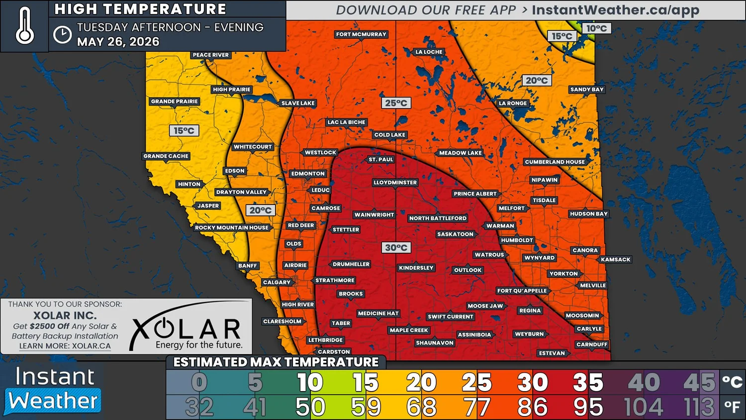
It was only a little over a week ago that we had snow falling across parts of the Prairies. Now, Mother Nature is treating us to some weather whiplash and a true taste of summer, with temperatures climbing into the 30s in a heat wave that begins today and continues through the week.
This extended period heat is courtesy of a strong upper level ridge in the jet stream which will allow much warmer air from the States to surge northward. This ridge is expected to gradually extend eastward over the course of the week, which will then bring the heat into Manitoba and possibly deliver some relief in Eastern Alberta.
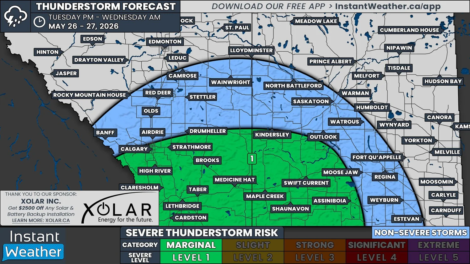
Along with the heat today, there will be the risk for severe thunderstorms to develop in Southern Alberta and Southwestern Saskatchewan.
Isolated thunderstorms are possible for Southern Alberta throughout the afternoon, but the greatest risk of severe weather begins with storms that develop later in the afternoon and early evening in both provinces, as well as in Montana. Storms that form during this time will likely be severe as they track northwestward, but as we get later into the evening and overnight hours, they should weaken and become non-severe.
Strong wind gusts in excess of 100km/h are the main threat from today’s severe thunderstorms, but there will also be a possibility of up to nickel-sized hail. There is a chance that there might be enough capping in the atmosphere today that storms could struggle to develop so we will certainly be keeping a close watch on how things shape up over the coming hours.