Midweek Snowstorm To Bring Up to 30cm of Snow to Parts of Northwestern Ontario Between Tuesday and Wednesday
/The low-pressure system currently bringing record-breaking flooding to parts of British Columbia will race across the Prairies and start to affect Northwestern Ontario starting Tuesday morning with the initial bands of precipitation. Instead of rain, we are mainly looking at snowfall which could come down quite heavy at times. The system will be a lot weaker than when it made landfall in BC so this won’t be any more than a fairly typical snowstorm for the region.
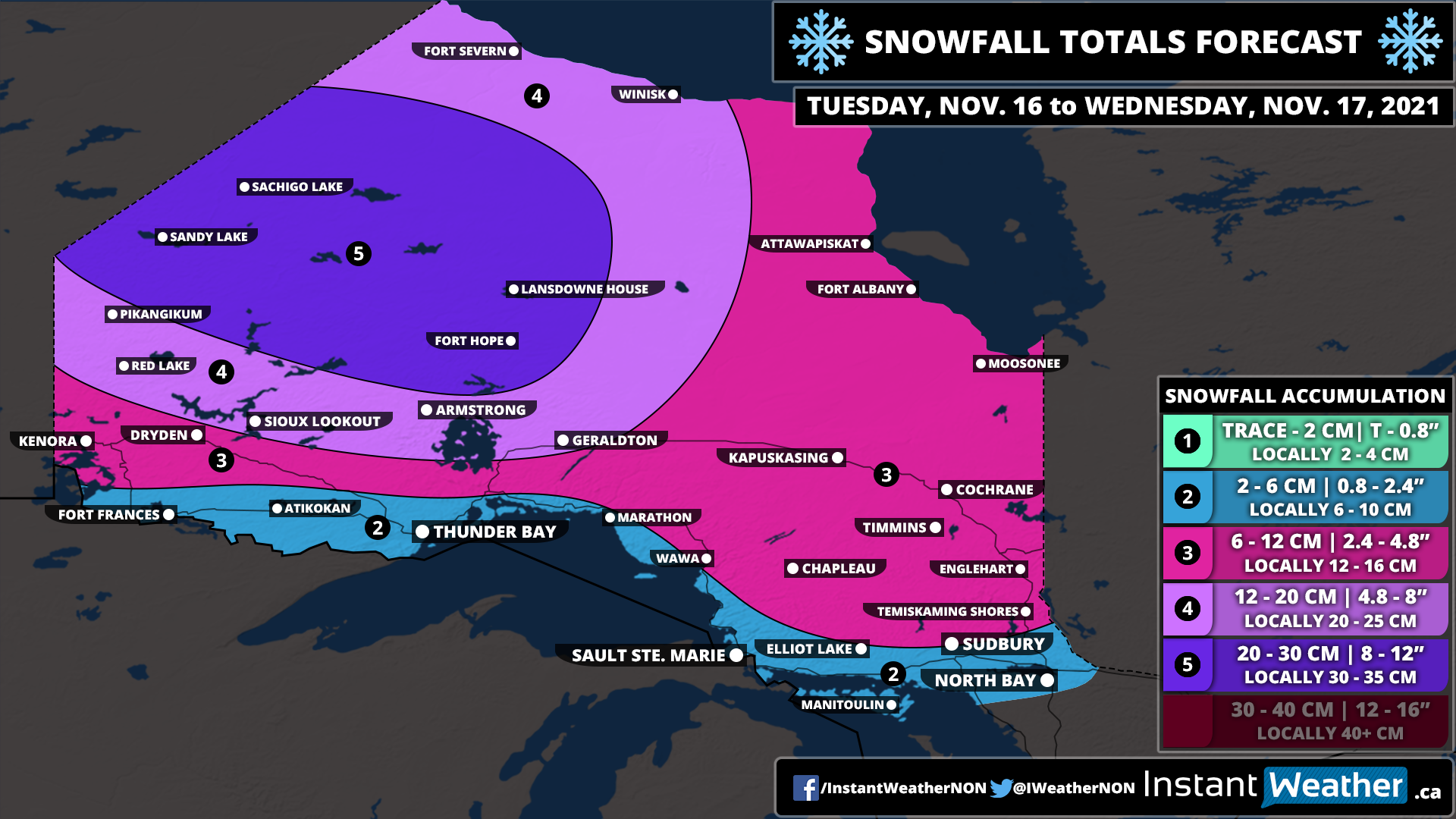
We will see the worst conditions from this storm through Sandy Lake and Sachigo Lake during the later part of Tuesday and into Wednesday morning. Heavy snow combined with strong wind gusts up to 50-70km/h could create very poor travel conditions. Snow will continue during the day on Wednesday, but it won’t be as intense with the heavier precipitation being found along the Quebec border. There could be the risk of some freezing rain just north of Sudbury during the morning on Wednesday although confidence in that is low. The system will finally exist in the region by the end of Wednesday, but a few flurries may linger into Thursday.
We’re looking at around 20-30cm of snowfall accumulation through the hardest hit zone including Sandy Lake, Sachigo Lake, Fort Hope and Lansdowne House. A few localized areas could pick up more than 30cm. Other parts of Northwestern Ontario can expect around 12-20cm with between 6-12cm for the rest of Northern Ontario away from the shoreline of Lake Superior and Georgian Bay. We will likely see some rain along the shorelines which will reduce potential accumulation.


